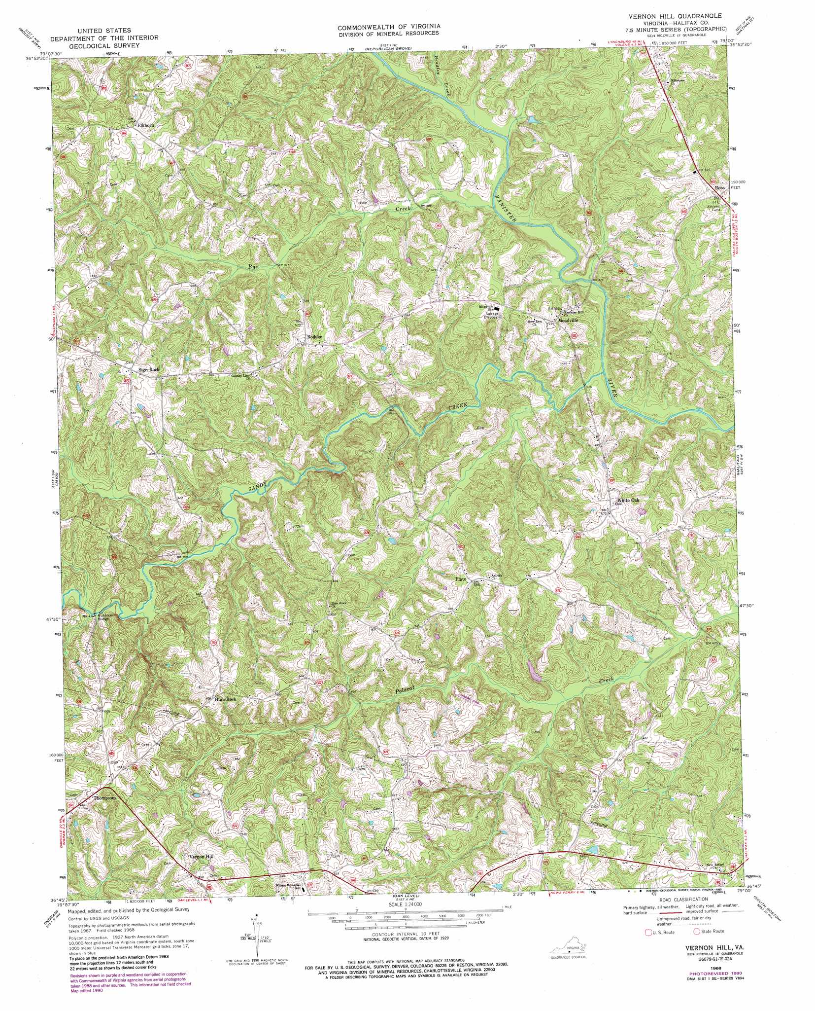
Vernon Hill Topo Map Virginia
To zoom in, hover over the map of Vernon Hill
USGS Topo Quad 36079g1 - 1:24,000 scale
| Topo Map Name: | Vernon Hill |
| USGS Topo Quad ID: | 36079g1 |
| Print Size: | ca. 21 1/4" wide x 27" high |
| Southeast Coordinates: | 36.75° N latitude / 79° W longitude |
| Map Center Coordinates: | 36.8125° N latitude / 79.0625° W longitude |
| U.S. State: | VA |
| Filename: | o36079g1.jpg |
| Download Map JPG Image: | Vernon Hill topo map 1:24,000 scale |
| Map Type: | Topographic |
| Topo Series: | 7.5´ |
| Map Scale: | 1:24,000 |
| Source of Map Images: | United States Geological Survey (USGS) |
| Alternate Map Versions: |
Vernon Hill VA 1968, updated 1971 Download PDF Buy paper map Vernon Hill VA 1968, updated 1985 Download PDF Buy paper map Vernon Hill VA 1968, updated 1990 Download PDF Buy paper map Vernon Hill VA 2011 Download PDF Buy paper map Vernon Hill VA 2013 Download PDF Buy paper map Vernon Hill VA 2016 Download PDF Buy paper map |
1:24,000 Topo Quads surrounding Vernon Hill
Altavista |
Straightstone |
Long Island |
Brookneal |
Aspen |
Gretna |
Mount Airy |
Republican Grove |
Nathalie |
Conner Lake |
Spring Garden |
Java |
Vernon Hill |
Halifax |
Scottsburg |
Blairs |
Ingram |
Oak Level |
South Boston |
Omega |
Ringgold |
Milton |
Alton |
Cluster Springs |
Virgilina |
> Back to 36079e1 at 1:100,000 scale
> Back to 36078a1 at 1:250,000 scale
> Back to U.S. Topo Maps home
Vernon Hill topo map: Gazetteer
Vernon Hill: Airports
Fox Fire Airport elevation 128m 419′Vernon Hill: Populated Places
Chaneys Store elevation 181m 593′Elkhorn elevation 176m 577′
High Rock elevation 185m 606′
Meadville elevation 142m 465′
Plato elevation 178m 583′
Rodden elevation 177m 580′
Rosa elevation 185m 606′
Sign Rock elevation 188m 616′
Thompsons elevation 196m 643′
Vernon Hill elevation 189m 620′
White Oak elevation 173m 567′
Vernon Hill: Streams
Bradley Creek elevation 118m 387′Bye Creek elevation 109m 357′
Sandy Creek elevation 109m 357′
Vernon Hill digital topo map on disk
Buy this Vernon Hill topo map showing relief, roads, GPS coordinates and other geographical features, as a high-resolution digital map file on DVD:
Western Virginia & Southern West Virginia
Buy digital topo maps: Western Virginia & Southern West Virginia