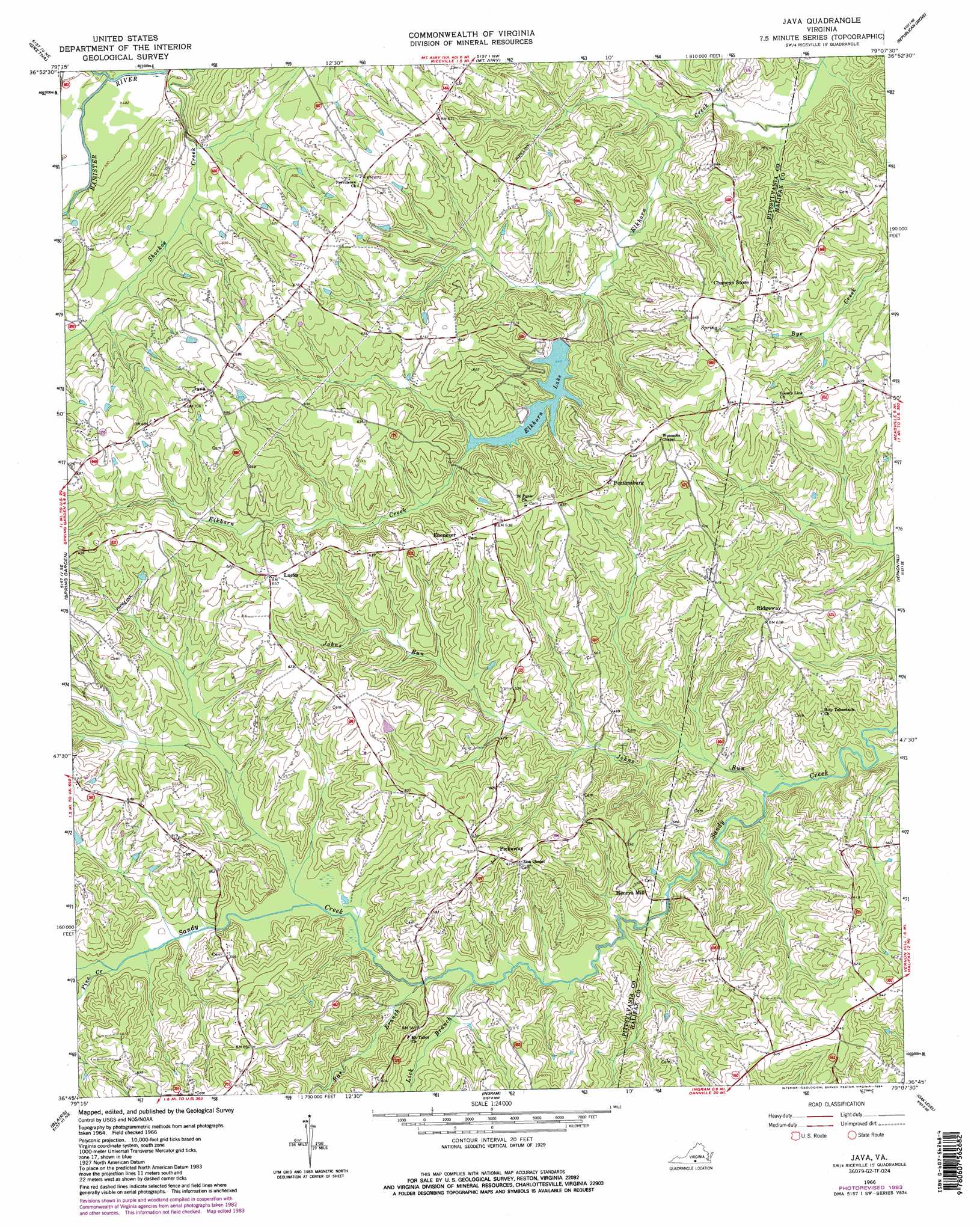
Java Topo Map Virginia
To zoom in, hover over the map of Java
USGS Topo Quad 36079g2 - 1:24,000 scale
| Topo Map Name: | Java |
| USGS Topo Quad ID: | 36079g2 |
| Print Size: | ca. 21 1/4" wide x 27" high |
| Southeast Coordinates: | 36.75° N latitude / 79.125° W longitude |
| Map Center Coordinates: | 36.8125° N latitude / 79.1875° W longitude |
| U.S. State: | VA |
| Filename: | o36079g2.jpg |
| Download Map JPG Image: | Java topo map 1:24,000 scale |
| Map Type: | Topographic |
| Topo Series: | 7.5´ |
| Map Scale: | 1:24,000 |
| Source of Map Images: | United States Geological Survey (USGS) |
| Alternate Map Versions: |
Java VA 1966, updated 1967 Download PDF Buy paper map Java VA 1966, updated 1984 Download PDF Buy paper map Java VA 1966, updated 1984 Download PDF Buy paper map Java VA 2011 Download PDF Buy paper map Java VA 2013 Download PDF Buy paper map Java VA 2016 Download PDF Buy paper map |
1:24,000 Topo Quads surrounding Java
Leesville |
Altavista |
Straightstone |
Long Island |
Brookneal |
Pittsville |
Gretna |
Mount Airy |
Republican Grove |
Nathalie |
Chatham |
Spring Garden |
Java |
Vernon Hill |
Halifax |
Mount Hermon |
Blairs |
Ingram |
Oak Level |
South Boston |
Danville |
Ringgold |
Milton |
Alton |
Cluster Springs |
> Back to 36079e1 at 1:100,000 scale
> Back to 36078a1 at 1:250,000 scale
> Back to U.S. Topo Maps home
Java topo map: Gazetteer
Java: Dams
Elkhorn Dam elevation 159m 521′Gregory Dam elevation 173m 567′
Java: Populated Places
Ebenezer elevation 191m 626′Henrys Mill elevation 154m 505′
Java elevation 213m 698′
Lucks elevation 199m 652′
Peytonsburg elevation 195m 639′
Pickaway elevation 190m 623′
Ridgeway elevation 195m 639′
Java: Reservoirs
Elkhorn Lake elevation 159m 521′Java: Streams
Bar Branch elevation 139m 456′Johns Run elevation 125m 410′
Lick Branch elevation 137m 449′
Pine Creek elevation 144m 472′
Whitethorn Creek elevation 146m 479′
Java digital topo map on disk
Buy this Java topo map showing relief, roads, GPS coordinates and other geographical features, as a high-resolution digital map file on DVD:
Western Virginia & Southern West Virginia
Buy digital topo maps: Western Virginia & Southern West Virginia