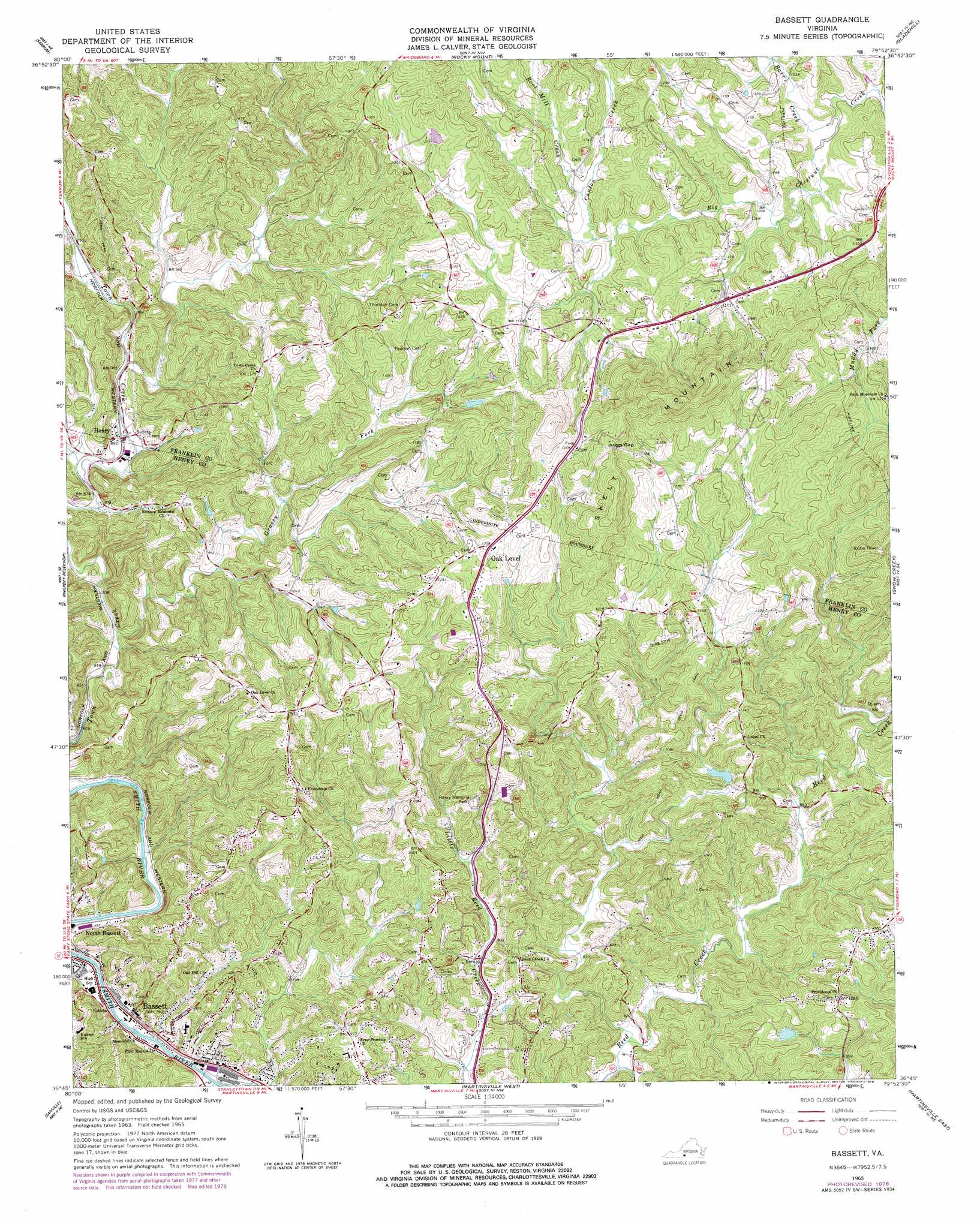
Bassett Topo Map Virginia
To zoom in, hover over the map of Bassett
USGS Topo Quad 36079g8 - 1:24,000 scale
| Topo Map Name: | Bassett |
| USGS Topo Quad ID: | 36079g8 |
| Print Size: | ca. 21 1/4" wide x 27" high |
| Southeast Coordinates: | 36.75° N latitude / 79.875° W longitude |
| Map Center Coordinates: | 36.8125° N latitude / 79.9375° W longitude |
| U.S. State: | VA |
| Filename: | o36079g8.jpg |
| Download Map JPG Image: | Bassett topo map 1:24,000 scale |
| Map Type: | Topographic |
| Topo Series: | 7.5´ |
| Map Scale: | 1:24,000 |
| Source of Map Images: | United States Geological Survey (USGS) |
| Alternate Map Versions: |
Bassett VA 1965, updated 1966 Download PDF Buy paper map Bassett VA 1965, updated 1978 Download PDF Buy paper map Bassett VA 1965, updated 1978 Download PDF Buy paper map Bassett VA 2011 Download PDF Buy paper map Bassett VA 2013 Download PDF Buy paper map Bassett VA 2016 Download PDF Buy paper map |
1:24,000 Topo Quads surrounding Bassett
Check |
Callaway |
Boones Mill |
Redwood |
Moneta Sw |
Endicott |
Ferrum |
Rocky Mount |
Gladehill |
Penhook |
Charity |
Philpott Reservoir |
Bassett |
Snow Creek |
Mountain Valley |
Patrick Springs |
Sanville |
Martinsville West |
Martinsville East |
Axton |
Nettleridge |
Spencer |
Price |
Northwest Eden |
Northeast Eden |
> Back to 36079e1 at 1:100,000 scale
> Back to 36078a1 at 1:250,000 scale
> Back to U.S. Topo Maps home
Bassett topo map: Gazetteer
Bassett: Gaps
Juggs Gap elevation 426m 1397′Bassett: Populated Places
Bassett elevation 234m 767′Fork Mountain elevation 337m 1105′
Henry elevation 272m 892′
North Bassett elevation 237m 777′
Oak Level elevation 382m 1253′
Reed Creek Village elevation 279m 915′
Bassett: Post Offices
Bassett Post Office elevation 230m 754′Bassett: Streams
Barr Creek elevation 303m 994′Blackberry Creek elevation 225m 738′
Canton Creek elevation 322m 1056′
Grassy Fork elevation 248m 813′
Root Mill Creek elevation 328m 1076′
Bassett: Summits
Skelt Mountain elevation 515m 1689′Bassett digital topo map on disk
Buy this Bassett topo map showing relief, roads, GPS coordinates and other geographical features, as a high-resolution digital map file on DVD:
Western Virginia & Southern West Virginia
Buy digital topo maps: Western Virginia & Southern West Virginia