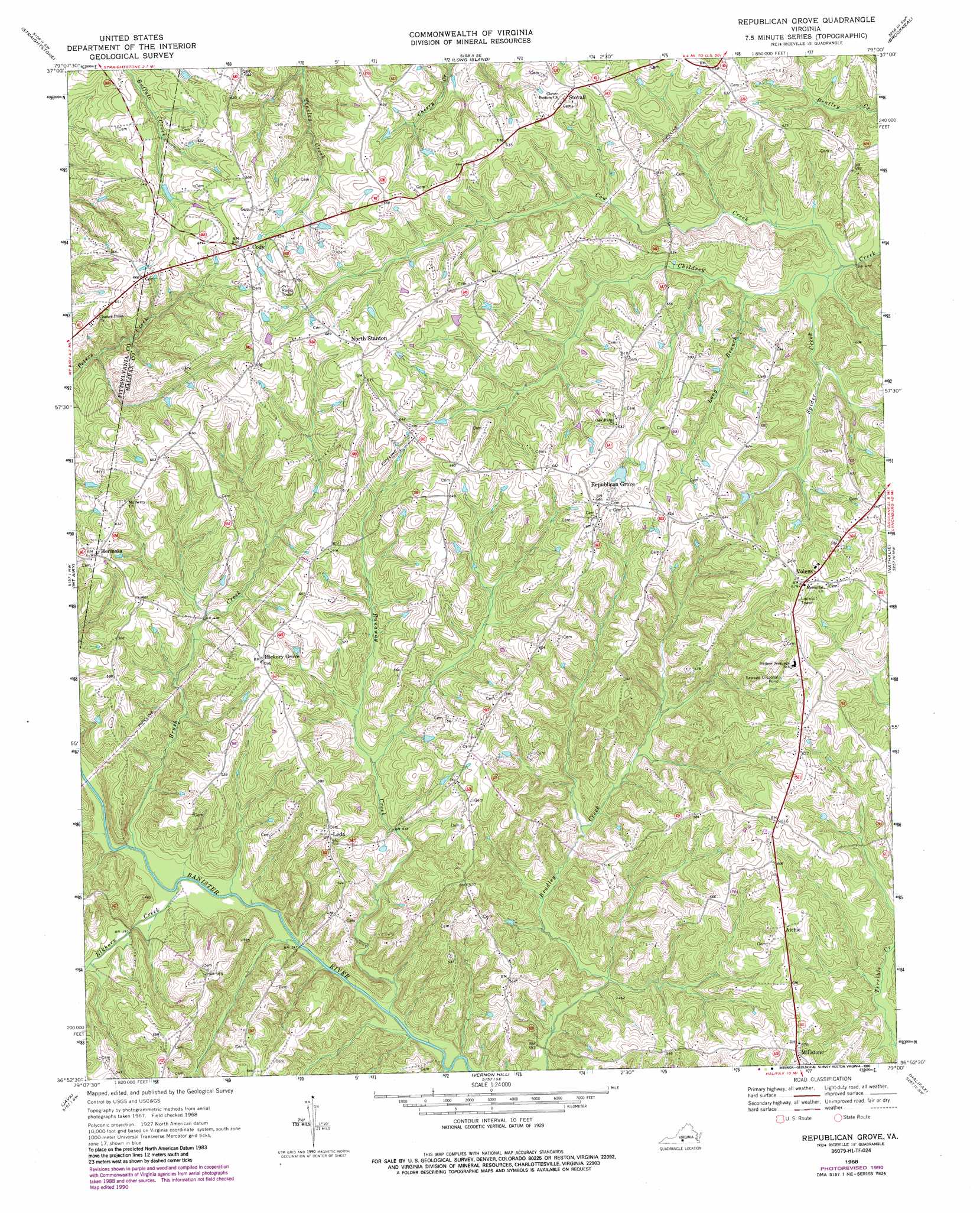
Republican Grove Topo Map Virginia
To zoom in, hover over the map of Republican Grove
USGS Topo Quad 36079h1 - 1:24,000 scale
| Topo Map Name: | Republican Grove |
| USGS Topo Quad ID: | 36079h1 |
| Print Size: | ca. 21 1/4" wide x 27" high |
| Southeast Coordinates: | 36.875° N latitude / 79° W longitude |
| Map Center Coordinates: | 36.9375° N latitude / 79.0625° W longitude |
| U.S. State: | VA |
| Filename: | o36079h1.jpg |
| Download Map JPG Image: | Republican Grove topo map 1:24,000 scale |
| Map Type: | Topographic |
| Topo Series: | 7.5´ |
| Map Scale: | 1:24,000 |
| Source of Map Images: | United States Geological Survey (USGS) |
| Alternate Map Versions: |
Republican Grove VA 1968, updated 1972 Download PDF Buy paper map Republican Grove VA 1968, updated 1985 Download PDF Buy paper map Republican Grove VA 1968, updated 1990 Download PDF Buy paper map Republican Grove VA 2011 Download PDF Buy paper map Republican Grove VA 2013 Download PDF Buy paper map Republican Grove VA 2016 Download PDF Buy paper map |
1:24,000 Topo Quads surrounding Republican Grove
Lynch Station |
Castle Craig |
Gladys |
Mike |
Red House |
Altavista |
Straightstone |
Long Island |
Brookneal |
Aspen |
Gretna |
Mount Airy |
Republican Grove |
Nathalie |
Conner Lake |
Spring Garden |
Java |
Vernon Hill |
Halifax |
Scottsburg |
Blairs |
Ingram |
Oak Level |
South Boston |
Omega |
> Back to 36079e1 at 1:100,000 scale
> Back to 36078a1 at 1:250,000 scale
> Back to U.S. Topo Maps home
Republican Grove topo map: Gazetteer
Republican Grove: Dams
Duncan Dam elevation 192m 629′Republican Grove: Populated Places
Alchie elevation 176m 577′Cody elevation 195m 639′
Hermosa elevation 191m 626′
Hickory Grove elevation 180m 590′
Leda elevation 171m 561′
Millstone elevation 178m 583′
North Stanton elevation 208m 682′
Republican Grove elevation 196m 643′
Stovall elevation 191m 626′
Volens elevation 204m 669′
Republican Grove: Streams
Brush Creek elevation 116m 380′Cow Creek elevation 140m 459′
Elkhorn Creek elevation 116m 380′
Long Branch elevation 145m 475′
Runaway Creek elevation 114m 374′
Spider Creek elevation 141m 462′
Republican Grove digital topo map on disk
Buy this Republican Grove topo map showing relief, roads, GPS coordinates and other geographical features, as a high-resolution digital map file on DVD:
Western Virginia & Southern West Virginia
Buy digital topo maps: Western Virginia & Southern West Virginia