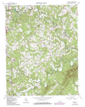
Gladehill Topo Map Virginia
To zoom in, hover over the map of Gladehill
USGS Topo Quad 36079h7 - 1:24,000 scale
| Topo Map Name: | Gladehill |
| USGS Topo Quad ID: | 36079h7 |
| Print Size: | ca. 21 1/4" wide x 27" high |
| Southeast Coordinates: | 36.875° N latitude / 79.75° W longitude |
| Map Center Coordinates: | 36.9375° N latitude / 79.8125° W longitude |
| U.S. State: | VA |
| Filename: | o36079h7.jpg |
| Download Map JPG Image: | Gladehill topo map 1:24,000 scale |
| Map Type: | Topographic |
| Topo Series: | 7.5´ |
| Map Scale: | 1:24,000 |
| Source of Map Images: | United States Geological Survey (USGS) |
| Alternate Map Versions: |
Gladehill VA 1964, updated 1966 Download PDF Buy paper map Gladehill VA 1964, updated 1978 Download PDF Buy paper map Gladehill VA 1964, updated 1986 Download PDF Buy paper map Gladehill VA 2011 Download PDF Buy paper map Gladehill VA 2013 Download PDF Buy paper map Gladehill VA 2016 Download PDF Buy paper map |
1:24,000 Topo Quads surrounding Gladehill
> Back to 36079e1 at 1:100,000 scale
> Back to 36078a1 at 1:250,000 scale
> Back to U.S. Topo Maps home
Gladehill topo map: Gazetteer
Gladehill: Dams
Pigg River Dam elevation 289m 948′Gladehill: Populated Places
Gladehill elevation 323m 1059′Henry Fork elevation 377m 1236′
Hopkins Mill elevation 236m 774′
Sydnorsville elevation 356m 1167′
Gladehill: Streams
Doe Run elevation 239m 784′Draper Mill Creek elevation 272m 892′
Little Chestnut Creek elevation 265m 869′
Little Doe Run elevation 255m 836′
North Fork Little Chestnut Creek elevation 277m 908′
South Fork Little Chestnut Creek elevation 277m 908′
Gladehill: Summits
Chesnut Mountain elevation 527m 1729′Gladehill digital topo map on disk
Buy this Gladehill topo map showing relief, roads, GPS coordinates and other geographical features, as a high-resolution digital map file on DVD:
Western Virginia & Southern West Virginia
Buy digital topo maps: Western Virginia & Southern West Virginia


