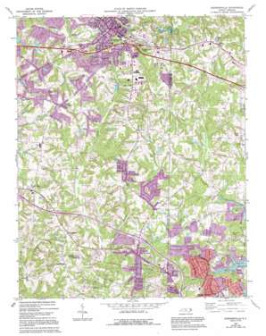
Kernersville Topo Map North Carolina
To zoom in, hover over the map of Kernersville
USGS Topo Quad 36080a1 - 1:24,000 scale
| Topo Map Name: | Kernersville |
| USGS Topo Quad ID: | 36080a1 |
| Print Size: | ca. 21 1/4" wide x 27" high |
| Southeast Coordinates: | 36° N latitude / 80° W longitude |
| Map Center Coordinates: | 36.0625° N latitude / 80.0625° W longitude |
| U.S. State: | NC |
| Filename: | o36080a1.jpg |
| Download Map JPG Image: | Kernersville topo map 1:24,000 scale |
| Map Type: | Topographic |
| Topo Series: | 7.5´ |
| Map Scale: | 1:24,000 |
| Source of Map Images: | United States Geological Survey (USGS) |
| Alternate Map Versions: |
Kernersville NC 1969, updated 1972 Download PDF Buy paper map Kernersville NC 1969, updated 1987 Download PDF Buy paper map Kernersville NC 1969, updated 1994 Download PDF Buy paper map Kernersville NC 1977, updated 1979 Download PDF Buy paper map Kernersville NC 2010 Download PDF Buy paper map Kernersville NC 2013 Download PDF Buy paper map Kernersville NC 2016 Download PDF Buy paper map |
1:24,000 Topo Quads surrounding Kernersville
> Back to 36080a1 at 1:100,000 scale
> Back to 36080a1 at 1:250,000 scale
> Back to U.S. Topo Maps home
Kernersville topo map: Gazetteer
Kernersville: Areas
Piedmont Province elevation 248m 813′Kernersville: Dams
Crawfords Dam elevation 275m 902′Hutchens Dam elevation 256m 839′
Lee Lake Dam elevation 270m 885′
Pine Tree Lake Number One Dam elevation 290m 951′
Upper Angel Lake Dam elevation 257m 843′
Kernersville: Lakes
Oak Hollow Lake elevation 244m 800′Kernersville: Populated Places
Abotts Creek (historical) elevation 265m 869′Beeson Crossroads elevation 298m 977′
Christy Acres elevation 307m 1007′
Colfax elevation 294m 964′
Country Meadows elevation 283m 928′
Fox Run elevation 289m 948′
Georgetown elevation 281m 921′
Glennwood Acres elevation 286m 938′
High Meadows elevation 277m 908′
Horneytown elevation 278m 912′
Kernersville elevation 308m 1010′
Oak Hollow Lake elevation 261m 856′
Pebble Creek Estates elevation 274m 898′
Quail Hollow elevation 291m 954′
Sun Meadows elevation 291m 954′
Teaguetown elevation 286m 938′
Union Cross elevation 293m 961′
Wellington Way elevation 278m 912′
Yorktown elevation 288m 944′
Kernersville: Reservoirs
Berry Water Gardens elevation 271m 889′Crawfords Lake elevation 275m 902′
Hutchens Lake elevation 256m 839′
Lee Lake elevation 270m 885′
Pine Tree Lake Number One elevation 290m 951′
Upper Angel Lake elevation 257m 843′
Kernersville: Streams
Cuddybum Branch elevation 243m 797′Mary Reich Creek elevation 239m 784′
Kernersville digital topo map on disk
Buy this Kernersville topo map showing relief, roads, GPS coordinates and other geographical features, as a high-resolution digital map file on DVD:
Western Virginia & Southern West Virginia
Buy digital topo maps: Western Virginia & Southern West Virginia


