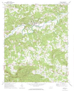
Ronda Topo Map North Carolina
To zoom in, hover over the map of Ronda
USGS Topo Quad 36080b8 - 1:24,000 scale
| Topo Map Name: | Ronda |
| USGS Topo Quad ID: | 36080b8 |
| Print Size: | ca. 21 1/4" wide x 27" high |
| Southeast Coordinates: | 36.125° N latitude / 80.875° W longitude |
| Map Center Coordinates: | 36.1875° N latitude / 80.9375° W longitude |
| U.S. State: | NC |
| Filename: | o36080b8.jpg |
| Download Map JPG Image: | Ronda topo map 1:24,000 scale |
| Map Type: | Topographic |
| Topo Series: | 7.5´ |
| Map Scale: | 1:24,000 |
| Source of Map Images: | United States Geological Survey (USGS) |
| Alternate Map Versions: |
Ronda NC 1971, updated 1973 Download PDF Buy paper map Ronda NC 1997, updated 2000 Download PDF Buy paper map Ronda NC 2010 Download PDF Buy paper map Ronda NC 2013 Download PDF Buy paper map Ronda NC 2016 Download PDF Buy paper map |
1:24,000 Topo Quads surrounding Ronda
> Back to 36080a1 at 1:100,000 scale
> Back to 36080a1 at 1:250,000 scale
> Back to U.S. Topo Maps home
Ronda topo map: Gazetteer
Ronda: Dams
Miller Dam elevation 325m 1066′Wildcat Lake Dam elevation 346m 1135′
Wright Dam elevation 334m 1095′
Ronda: Populated Places
Allin (historical) elevation 303m 994′Brier Creek (historical) elevation 279m 915′
Clingman elevation 346m 1135′
Dimmette (historical) elevation 358m 1174′
Martin (historical) elevation 283m 928′
New Castle (historical) elevation 351m 1151′
Ronda elevation 293m 961′
Weatherspon (historical) elevation 273m 895′
Ronda: Reservoirs
Noname elevation 325m 1066′Wildcat Lake elevation 346m 1135′
Wright Lake elevation 334m 1095′
Ronda: Ridges
Oakley Ridge elevation 506m 1660′Ronda: Streams
Big Bugaboo Creek elevation 274m 898′Brier Creek elevation 278m 912′
East Swan Creek elevation 273m 895′
Grays Creek elevation 275m 902′
Hughes Branch elevation 271m 889′
Little Bugaboo Creek elevation 313m 1026′
Little Elkin Creek elevation 267m 875′
Swan Creek elevation 271m 889′
West Swan Creek elevation 271m 889′
Ronda: Summits
Byrd Mountain elevation 532m 1745′Dark Mountain elevation 531m 1742′
Gobblers Knob elevation 451m 1479′
Horde Mountain elevation 486m 1594′
Mathis Mountain elevation 522m 1712′
Redding Mountain elevation 433m 1420′
Segraves Mountain elevation 455m 1492′
Ronda: Valleys
Adams Hollow elevation 336m 1102′Dobins Hollow elevation 367m 1204′
Engle Hollow elevation 349m 1145′
Ronda digital topo map on disk
Buy this Ronda topo map showing relief, roads, GPS coordinates and other geographical features, as a high-resolution digital map file on DVD:
Western Virginia & Southern West Virginia
Buy digital topo maps: Western Virginia & Southern West Virginia


