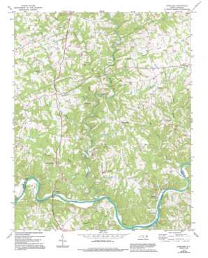
Copeland Topo Map North Carolina
To zoom in, hover over the map of Copeland
USGS Topo Quad 36080c6 - 1:24,000 scale
| Topo Map Name: | Copeland |
| USGS Topo Quad ID: | 36080c6 |
| Print Size: | ca. 21 1/4" wide x 27" high |
| Southeast Coordinates: | 36.25° N latitude / 80.625° W longitude |
| Map Center Coordinates: | 36.3125° N latitude / 80.6875° W longitude |
| U.S. State: | NC |
| Filename: | o36080c6.jpg |
| Download Map JPG Image: | Copeland topo map 1:24,000 scale |
| Map Type: | Topographic |
| Topo Series: | 7.5´ |
| Map Scale: | 1:24,000 |
| Source of Map Images: | United States Geological Survey (USGS) |
| Alternate Map Versions: |
Copeland NC 1970, updated 1973 Download PDF Buy paper map Copeland NC 1970, updated 1994 Download PDF Buy paper map Copeland NC 2010 Download PDF Buy paper map Copeland NC 2013 Download PDF Buy paper map Copeland NC 2016 Download PDF Buy paper map |
1:24,000 Topo Quads surrounding Copeland
> Back to 36080a1 at 1:100,000 scale
> Back to 36080a1 at 1:250,000 scale
> Back to U.S. Topo Maps home
Copeland topo map: Gazetteer
Copeland: Crossings
Rockford Ferry (historical) elevation 248m 813′White Rock Ford elevation 247m 810′
Copeland: Dams
Fairview Wildlife Club Dam elevation 295m 967′Copeland: Parks
Cody Park elevation 339m 1112′John Dobson Home elevation 272m 892′
Rockford Courthouse elevation 283m 928′
Rockford Historic District elevation 269m 882′
Copeland: Populated Places
Copeland elevation 356m 1167′Crutchfield elevation 261m 856′
Fairview elevation 338m 1108′
Level Cross elevation 366m 1200′
Rockford elevation 260m 853′
Stony Knoll elevation 350m 1148′
Copeland: Reservoirs
Fairview Wildlife elevation 295m 967′Copeland: Streams
Bear Creek elevation 266m 872′Beaver Creek elevation 286m 938′
Cody Creek elevation 271m 889′
Davenport Creek elevation 255m 836′
Double Creek elevation 244m 800′
Dunagan Creek elevation 264m 866′
East Double Creek elevation 248m 813′
Fall Creek elevation 249m 816′
Fisher River elevation 254m 833′
Horns Branch elevation 298m 977′
King Creek elevation 281m 921′
Little Beaver Creek elevation 280m 918′
Pheasant Creek elevation 258m 846′
Tanyard Creek elevation 251m 823′
West Double Creek elevation 245m 803′
Whiteoak Branch elevation 323m 1059′
Copeland digital topo map on disk
Buy this Copeland topo map showing relief, roads, GPS coordinates and other geographical features, as a high-resolution digital map file on DVD:
Western Virginia & Southern West Virginia
Buy digital topo maps: Western Virginia & Southern West Virginia


