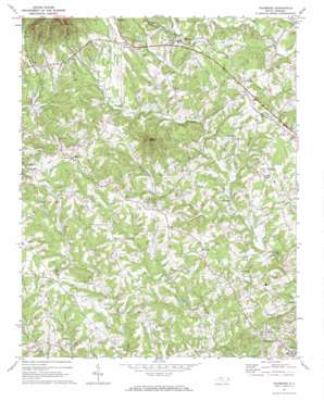
Thurmond Topo Map North Carolina
To zoom in, hover over the map of Thurmond
USGS Topo Quad 36080c8 - 1:24,000 scale
| Topo Map Name: | Thurmond |
| USGS Topo Quad ID: | 36080c8 |
| Print Size: | ca. 21 1/4" wide x 27" high |
| Southeast Coordinates: | 36.25° N latitude / 80.875° W longitude |
| Map Center Coordinates: | 36.3125° N latitude / 80.9375° W longitude |
| U.S. State: | NC |
| Filename: | o36080c8.jpg |
| Download Map JPG Image: | Thurmond topo map 1:24,000 scale |
| Map Type: | Topographic |
| Topo Series: | 7.5´ |
| Map Scale: | 1:24,000 |
| Source of Map Images: | United States Geological Survey (USGS) |
| Alternate Map Versions: |
Thurmond NC 1971, updated 1973 Download PDF Buy paper map Thurmond NC 2010 Download PDF Buy paper map Thurmond NC 2013 Download PDF Buy paper map Thurmond NC 2016 Download PDF Buy paper map |
1:24,000 Topo Quads surrounding Thurmond
> Back to 36080a1 at 1:100,000 scale
> Back to 36080a1 at 1:250,000 scale
> Back to U.S. Topo Maps home
Thurmond topo map: Gazetteer
Thurmond: Falls
Carter Falls elevation 328m 1076′Thurmond: Populated Places
Austin elevation 458m 1502′Benham elevation 392m 1286′
Doughton elevation 473m 1551′
Pleasant Hill elevation 346m 1135′
Pleasant Ridge elevation 395m 1295′
Thurmond elevation 427m 1400′
Thurmond: Streams
Grassy Fork elevation 336m 1102′Long Branch elevation 291m 954′
North Prong South Fork Mitchell River elevation 368m 1207′
Thurmond: Summits
Wells Knob elevation 568m 1863′Thurmond digital topo map on disk
Buy this Thurmond topo map showing relief, roads, GPS coordinates and other geographical features, as a high-resolution digital map file on DVD:
Western Virginia & Southern West Virginia
Buy digital topo maps: Western Virginia & Southern West Virginia


