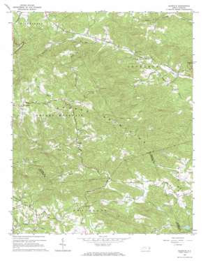
Gilreath Topo Map North Carolina
To zoom in, hover over the map of Gilreath
USGS Topo Quad 36081a1 - 1:24,000 scale
| Topo Map Name: | Gilreath |
| USGS Topo Quad ID: | 36081a1 |
| Print Size: | ca. 21 1/4" wide x 27" high |
| Southeast Coordinates: | 36° N latitude / 81° W longitude |
| Map Center Coordinates: | 36.0625° N latitude / 81.0625° W longitude |
| U.S. State: | NC |
| Filename: | o36081a1.jpg |
| Download Map JPG Image: | Gilreath topo map 1:24,000 scale |
| Map Type: | Topographic |
| Topo Series: | 7.5´ |
| Map Scale: | 1:24,000 |
| Source of Map Images: | United States Geological Survey (USGS) |
| Alternate Map Versions: |
Gilreath NC 1966, updated 1968 Download PDF Buy paper map Gilreath NC 1966, updated 1968 Download PDF Buy paper map Gilreath NC 2000, updated 2003 Download PDF Buy paper map Gilreath NC 2010 Download PDF Buy paper map Gilreath NC 2013 Download PDF Buy paper map Gilreath NC 2016 Download PDF Buy paper map |
1:24,000 Topo Quads surrounding Gilreath
> Back to 36081a1 at 1:100,000 scale
> Back to 36080a1 at 1:250,000 scale
> Back to U.S. Topo Maps home
Gilreath topo map: Gazetteer
Gilreath: Dams
Deater Dam elevation 529m 1735′Dwight Baity Dam elevation 605m 1984′
Fox Mountain Lake Dam elevation 386m 1266′
Gilreath: Populated Places
Gilreath elevation 422m 1384′Hunting Creek (historical) elevation 398m 1305′
Old Gilreath elevation 658m 2158′
Spurgeon (historical) elevation 346m 1135′
Gilreath: Reservoirs
Fox Mountain Lake elevation 386m 1266′Noname elevation 605m 1984′
Noname elevation 529m 1735′
Gilreath: Summits
Debs Knob elevation 525m 1722′Pilot Mountain elevation 584m 1916′
Pole Mountain elevation 446m 1463′
Rich Mountain elevation 464m 1522′
Gilreath digital topo map on disk
Buy this Gilreath topo map showing relief, roads, GPS coordinates and other geographical features, as a high-resolution digital map file on DVD:
Western Virginia & Southern West Virginia
Buy digital topo maps: Western Virginia & Southern West Virginia


