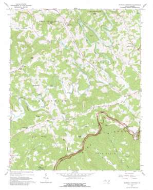
Glendale Springs Topo Map North Carolina
To zoom in, hover over the map of Glendale Springs
USGS Topo Quad 36081c4 - 1:24,000 scale
| Topo Map Name: | Glendale Springs |
| USGS Topo Quad ID: | 36081c4 |
| Print Size: | ca. 21 1/4" wide x 27" high |
| Southeast Coordinates: | 36.25° N latitude / 81.375° W longitude |
| Map Center Coordinates: | 36.3125° N latitude / 81.4375° W longitude |
| U.S. State: | NC |
| Filename: | o36081c4.jpg |
| Download Map JPG Image: | Glendale Springs topo map 1:24,000 scale |
| Map Type: | Topographic |
| Topo Series: | 7.5´ |
| Map Scale: | 1:24,000 |
| Source of Map Images: | United States Geological Survey (USGS) |
| Alternate Map Versions: |
Glendale Springs NC 1967, updated 1968 Download PDF Buy paper map Glendale Springs NC 1967, updated 1979 Download PDF Buy paper map Glendale Springs NC 1967, updated 1979 Download PDF Buy paper map Glendale Springs NC 2000, updated 2001 Download PDF Buy paper map Glendale Springs NC 2010 Download PDF Buy paper map Glendale Springs NC 2013 Download PDF Buy paper map Glendale Springs NC 2016 Download PDF Buy paper map |
1:24,000 Topo Quads surrounding Glendale Springs
> Back to 36081a1 at 1:100,000 scale
> Back to 36080a1 at 1:250,000 scale
> Back to U.S. Topo Maps home
Glendale Springs topo map: Gazetteer
Glendale Springs: Dams
Ashe Lake Dam elevation 906m 2972′Glendale Springs: Falls
Betseys Rock Falls elevation 945m 3100′Glendale Springs: Gaps
Benge Gap elevation 1007m 3303′Calloway Gap elevation 1046m 3431′
Hewed Log Gap elevation 968m 3175′
Phillips Gap elevation 978m 3208′
Glendale Springs: Lakes
Lake Ashe elevation 879m 2883′Glendale Springs: Populated Places
Glendale Springs elevation 937m 3074′Idlewild elevation 888m 2913′
Obids elevation 883m 2896′
Othello elevation 891m 2923′
Oval elevation 950m 3116′
Walsh (historical) elevation 707m 2319′
Yates elevation 887m 2910′
Glendale Springs: Reservoirs
Ashe Lake elevation 906m 2972′Glendale Springs: Ridges
Big Ridge elevation 1068m 3503′Nathens Ridge elevation 938m 3077′
Glendale Springs: Streams
Beaver Creek elevation 847m 2778′Cole Branch elevation 904m 2965′
East Fork Pine Swamp Creek elevation 886m 2906′
Gap Creek elevation 870m 2854′
Little Fork elevation 600m 1968′
Obids Creek elevation 827m 2713′
Pine Swamp Creek elevation 859m 2818′
South Beaver Creek elevation 848m 2782′
West Fork Pine Swamp Creek elevation 859m 2818′
Wolfpen Creek elevation 889m 2916′
Glendale Springs: Summits
Benge Knob elevation 1126m 3694′Frenches Knob elevation 1148m 3766′
Henson Mountain elevation 1097m 3599′
Nettle Knob elevation 1148m 3766′
Round Knob elevation 1062m 3484′
The Lump elevation 1071m 3513′
Glendale Springs digital topo map on disk
Buy this Glendale Springs topo map showing relief, roads, GPS coordinates and other geographical features, as a high-resolution digital map file on DVD:
Western Virginia & Southern West Virginia
Buy digital topo maps: Western Virginia & Southern West Virginia


