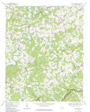
Laurel Springs Topo Map North Carolina
To zoom in, hover over the map of Laurel Springs
USGS Topo Quad 36081d3 - 1:24,000 scale
| Topo Map Name: | Laurel Springs |
| USGS Topo Quad ID: | 36081d3 |
| Print Size: | ca. 21 1/4" wide x 27" high |
| Southeast Coordinates: | 36.375° N latitude / 81.25° W longitude |
| Map Center Coordinates: | 36.4375° N latitude / 81.3125° W longitude |
| U.S. State: | NC |
| Filename: | o36081d3.jpg |
| Download Map JPG Image: | Laurel Springs topo map 1:24,000 scale |
| Map Type: | Topographic |
| Topo Series: | 7.5´ |
| Map Scale: | 1:24,000 |
| Source of Map Images: | United States Geological Survey (USGS) |
| Alternate Map Versions: |
Laurel Springs NC 1968, updated 1971 Download PDF Buy paper map Laurel Springs NC 1968, updated 1979 Download PDF Buy paper map Laurel Springs NC 1996, updated 1999 Download PDF Buy paper map Laurel Springs NC 2010 Download PDF Buy paper map Laurel Springs NC 2013 Download PDF Buy paper map Laurel Springs NC 2016 Download PDF Buy paper map |
1:24,000 Topo Quads surrounding Laurel Springs
> Back to 36081a1 at 1:100,000 scale
> Back to 36080a1 at 1:250,000 scale
> Back to U.S. Topo Maps home
Laurel Springs topo map: Gazetteer
Laurel Springs: Airports
Skyland Airport elevation 874m 2867′Laurel Springs: Gaps
Low Gap elevation 946m 3103′Laurel Springs: Populated Places
Furches elevation 869m 2851′Laurel Springs elevation 838m 2749′
New Hope elevation 917m 3008′
Ore Knob elevation 955m 3133′
Peden elevation 796m 2611′
Scottville elevation 870m 2854′
Transou elevation 899m 2949′
Laurel Springs: Ridges
Huckleberry Ridge elevation 915m 3001′Laurel Springs: Springs
Laurel Springs elevation 849m 2785′Laurel Springs: Streams
Beaver Branch elevation 780m 2559′Crab Fork elevation 818m 2683′
Cranberry Creek elevation 779m 2555′
Laurel Fork elevation 854m 2801′
Little Peak Creek elevation 794m 2604′
Long Branch elevation 793m 2601′
Meadow Fork elevation 854m 2801′
Nathans Creek elevation 781m 2562′
Peak Creek elevation 791m 2595′
Piney Branch elevation 807m 2647′
Piney Fork elevation 835m 2739′
Prathers Creek elevation 765m 2509′
Reeves Branch elevation 850m 2788′
Silas Branch elevation 791m 2595′
Wolf Branch elevation 829m 2719′
Laurel Springs: Summits
Franks Knob elevation 930m 3051′Rattlesnake Mountain elevation 1112m 3648′
The Peak elevation 1178m 3864′
Upper Mountain elevation 1072m 3517′
Laurel Springs digital topo map on disk
Buy this Laurel Springs topo map showing relief, roads, GPS coordinates and other geographical features, as a high-resolution digital map file on DVD:
Western Virginia & Southern West Virginia
Buy digital topo maps: Western Virginia & Southern West Virginia


