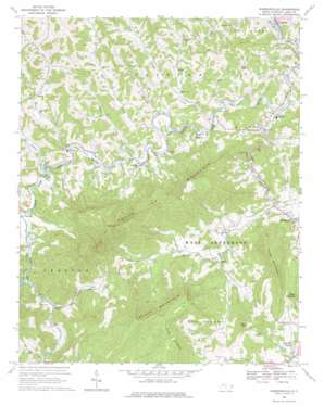
Warrensville Topo Map North Carolina
To zoom in, hover over the map of Warrensville
USGS Topo Quad 36081d5 - 1:24,000 scale
| Topo Map Name: | Warrensville |
| USGS Topo Quad ID: | 36081d5 |
| Print Size: | ca. 21 1/4" wide x 27" high |
| Southeast Coordinates: | 36.375° N latitude / 81.5° W longitude |
| Map Center Coordinates: | 36.4375° N latitude / 81.5625° W longitude |
| U.S. State: | NC |
| Filename: | o36081d5.jpg |
| Download Map JPG Image: | Warrensville topo map 1:24,000 scale |
| Map Type: | Topographic |
| Topo Series: | 7.5´ |
| Map Scale: | 1:24,000 |
| Source of Map Images: | United States Geological Survey (USGS) |
| Alternate Map Versions: |
Warrensville NC 1966, updated 1969 Download PDF Buy paper map Warrensville NC 1966, updated 1978 Download PDF Buy paper map Warrensville NC 1966, updated 1978 Download PDF Buy paper map Warrensville NC 2010 Download PDF Buy paper map Warrensville NC 2013 Download PDF Buy paper map Warrensville NC 2016 Download PDF Buy paper map |
1:24,000 Topo Quads surrounding Warrensville
> Back to 36081a1 at 1:100,000 scale
> Back to 36080a1 at 1:250,000 scale
> Back to U.S. Topo Maps home
Warrensville topo map: Gazetteer
Warrensville: Populated Places
Beaver Creek elevation 921m 3021′Clifton elevation 845m 2772′
Comet elevation 896m 2939′
Creston elevation 871m 2857′
Dresden elevation 826m 2709′
Fig elevation 856m 2808′
Lansing elevation 809m 2654′
Roten elevation 914m 2998′
Smethport elevation 861m 2824′
Trout elevation 921m 3021′
Warrensville elevation 822m 2696′
Warrensville: Streams
Ben Bolen Creek elevation 920m 3018′Big Branch elevation 947m 3106′
Big Laurel Creek elevation 855m 2805′
Buffalo Creek elevation 813m 2667′
Claybank Creek elevation 857m 2811′
Copeland Creek elevation 839m 2752′
Little Buffalo Creek elevation 845m 2772′
Long Hope Creek elevation 922m 3024′
Mill Creek elevation 831m 2726′
Old Field Branch elevation 807m 2647′
Rich Hill Creek elevation 850m 2788′
Stagg Creek elevation 821m 2693′
Sugar Tree Branch elevation 829m 2719′
Three Top Creek elevation 870m 2854′
Warrensville: Summits
Bluff Mountain elevation 1548m 5078′Buck Mountain elevation 1219m 3999′
Paddy Mountain elevation 1320m 4330′
Three Top Mountain elevation 1483m 4865′
Warrensville digital topo map on disk
Buy this Warrensville topo map showing relief, roads, GPS coordinates and other geographical features, as a high-resolution digital map file on DVD:
Western Virginia & Southern West Virginia
Buy digital topo maps: Western Virginia & Southern West Virginia


