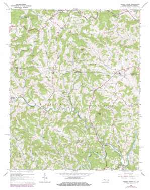
Grassy Creek Topo Map North Carolina
To zoom in, hover over the map of Grassy Creek
USGS Topo Quad 36081e4 - 1:24,000 scale
| Topo Map Name: | Grassy Creek |
| USGS Topo Quad ID: | 36081e4 |
| Print Size: | ca. 21 1/4" wide x 27" high |
| Southeast Coordinates: | 36.5° N latitude / 81.375° W longitude |
| Map Center Coordinates: | 36.5625° N latitude / 81.4375° W longitude |
| U.S. States: | NC, VA |
| Filename: | o36081e4.jpg |
| Download Map JPG Image: | Grassy Creek topo map 1:24,000 scale |
| Map Type: | Topographic |
| Topo Series: | 7.5´ |
| Map Scale: | 1:24,000 |
| Source of Map Images: | United States Geological Survey (USGS) |
| Alternate Map Versions: |
Grassy Creek NC 1966, updated 1968 Download PDF Buy paper map Grassy Creek NC 1966, updated 1978 Download PDF Buy paper map Grassy Creek NC 2011 Download PDF Buy paper map Grassy Creek NC 2013 Download PDF Buy paper map Grassy Creek NC 2016 Download PDF Buy paper map |
| FStopo: | US Forest Service topo Grassy Creek is available: Download FStopo PDF Download FStopo TIF |
1:24,000 Topo Quads surrounding Grassy Creek
> Back to 36081e1 at 1:100,000 scale
> Back to 36080a1 at 1:250,000 scale
> Back to U.S. Topo Maps home
Grassy Creek topo map: Gazetteer
Grassy Creek: Parks
Grayson Highlands State Park elevation 1492m 4895′Grassy Creek: Populated Places
Crumpler elevation 779m 2555′Grassy Creek elevation 809m 2654′
Helton elevation 832m 2729′
Mill Creek elevation 964m 3162′
Rugby elevation 962m 3156′
Sessex elevation 846m 2775′
Sturgills elevation 860m 2821′
Grassy Creek: Ridges
Quillen Ridge elevation 1083m 3553′York Ridge elevation 1061m 3480′
Grassy Creek: Streams
Brier Run elevation 916m 3005′Helton Creek elevation 772m 2532′
Jerd Branch elevation 854m 2801′
Jones Branch elevation 827m 2713′
Jones Branch elevation 829m 2719′
Little Helton Creek elevation 802m 2631′
Little Helton Creek elevation 802m 2631′
Long Branch elevation 803m 2634′
Long Branch elevation 803m 2634′
Mill Creek elevation 911m 2988′
Millpond Branch elevation 769m 2522′
Old Field Creek elevation 783m 2568′
Shippy Branch elevation 832m 2729′
Slippy Branch elevation 832m 2729′
Grassy Creek: Summits
Blackburn Knob elevation 1099m 3605′Helton Knob elevation 1079m 3540′
Grassy Creek digital topo map on disk
Buy this Grassy Creek topo map showing relief, roads, GPS coordinates and other geographical features, as a high-resolution digital map file on DVD:
Western Virginia & Southern West Virginia
Buy digital topo maps: Western Virginia & Southern West Virginia


