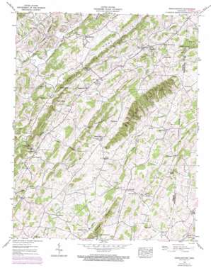
Jearoldstown Topo Map Tennessee
To zoom in, hover over the map of Jearoldstown
USGS Topo Quad 36082c6 - 1:24,000 scale
| Topo Map Name: | Jearoldstown |
| USGS Topo Quad ID: | 36082c6 |
| Print Size: | ca. 21 1/4" wide x 27" high |
| Southeast Coordinates: | 36.25° N latitude / 82.625° W longitude |
| Map Center Coordinates: | 36.3125° N latitude / 82.6875° W longitude |
| U.S. State: | TN |
| Filename: | o36082c6.jpg |
| Download Map JPG Image: | Jearoldstown topo map 1:24,000 scale |
| Map Type: | Topographic |
| Topo Series: | 7.5´ |
| Map Scale: | 1:24,000 |
| Source of Map Images: | United States Geological Survey (USGS) |
| Alternate Map Versions: |
Jearoldstown TN 1935 Download PDF Buy paper map Jearoldstown TN 1939 Download PDF Buy paper map Jearoldstown TN 1939, updated 1960 Download PDF Buy paper map Jearoldstown TN 1939, updated 1972 Download PDF Buy paper map Jearoldstown TN 2010 Download PDF Buy paper map Jearoldstown TN 2013 Download PDF Buy paper map Jearoldstown TN 2016 Download PDF Buy paper map |
1:24,000 Topo Quads surrounding Jearoldstown
> Back to 36082a1 at 1:100,000 scale
> Back to 36082a1 at 1:250,000 scale
> Back to U.S. Topo Maps home
Jearoldstown topo map: Gazetteer
Jearoldstown: Gaps
Gap of the Knobs elevation 499m 1637′Jearoldstown: Populated Places
Cedar Lane elevation 488m 1601′Centersville elevation 500m 1640′
Ducktown elevation 557m 1827′
Grandview elevation 491m 1610′
Graysburg elevation 525m 1722′
Jearoldstown elevation 424m 1391′
Liberty Hill elevation 549m 1801′
Maltsberger (historical) elevation 476m 1561′
Milburnton elevation 518m 1699′
Mill Brook elevation 469m 1538′
Pine Grove elevation 393m 1289′
Pleasant Vale elevation 500m 1640′
Swanay (historical) elevation 465m 1525′
Union Temple elevation 466m 1528′
Jearoldstown: Ranges
Graysburg Hills elevation 586m 1922′Jearoldstown: Ridges
Allegheny Ridge elevation 586m 1922′Baskett Ridge elevation 590m 1935′
Doty Ridge elevation 541m 1774′
Graysburg Knobs elevation 616m 2020′
Hayes Ridge elevation 520m 1706′
Pyborn Ridge elevation 405m 1328′
Shed Ridge elevation 567m 1860′
Skipper Ridge elevation 550m 1804′
Jearoldstown: Springs
Clear Springs elevation 490m 1607′Crawford Spring elevation 496m 1627′
Gourley Spring elevation 491m 1610′
Morelock Spring elevation 473m 1551′
Wheeler Spring elevation 438m 1437′
Whitaker Spring elevation 528m 1732′
Jearoldstown: Streams
Clear Creek elevation 384m 1259′Double Lick Branch elevation 379m 1243′
Milburnton Creek elevation 516m 1692′
Pyborn Creek elevation 372m 1220′
Splatter Creek elevation 466m 1528′
Jearoldstown: Summits
Cheroy Hill elevation 568m 1863′Eames Knob elevation 501m 1643′
Pence Hill elevation 552m 1811′
Taylor Knob elevation 538m 1765′
Jearoldstown: Valleys
Bone Valley elevation 434m 1423′Crabtree Hollow elevation 466m 1528′
Dark Hollow elevation 522m 1712′
Eisenhour Hollow elevation 378m 1240′
Glade Hollow elevation 453m 1486′
Good Hollow elevation 525m 1722′
Happy Valley elevation 477m 1564′
Hootowl Hollow elevation 497m 1630′
Lick Hollow elevation 510m 1673′
Sugar Hollow elevation 539m 1768′
Tadpole Hollow elevation 384m 1259′
Taughn Hollow elevation 380m 1246′
Tucker Hollow elevation 504m 1653′
Tucker Hollow elevation 535m 1755′
Tucker Hollow elevation 534m 1751′
Jearoldstown digital topo map on disk
Buy this Jearoldstown topo map showing relief, roads, GPS coordinates and other geographical features, as a high-resolution digital map file on DVD:
Western Virginia & Southern West Virginia
Buy digital topo maps: Western Virginia & Southern West Virginia


