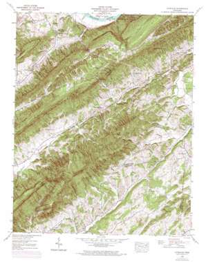
Lovelace Topo Map Tennessee
To zoom in, hover over the map of Lovelace
USGS Topo Quad 36082d6 - 1:24,000 scale
| Topo Map Name: | Lovelace |
| USGS Topo Quad ID: | 36082d6 |
| Print Size: | ca. 21 1/4" wide x 27" high |
| Southeast Coordinates: | 36.375° N latitude / 82.625° W longitude |
| Map Center Coordinates: | 36.4375° N latitude / 82.6875° W longitude |
| U.S. State: | TN |
| Filename: | o36082d6.jpg |
| Download Map JPG Image: | Lovelace topo map 1:24,000 scale |
| Map Type: | Topographic |
| Topo Series: | 7.5´ |
| Map Scale: | 1:24,000 |
| Source of Map Images: | United States Geological Survey (USGS) |
| Alternate Map Versions: |
Lovelace TN 1935 Download PDF Buy paper map Lovelace TN 1939 Download PDF Buy paper map Lovelace TN 1939, updated 1956 Download PDF Buy paper map Lovelace TN 1939, updated 1965 Download PDF Buy paper map Lovelace TN 1939, updated 1972 Download PDF Buy paper map Lovelace TN 2010 Download PDF Buy paper map Lovelace TN 2013 Download PDF Buy paper map Lovelace TN 2016 Download PDF Buy paper map |
1:24,000 Topo Quads surrounding Lovelace
> Back to 36082a1 at 1:100,000 scale
> Back to 36082a1 at 1:250,000 scale
> Back to U.S. Topo Maps home
Lovelace topo map: Gazetteer
Lovelace: Cliffs
Laurel Run Cliffs elevation 400m 1312′The Cliffs elevation 402m 1318′
Lovelace: Gaps
Blair Gap elevation 440m 1443′Hunt Gap elevation 375m 1230′
Little Horse Gap elevation 607m 1991′
Smith Gap elevation 424m 1391′
Wolf Gap elevation 625m 2050′
Wolf Pen Gap elevation 613m 2011′
Lovelace: Populated Places
Blair Gap elevation 402m 1318′Conkintown elevation 422m 1384′
Dykes Mill elevation 410m 1345′
Goshen elevation 412m 1351′
Harbour elevation 395m 1295′
Horse Creek elevation 392m 1286′
Lovelace elevation 414m 1358′
McPheeter Bend elevation 356m 1167′
Lovelace: Ridges
Big Ridge elevation 482m 1581′Big Ridge elevation 696m 2283′
Goshen Mountain elevation 623m 2043′
Onionbed Ridge elevation 531m 1742′
Pine Ridge elevation 646m 2119′
Pretty Ridge elevation 607m 1991′
The Doubles elevation 646m 2119′
Lovelace: Streams
Big Double Branch elevation 452m 1482′Blair Gap Branch elevation 402m 1318′
Fall Branch elevation 388m 1272′
Laurel Run elevation 346m 1135′
Lickskillet Branch elevation 459m 1505′
Limestone Branch elevation 405m 1328′
Lynch Branch elevation 382m 1253′
Smith Gap Creek elevation 347m 1138′
Upper Grassy Fork elevation 459m 1505′
Lovelace: Summits
Canebrake Mountain elevation 616m 2020′Chimneytop elevation 945m 3100′
Chimneytop Mountain elevation 926m 3038′
Kyle Hill elevation 588m 1929′
Little Mountain elevation 646m 2119′
Little Pine Mountain elevation 530m 1738′
Nathan Peak elevation 579m 1899′
Wire Knob elevation 616m 2020′
Lovelace: Valleys
Back Hollow elevation 490m 1607′Barrett Hollow elevation 451m 1479′
Bear Hollow elevation 431m 1414′
Crawford Hollow elevation 412m 1351′
Dark Hollow elevation 427m 1400′
Dixon Hollow elevation 399m 1309′
Front Hollow elevation 494m 1620′
Goshen Valley elevation 352m 1154′
Hensley Hollow elevation 409m 1341′
Horse Hollow elevation 390m 1279′
Kate Hollow elevation 415m 1361′
Kiner Hollow elevation 430m 1410′
Light Hollow elevation 397m 1302′
Mose Hollow elevation 413m 1354′
Sugar Tree Hollow elevation 395m 1295′
Ugly Hollow elevation 421m 1381′
Lovelace digital topo map on disk
Buy this Lovelace topo map showing relief, roads, GPS coordinates and other geographical features, as a high-resolution digital map file on DVD:
Western Virginia & Southern West Virginia
Buy digital topo maps: Western Virginia & Southern West Virginia


