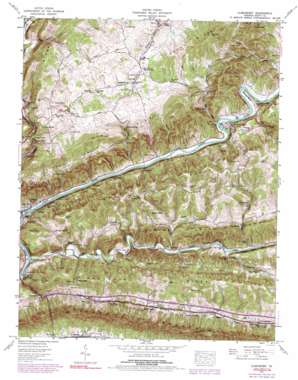
Clinchport Topo Map Virginia
To zoom in, hover over the map of Clinchport
USGS Topo Quad 36082f6 - 1:24,000 scale
| Topo Map Name: | Clinchport |
| USGS Topo Quad ID: | 36082f6 |
| Print Size: | ca. 21 1/4" wide x 27" high |
| Southeast Coordinates: | 36.625° N latitude / 82.625° W longitude |
| Map Center Coordinates: | 36.6875° N latitude / 82.6875° W longitude |
| U.S. State: | VA |
| Filename: | o36082f6.jpg |
| Download Map JPG Image: | Clinchport topo map 1:24,000 scale |
| Map Type: | Topographic |
| Topo Series: | 7.5´ |
| Map Scale: | 1:24,000 |
| Source of Map Images: | United States Geological Survey (USGS) |
| Alternate Map Versions: |
Clinchport VA 1935 Download PDF Buy paper map Clinchport VA 1947, updated 1970 Download PDF Buy paper map Clinchport VA 1947, updated 1978 Download PDF Buy paper map Clinchport VA 1947, updated 1991 Download PDF Buy paper map Clinchport VA 1950 Download PDF Buy paper map Clinchport VA 1950 Download PDF Buy paper map Clinchport VA 2011 Download PDF Buy paper map Clinchport VA 2013 Download PDF Buy paper map Clinchport VA 2016 Download PDF Buy paper map |
| FStopo: | US Forest Service topo Clinchport is available: Download FStopo PDF Download FStopo TIF |
1:24,000 Topo Quads surrounding Clinchport
> Back to 36082e1 at 1:100,000 scale
> Back to 36082a1 at 1:250,000 scale
> Back to U.S. Topo Maps home
Clinchport topo map: Gazetteer
Clinchport: Basins
Greasy Valley elevation 480m 1574′Clinchport: Bends
Starnes Bend elevation 396m 1299′Clinchport: Bridges
Clinchfield Viaduct elevation 371m 1217′Clinchport: Crossings
Carter Ferry Ford elevation 371m 1217′Jennings Ford elevation 375m 1230′
Spivey Ford elevation 377m 1236′
Clinchport: Gaps
Hall Gap elevation 471m 1545′Pisgah Gap elevation 551m 1807′
Clinchport: Parks
Natural Tunnel State Park elevation 539m 1768′Clinchport: Populated Places
Bellamy elevation 392m 1286′Boulder elevation 386m 1266′
Clinchport elevation 374m 1227′
Craft Mill elevation 378m 1240′
Kermit elevation 420m 1377′
Manville elevation 424m 1391′
Rhoton Mill elevation 385m 1263′
Rye Cove elevation 442m 1450′
Spivey Mill elevation 390m 1279′
Spivey Store elevation 378m 1240′
Clinchport: Ranges
Copper Creek Knob elevation 585m 1919′Clinchport: Ridges
Cedar Ridge elevation 512m 1679′Cove Ridge elevation 537m 1761′
Clinchport: Springs
Johnson Springs elevation 406m 1332′Clinchport: Streams
Baker Branch elevation 376m 1233′Beecher Branch elevation 388m 1272′
Big Branch elevation 371m 1217′
Blackoak Branch elevation 389m 1276′
Copper Creek elevation 370m 1213′
Jennings Branch elevation 371m 1217′
Lick Branch elevation 405m 1328′
Mill Creek elevation 376m 1233′
Sorrel Creek elevation 385m 1263′
Stock Creek elevation 372m 1220′
Taylortown Branch elevation 398m 1305′
Clinchport: Summits
Bald Knob elevation 575m 1886′Clinchport: Tunnels
Clinch Mountain Tunnel elevation 704m 2309′Clinchport Tunnel elevation 456m 1496′
Moccasin Ridge Tunnel elevation 501m 1643′
Natural Tunnel elevation 513m 1683′
Starnes Tunnel elevation 431m 1414′
Twin Tunnels elevation 398m 1305′
Clinchport: Valleys
Long Hollow elevation 371m 1217′Vicar Hollow elevation 557m 1827′
Clinchport digital topo map on disk
Buy this Clinchport topo map showing relief, roads, GPS coordinates and other geographical features, as a high-resolution digital map file on DVD:
Western Virginia & Southern West Virginia
Buy digital topo maps: Western Virginia & Southern West Virginia


