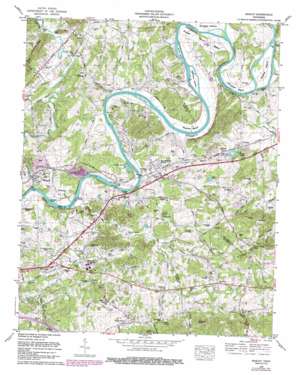
Mascot Topo Map Tennessee
To zoom in, hover over the map of Mascot
USGS Topo Quad 36083a6 - 1:24,000 scale
| Topo Map Name: | Mascot |
| USGS Topo Quad ID: | 36083a6 |
| Print Size: | ca. 21 1/4" wide x 27" high |
| Southeast Coordinates: | 36° N latitude / 83.625° W longitude |
| Map Center Coordinates: | 36.0625° N latitude / 83.6875° W longitude |
| U.S. State: | TN |
| Filename: | o36083a6.jpg |
| Download Map JPG Image: | Mascot topo map 1:24,000 scale |
| Map Type: | Topographic |
| Topo Series: | 7.5´ |
| Map Scale: | 1:24,000 |
| Source of Map Images: | United States Geological Survey (USGS) |
| Alternate Map Versions: |
Mascot TN 1935 Download PDF Buy paper map Mascot TN 1938 Download PDF Buy paper map Mascot TN 1953, updated 1958 Download PDF Buy paper map Mascot TN 1966, updated 1968 Download PDF Buy paper map Mascot TN 1966, updated 1978 Download PDF Buy paper map Mascot TN 1966, updated 1980 Download PDF Buy paper map Mascot TN 1966, updated 1988 Download PDF Buy paper map Mascot TN 2010 Download PDF Buy paper map Mascot TN 2013 Download PDF Buy paper map Mascot TN 2016 Download PDF Buy paper map |
1:24,000 Topo Quads surrounding Mascot
> Back to 36083a1 at 1:100,000 scale
> Back to 36082a1 at 1:250,000 scale
> Back to U.S. Topo Maps home
Mascot topo map: Gazetteer
Mascot: Bars
Cobbs Shoals elevation 257m 843′Flat Creek Shoals elevation 251m 823′
Jarnagins Shoals elevation 264m 866′
McBees Shoals elevation 254m 833′
Sailor Shoals elevation 253m 830′
Six Shoals elevation 260m 853′
Mascot: Bends
Big Bend elevation 281m 921′Byerley Bend elevation 267m 875′
Lower Bend elevation 254m 833′
Mitchell Bend elevation 273m 895′
Sweet Gum Bend elevation 283m 928′
Mascot: Bridges
Brice Bridge elevation 290m 951′McBee Bridge elevation 254m 833′
Mascot: Crossings
McBee Ferry (historical) elevation 254m 833′McBee Ford elevation 264m 866′
Mascot: Gaps
Williams Gap elevation 381m 1250′Mascot: Islands
Byerley Island elevation 265m 869′Calf Island elevation 272m 892′
McBee Island elevation 275m 902′
McKinney Islands elevation 265m 869′
Monday Island elevation 258m 846′
Sailor Island elevation 253m 830′
Snaggy Island elevation 268m 879′
Trent Island elevation 263m 862′
Mascot: Lakes
Cates Pond elevation 281m 921′Hodges Lake elevation 271m 889′
Mill Pond elevation 277m 908′
Mascot: Mines
Mascot Mine elevation 293m 961′Mascot: Parks
Carter Community Park elevation 272m 892′Mascot Park elevation 267m 875′
Skaggston Community Park elevation 311m 1020′
Mascot: Populated Places
Carter elevation 275m 902′Hickory elevation 342m 1122′
Hodges elevation 279m 915′
Lyonton elevation 284m 931′
Mascot elevation 263m 862′
Pleasant Grove elevation 372m 1220′
Ridgeview Mobile Home Park elevation 322m 1056′
Strawberry Plains elevation 261m 856′
Thorn Grove elevation 335m 1099′
Thorn Grove elevation 305m 1000′
Trentville elevation 269m 882′
Wyricktown elevation 275m 902′
Mascot: Post Offices
Mascot Post Office elevation 291m 954′Strawberry Plains Post Office elevation 265m 869′
Mascot: Ranges
Bays Mountain elevation 395m 1295′Mascot: Reservoirs
Cress Pond elevation 263m 862′Mascot: Ridges
Pine Ridge elevation 355m 1164′Mascot: Springs
Baker Spring elevation 266m 872′Boiling Springs elevation 270m 885′
Caldwell Spring elevation 285m 935′
Carter Mill Springs elevation 274m 898′
Plummer Spring elevation 261m 856′
Weaver Spring elevation 297m 974′
Mascot: Streams
Beaver Creek elevation 264m 866′Brice Branch elevation 288m 944′
Clift Creek elevation 253m 830′
Crowder Branch elevation 256m 839′
Duggan Branch elevation 286m 938′
Flat Creek elevation 251m 823′
Lyon Creek elevation 255m 836′
Nicely Branch elevation 291m 954′
Rutherford Branch elevation 255m 836′
Thompson Creek elevation 262m 859′
Zachary Branch elevation 291m 954′
Mascot: Summits
Branners Knob elevation 380m 1246′Cline Knob elevation 321m 1053′
Edwards Knob elevation 379m 1243′
Gobbler Knob elevation 359m 1177′
Mascot Rocks elevation 318m 1043′
Roderick Mountain elevation 432m 1417′
Rolling Hill elevation 329m 1079′
Mascot: Valleys
Paw Paw Hollow elevation 311m 1020′Rocky Valley elevation 380m 1246′
Mascot digital topo map on disk
Buy this Mascot topo map showing relief, roads, GPS coordinates and other geographical features, as a high-resolution digital map file on DVD:
Western Virginia & Southern West Virginia
Buy digital topo maps: Western Virginia & Southern West Virginia


