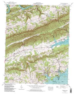
Avondale Topo Map Tennessee
To zoom in, hover over the map of Avondale
USGS Topo Quad 36083c4 - 1:24,000 scale
| Topo Map Name: | Avondale |
| USGS Topo Quad ID: | 36083c4 |
| Print Size: | ca. 21 1/4" wide x 27" high |
| Southeast Coordinates: | 36.25° N latitude / 83.375° W longitude |
| Map Center Coordinates: | 36.3125° N latitude / 83.4375° W longitude |
| U.S. State: | TN |
| Filename: | o36083c4.jpg |
| Download Map JPG Image: | Avondale topo map 1:24,000 scale |
| Map Type: | Topographic |
| Topo Series: | 7.5´ |
| Map Scale: | 1:24,000 |
| Source of Map Images: | United States Geological Survey (USGS) |
| Alternate Map Versions: |
Avondale TN 1935 Download PDF Buy paper map Avondale TN 1938, updated 1954 Download PDF Buy paper map Avondale TN 1939 Download PDF Buy paper map Avondale TN 1939 Download PDF Buy paper map Avondale TN 1960, updated 1962 Download PDF Buy paper map Avondale TN 1979, updated 1980 Download PDF Buy paper map Avondale TN 1979, updated 1980 Download PDF Buy paper map Avondale TN 2010 Download PDF Buy paper map Avondale TN 2013 Download PDF Buy paper map Avondale TN 2016 Download PDF Buy paper map |
1:24,000 Topo Quads surrounding Avondale
> Back to 36083a1 at 1:100,000 scale
> Back to 36082a1 at 1:250,000 scale
> Back to U.S. Topo Maps home
Avondale topo map: Gazetteer
Avondale: Bars
Big Slip elevation 311m 1020′Avondale: Bends
Condry Bend elevation 343m 1125′McCullough Bend elevation 329m 1079′
Avondale: Bridges
Turley Bridge (historical) elevation 327m 1072′Avondale: Capes
Copper Ridge Point elevation 312m 1023′Avondale: Crossings
Turley Ferry (historical) elevation 327m 1072′Avondale: Dams
Wolfe Dam elevation 351m 1151′Avondale: Gaps
Notchy Gap elevation 618m 2027′Thorn Hill Gap elevation 595m 1952′
Avondale: Islands
Turley Island (historical) elevation 327m 1072′Avondale: Populated Places
Avondale elevation 339m 1112′Avondale Springs elevation 337m 1105′
Beech Grove elevation 326m 1069′
Big Q Estates elevation 350m 1148′
Boggs elevation 339m 1112′
Bowen elevation 342m 1122′
Dotson elevation 380m 1246′
Helton elevation 388m 1272′
Hopper Bluff elevation 331m 1085′
Idol elevation 429m 1407′
Lake Forest Estates elevation 341m 1118′
Rock Haven elevation 330m 1082′
Thorn Hill elevation 421m 1381′
Turley Mills (historical) elevation 327m 1072′
Avondale: Post Offices
Thorn Hill Post Office elevation 420m 1377′Avondale: Reservoirs
Wolfe Lake elevation 351m 1151′Avondale: Ridges
McCarty Ridge elevation 398m 1305′Poor Valley Ridge elevation 525m 1722′
Skinfoot Ridge elevation 428m 1404′
Avondale: Springs
Black Sulfur Spring elevation 339m 1112′Free Stone Spring elevation 346m 1135′
Iron Water Spring elevation 339m 1112′
Lithia Spring elevation 337m 1105′
Nuckles Spring elevation 544m 1784′
Red Sulfur Spring elevation 337m 1105′
Russel Spout Spring elevation 438m 1437′
White Sulfur Spring elevation 336m 1102′
Avondale: Streams
Honey Creek elevation 327m 1072′Noe Creek elevation 327m 1072′
Notchy Creek elevation 314m 1030′
Nuckles Branch elevation 335m 1099′
Rocky Branch elevation 317m 1040′
Shields Creek elevation 327m 1072′
Avondale: Summits
Gouge Knob elevation 487m 1597′Avondale: Valleys
Broken Valley elevation 387m 1269′Bullen Valley elevation 315m 1033′
Christian Hollow elevation 327m 1072′
Kettle Hollow elevation 380m 1246′
Narrow Valley elevation 327m 1072′
Owl Hollow elevation 313m 1026′
Sulphur Springs Hollow elevation 327m 1072′
Avondale digital topo map on disk
Buy this Avondale topo map showing relief, roads, GPS coordinates and other geographical features, as a high-resolution digital map file on DVD:
Western Virginia & Southern West Virginia
Buy digital topo maps: Western Virginia & Southern West Virginia


