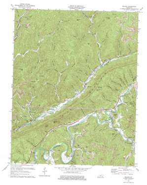
Balkan Topo Map Kentucky
To zoom in, hover over the map of Balkan
USGS Topo Quad 36083g5 - 1:24,000 scale
| Topo Map Name: | Balkan |
| USGS Topo Quad ID: | 36083g5 |
| Print Size: | ca. 21 1/4" wide x 27" high |
| Southeast Coordinates: | 36.75° N latitude / 83.5° W longitude |
| Map Center Coordinates: | 36.8125° N latitude / 83.5625° W longitude |
| U.S. State: | KY |
| Filename: | o36083g5.jpg |
| Download Map JPG Image: | Balkan topo map 1:24,000 scale |
| Map Type: | Topographic |
| Topo Series: | 7.5´ |
| Map Scale: | 1:24,000 |
| Source of Map Images: | United States Geological Survey (USGS) |
| Alternate Map Versions: |
Balkan KY 1954, updated 1956 Download PDF Buy paper map Balkan KY 1954, updated 1971 Download PDF Buy paper map Balkan KY 1974, updated 1975 Download PDF Buy paper map Balkan KY 2010 Download PDF Buy paper map Balkan KY 2013 Download PDF Buy paper map Balkan KY 2016 Download PDF Buy paper map |
1:24,000 Topo Quads surrounding Balkan
> Back to 36083e1 at 1:100,000 scale
> Back to 36082a1 at 1:250,000 scale
> Back to U.S. Topo Maps home
Balkan topo map: Gazetteer
Balkan: Areas
Salting Ground elevation 677m 2221′Balkan: Gaps
Bailey Gap elevation 662m 2171′Basin Gap elevation 657m 2155′
Bingham Gap elevation 624m 2047′
Blind John Taylor Gap elevation 646m 2119′
Callaway Gap elevation 674m 2211′
Dewing Gap elevation 485m 1591′
Hanner Gap elevation 644m 2112′
Kettle Gap elevation 695m 2280′
Lark Howard Gap elevation 687m 2253′
Lockes Gap elevation 657m 2155′
Moccasin Gap elevation 658m 2158′
Balkan: Populated Places
Balkan elevation 386m 1266′Black Snake elevation 340m 1115′
Blackmont elevation 339m 1112′
Callaway elevation 333m 1092′
Cardinal elevation 335m 1099′
Kettle Island elevation 342m 1122′
Laurel Ford elevation 328m 1076′
Miracle elevation 327m 1072′
Stoney Fork elevation 339m 1112′
Tejay elevation 324m 1062′
Tuggleville elevation 345m 1131′
Balkan: Post Offices
Hulen Post Office elevation 339m 1112′Balkan: Ranges
Pine Mountain elevation 352m 1154′Balkan: Ridges
Hampton Ridge elevation 636m 2086′Lewis Ridge elevation 493m 1617′
Balkan: Streams
Apple Blossom Branch elevation 324m 1062′Ben Howard Branch elevation 337m 1105′
Betsie Branch elevation 343m 1125′
Blacksnake Branch elevation 347m 1138′
Blanton Branch elevation 318m 1043′
Brownies Creek elevation 323m 1059′
Buckeye Branch elevation 409m 1341′
Buffalo Creek elevation 353m 1158′
Bull Branch elevation 331m 1085′
Bullins Branch elevation 449m 1473′
Burst Branch elevation 329m 1079′
Camp Branch elevation 355m 1164′
Campbell Branch elevation 341m 1118′
Country Club Branch elevation 330m 1082′
Crooked Branch elevation 327m 1072′
Cy Hoskins Branch elevation 325m 1066′
Deer Branch elevation 349m 1145′
Dry Branch elevation 321m 1053′
Dry Fork elevation 425m 1394′
Gabe Branch elevation 328m 1076′
Green Howard Branch elevation 329m 1079′
James York Branch elevation 368m 1207′
Jerrys Branch elevation 329m 1079′
John Branch elevation 360m 1181′
Johnson Branch elevation 364m 1194′
Kettle Island Branch elevation 315m 1033′
Knuckles Branch elevation 364m 1194′
Lee Andrews Branch elevation 329m 1079′
Lick Branch elevation 341m 1118′
Mary Branch elevation 334m 1095′
McFarland Branch elevation 350m 1148′
Meadow Branch elevation 327m 1072′
Meetinghouse Branch elevation 325m 1066′
Middle Fork Watts Creek elevation 355m 1164′
Mill Creek elevation 323m 1059′
Minton Branch elevation 329m 1079′
Newton Branch elevation 327m 1072′
Newtown Branch elevation 323m 1059′
Oldhouse Branch elevation 329m 1079′
Pickerin Branch elevation 317m 1040′
Pound Mill Branch elevation 329m 1079′
Puckett Creek elevation 328m 1076′
Roaring Fork elevation 366m 1200′
Rockhouse Branch elevation 398m 1305′
Rough Branch elevation 342m 1122′
Saylor Branch elevation 384m 1259′
Schoolhouse Branch elevation 328m 1076′
Stillhouse Branch elevation 329m 1079′
Stoney Fork elevation 339m 1112′
Tom Fork elevation 321m 1053′
Wolf Pen Branch elevation 399m 1309′
Yellow Cliff Branch elevation 315m 1033′
York Branch elevation 383m 1256′
Balkan: Summits
Chestnut Flats elevation 672m 2204′Pumpkin Knob elevation 632m 2073′
Tan Yard Hill elevation 474m 1555′
Balkan: Valleys
Board Tree Hollow elevation 342m 1122′Balkan digital topo map on disk
Buy this Balkan topo map showing relief, roads, GPS coordinates and other geographical features, as a high-resolution digital map file on DVD:
Western Virginia & Southern West Virginia
Buy digital topo maps: Western Virginia & Southern West Virginia


