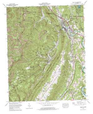
Lake City Topo Map Tennessee
To zoom in, hover over the map of Lake City
USGS Topo Quad 36084b2 - 1:24,000 scale
| Topo Map Name: | Lake City |
| USGS Topo Quad ID: | 36084b2 |
| Print Size: | ca. 21 1/4" wide x 27" high |
| Southeast Coordinates: | 36.125° N latitude / 84.125° W longitude |
| Map Center Coordinates: | 36.1875° N latitude / 84.1875° W longitude |
| U.S. State: | TN |
| Filename: | o36084b2.jpg |
| Download Map JPG Image: | Lake City topo map 1:24,000 scale |
| Map Type: | Topographic |
| Topo Series: | 7.5´ |
| Map Scale: | 1:24,000 |
| Source of Map Images: | United States Geological Survey (USGS) |
| Alternate Map Versions: |
Coal Creek TN 1936 Download PDF Buy paper map Lake City TN 1947, updated 1947 Download PDF Buy paper map Lake City TN 1952, updated 1955 Download PDF Buy paper map Lake City TN 1952, updated 1968 Download PDF Buy paper map Lake City TN 1973, updated 1975 Download PDF Buy paper map Lake City TN 2010 Download PDF Buy paper map Lake City TN 2013 Download PDF Buy paper map Lake City TN 2016 Download PDF Buy paper map |
1:24,000 Topo Quads surrounding Lake City
> Back to 36084a1 at 1:100,000 scale
> Back to 36084a1 at 1:250,000 scale
> Back to U.S. Topo Maps home
Lake City topo map: Gazetteer
Lake City: Bars
Llewellyns Schoals elevation 242m 793′Offutts Shoals elevation 248m 813′
Thomas Shoals elevation 248m 813′
Lake City: Crossings
Interchange 128 elevation 275m 902′Interchange 129 elevation 273m 895′
Lake City: Flats
Braden Flats elevation 588m 1929′Brown Flats elevation 512m 1679′
Lake City: Gaps
Cold Gap elevation 876m 2874′Grassy Gap elevation 916m 3005′
Graves Gap elevation 654m 2145′
Low Gap elevation 941m 3087′
White Gap elevation 910m 2985′
Lake City: Islands
Llewellyn Island elevation 243m 797′Lake City: Mines
Beech Grove Mine elevation 751m 2463′Beech Valley Mine elevation 391m 1282′
Hurstle Braden Mine elevation 543m 1781′
Slatestone Mine elevation 310m 1017′
Thistle Mine elevation 293m 961′
Lake City: Populated Places
Beech Grove elevation 305m 1000′Blowing Springs elevation 303m 994′
Briceville elevation 278m 912′
Cane Creek (historical) elevation 255m 836′
Cumberland View Estates elevation 381m 1250′
Disney elevation 303m 994′
Fraterville elevation 277m 908′
Granite elevation 283m 928′
Knapp (historical) elevation 282m 925′
Lake City elevation 264m 866′
Medford elevation 283m 928′
Minersville elevation 322m 1056′
Offutt elevation 254m 833′
Seeber Flats elevation 501m 1643′
Slatestone elevation 309m 1013′
The Wye elevation 264m 866′
Lake City: Post Offices
Briceville Post Office elevation 285m 935′Lake City: Reservoirs
Clinton Reservoir elevation 323m 1059′Lake City: Ridges
Andy Ridge elevation 392m 1286′Backbone Ridge elevation 512m 1679′
Middle Ridge elevation 475m 1558′
Middle ridge elevation 507m 1663′
Root Hog Ridge elevation 451m 1479′
Lake City: Springs
Blowing Springs elevation 271m 889′Disney Spring elevation 299m 980′
Hawkins Spring elevation 320m 1049′
Hoskins Spring elevation 292m 958′
Lovely Spring elevation 271m 889′
Martin Spring elevation 252m 826′
Queener Spring elevation 274m 898′
Slover Spring elevation 331m 1085′
Lake City: Streams
Alder Branch elevation 243m 797′Beech Grove Fork elevation 262m 859′
Cane Creek elevation 249m 816′
Clear Branch elevation 256m 839′
Doe Creek elevation 256m 839′
Laurel Branch elevation 278m 912′
Lovely Branch elevation 250m 820′
Middle Creek elevation 274m 898′
Miller Creek elevation 278m 912′
Right Fork Coal Creek elevation 258m 846′
Schoolhouse Branch elevation 306m 1003′
Slatestone Creek elevation 276m 905′
Lake City: Summits
Cross Mountain elevation 1075m 3526′Militia Hill elevation 434m 1423′
Sun Butte elevation 587m 1925′
The Flag Pole elevation 1075m 3526′
Vowell Mountain elevation 813m 2667′
Lake City: Valleys
Airshaft Hollow elevation 304m 997′Airshaft Hollow elevation 274m 898′
Andy Hollow elevation 272m 892′
Backbone Hollow elevation 347m 1138′
Barb Hollow elevation 395m 1295′
Bear Hollow elevation 317m 1040′
Burn Out Hollow elevation 328m 1076′
Cambria Hollow elevation 304m 997′
Coldspring Hollow elevation 364m 1194′
Jackson Hollow elevation 339m 1112′
Log Camp Hollow elevation 320m 1049′
Longfield Hollow elevation 257m 843′
Lovely Hollow elevation 249m 816′
McQueen Hollow elevation 315m 1033′
Nunn Hollow elevation 301m 987′
Old Sawmill Hollow elevation 333m 1092′
Rainbow Bluff Hollow elevation 271m 889′
Slatestone Hollow elevation 297m 974′
Strong Hollow elevation 261m 856′
Tennessee Hollow elevation 278m 912′
Thistle Hollow elevation 278m 912′
Three Forks Hollow elevation 357m 1171′
Lake City digital topo map on disk
Buy this Lake City topo map showing relief, roads, GPS coordinates and other geographical features, as a high-resolution digital map file on DVD:


