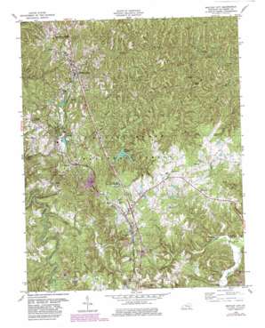
Whitley City Topo Map Kentucky
To zoom in, hover over the map of Whitley City
USGS Topo Quad 36084f4 - 1:24,000 scale
| Topo Map Name: | Whitley City |
| USGS Topo Quad ID: | 36084f4 |
| Print Size: | ca. 21 1/4" wide x 27" high |
| Southeast Coordinates: | 36.625° N latitude / 84.375° W longitude |
| Map Center Coordinates: | 36.6875° N latitude / 84.4375° W longitude |
| U.S. State: | KY |
| Filename: | o36084f4.jpg |
| Download Map JPG Image: | Whitley City topo map 1:24,000 scale |
| Map Type: | Topographic |
| Topo Series: | 7.5´ |
| Map Scale: | 1:24,000 |
| Source of Map Images: | United States Geological Survey (USGS) |
| Alternate Map Versions: |
Whitley City KY 1952, updated 1954 Download PDF Buy paper map Whitley City KY 1963, updated 1966 Download PDF Buy paper map Whitley City KY 1979, updated 1979 Download PDF Buy paper map Whitley City KY 1979, updated 1983 Download PDF Buy paper map Whitley City KY 2010 Download PDF Buy paper map Whitley City KY 2013 Download PDF Buy paper map Whitley City KY 2016 Download PDF Buy paper map |
| FStopo: | US Forest Service topo Whitley City is available: Download FStopo PDF Download FStopo TIF |
1:24,000 Topo Quads surrounding Whitley City
> Back to 36084e1 at 1:100,000 scale
> Back to 36084a1 at 1:250,000 scale
> Back to U.S. Topo Maps home
Whitley City topo map: Gazetteer
Whitley City: Airports
McCreary County Airport elevation 410m 1345′Whitley City: Populated Places
Gilreath elevation 410m 1345′Hickory Grove elevation 394m 1292′
Marshes Siding elevation 405m 1328′
Pine Knot elevation 433m 1420′
Revelo elevation 428m 1404′
Silerville elevation 432m 1417′
Stearns elevation 408m 1338′
Whitley City elevation 412m 1351′
Whitley City: Post Offices
Stearns Post Office elevation 404m 1325′Strunk Post Office elevation 432m 1417′
Whitley City: Reservoirs
Laurel Creek Reservoir elevation 354m 1161′Whitley City: Streams
Battery Creek elevation 354m 1161′Bowman Branch elevation 339m 1112′
Bridge Fork elevation 305m 1000′
Buncomb Branch elevation 315m 1033′
Cat Creek elevation 325m 1066′
Chewford Creek elevation 342m 1122′
East Apple Tree Branch elevation 348m 1141′
Elisha Branch elevation 315m 1033′
Jenneys Branch elevation 300m 984′
Otter Creek elevation 339m 1112′
Smith Fork elevation 317m 1040′
Sweet Gum Branch elevation 333m 1092′
Wolf Pen Creek elevation 342m 1122′
Wright Branch elevation 296m 971′
Whitley City: Summits
American Legion Knoll elevation 397m 1302′Indian Knob elevation 422m 1384′
Whitley City: Trails
Laurel Creek Trail elevation 340m 1115′Whitley City digital topo map on disk
Buy this Whitley City topo map showing relief, roads, GPS coordinates and other geographical features, as a high-resolution digital map file on DVD:


