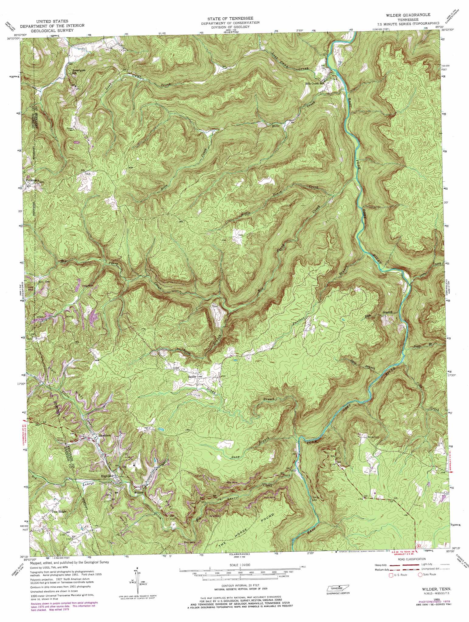
Wilder Topo Map Tennessee
To zoom in, hover over the map of Wilder
USGS Topo Quad 36085c1 - 1:24,000 scale
| Topo Map Name: | Wilder |
| USGS Topo Quad ID: | 36085c1 |
| Print Size: | ca. 21 1/4" wide x 27" high |
| Southeast Coordinates: | 36.25° N latitude / 85° W longitude |
| Map Center Coordinates: | 36.3125° N latitude / 85.0625° W longitude |
| U.S. State: | TN |
| Filename: | o36085c1.jpg |
| Download Map JPG Image: | Wilder topo map 1:24,000 scale |
| Map Type: | Topographic |
| Topo Series: | 7.5´ |
| Map Scale: | 1:24,000 |
| Source of Map Images: | United States Geological Survey (USGS) |
| Alternate Map Versions: |
Wilder TN 1955, updated 1956 Download PDF Buy paper map Wilder TN 1955, updated 1973 Download PDF Buy paper map Wilder TN 1955, updated 1979 Download PDF Buy paper map Wilder TN 2010 Download PDF Buy paper map Wilder TN 2013 Download PDF Buy paper map Wilder TN 2016 Download PDF Buy paper map |
1:24,000 Topo Quads surrounding Wilder
Dale Hollow Reservoir Se |
Byrdstown |
Moodyville |
Pall Mall |
Sharp Place |
Livingston |
Alpine |
Riverton |
Jamestown |
Stockton |
Okalona |
Crawford |
Wilder |
Grimsley |
Burrville |
Monterey |
Obey City |
Clarkrange |
Jones Knob |
Twin Bridges |
Monterey Lake |
Campbell Junction |
Isoline |
Fox Creek |
Hebbertsburg |
> Back to 36085a1 at 1:100,000 scale
> Back to 36084a1 at 1:250,000 scale
> Back to U.S. Topo Maps home
Wilder topo map: Gazetteer
Wilder: Mines
Claude Ledbetter Mine elevation 523m 1715′Howard Burks Mine elevation 522m 1712′
Wilder: Populated Places
Cooktown elevation 555m 1820′Davidson elevation 468m 1535′
Highland elevation 472m 1548′
Sandy elevation 525m 1722′
Vine Ridge elevation 542m 1778′
Wilder elevation 459m 1505′
Wilder: Post Offices
Wilder Post Office elevation 488m 1601′Wilder: Streams
Big Laurel Creek elevation 278m 912′Big Piney Creek elevation 228m 748′
Bills Creek elevation 221m 725′
Buck Branch elevation 522m 1712′
Cobb Creek elevation 252m 826′
Deep Branch elevation 245m 803′
Lick Branch elevation 241m 790′
Lints Cove branch elevation 240m 787′
Little Laurel Creek elevation 444m 1456′
Little Piney Creek elevation 236m 774′
Long Branch elevation 328m 1076′
Lost Cane Creek elevation 220m 721′
Panther Branch elevation 235m 770′
Pratt Branch elevation 244m 800′
Sandy Branch elevation 273m 895′
Snap Branch elevation 277m 908′
Tar Kiln Branch elevation 254m 833′
Wilder: Summits
The Horse Pound elevation 543m 1781′Wilder: Valleys
Lints Cove elevation 239m 784′Wilder digital topo map on disk
Buy this Wilder topo map showing relief, roads, GPS coordinates and other geographical features, as a high-resolution digital map file on DVD: