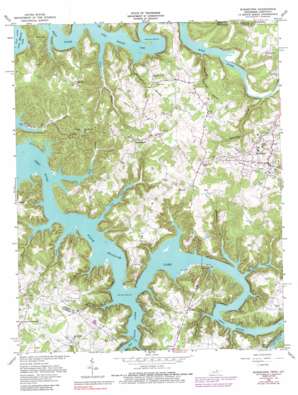
Byrdstown Topo Map Tennessee
To zoom in, hover over the map of Byrdstown
USGS Topo Quad 36085e2 - 1:24,000 scale
| Topo Map Name: | Byrdstown |
| USGS Topo Quad ID: | 36085e2 |
| Print Size: | ca. 21 1/4" wide x 27" high |
| Southeast Coordinates: | 36.5° N latitude / 85.125° W longitude |
| Map Center Coordinates: | 36.5625° N latitude / 85.1875° W longitude |
| U.S. States: | TN, KY |
| Filename: | o36085e2.jpg |
| Download Map JPG Image: | Byrdstown topo map 1:24,000 scale |
| Map Type: | Topographic |
| Topo Series: | 7.5´ |
| Map Scale: | 1:24,000 |
| Source of Map Images: | United States Geological Survey (USGS) |
| Alternate Map Versions: |
Byrdstown TN 1962, updated 1964 Download PDF Buy paper map Byrdstown TN 1962, updated 1979 Download PDF Buy paper map Byrdstown TN 1962, updated 1988 Download PDF Buy paper map Byrdstown TN 2010 Download PDF Buy paper map Byrdstown TN 2013 Download PDF Buy paper map Byrdstown TN 2016 Download PDF Buy paper map |
1:24,000 Topo Quads surrounding Byrdstown
> Back to 36085e1 at 1:100,000 scale
> Back to 36084a1 at 1:250,000 scale
> Back to U.S. Topo Maps home
Byrdstown topo map: Gazetteer
Byrdstown: Bends
Amonette Bend elevation 240m 787′Pipern Bend elevation 243m 797′
Pryor Bend elevation 282m 925′
Byrdstown: Crossings
Babb Ford (historical) elevation 196m 643′Franklin Ferry (historical) elevation 196m 643′
Byrdstown: Parks
Cove Creek Recreation Area elevation 213m 698′Obey River Recreation Area elevation 202m 662′
Byrdstown: Populated Places
Barnes elevation 287m 941′Bloomington elevation 307m 1007′
Boom elevation 295m 967′
Byrdstown elevation 313m 1026′
Fairview elevation 298m 977′
Faix elevation 314m 1030′
Green Brier elevation 301m 987′
Huntersville elevation 278m 912′
Love Lady elevation 312m 1023′
Midway elevation 304m 997′
Oak Hill elevation 295m 967′
Plain Grove elevation 305m 1000′
Smyrna elevation 314m 1030′
Star Point elevation 319m 1046′
Sunset elevation 205m 672′
Byrdstown: Post Offices
Byrdstown Post Office elevation 302m 990′Byrdstown: Streams
Barnes Creek elevation 196m 643′Big Eagle Creek elevation 196m 643′
Brimstone Creek elevation 199m 652′
Cope Creek elevation 196m 643′
Cove Creek elevation 196m 643′
Hurricane Creek elevation 196m 643′
Jackson Creek elevation 196m 643′
Jolly Creek elevation 196m 643′
Key Branch elevation 196m 643′
Meetinghouse Branch elevation 196m 643′
Pendergrass Creek elevation 196m 643′
Sewell Creek elevation 196m 643′
Byrdstown: Valleys
Blowing Springs Hollow elevation 196m 643′Garrett Hollow elevation 196m 643′
Horsetrough Hollow elevation 198m 649′
Byrdstown digital topo map on disk
Buy this Byrdstown topo map showing relief, roads, GPS coordinates and other geographical features, as a high-resolution digital map file on DVD:


