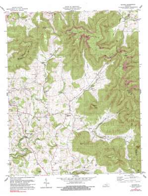
Savage Topo Map Kentucky
To zoom in, hover over the map of Savage
USGS Topo Quad 36085f1 - 1:24,000 scale
| Topo Map Name: | Savage |
| USGS Topo Quad ID: | 36085f1 |
| Print Size: | ca. 21 1/4" wide x 27" high |
| Southeast Coordinates: | 36.625° N latitude / 85° W longitude |
| Map Center Coordinates: | 36.6875° N latitude / 85.0625° W longitude |
| U.S. State: | KY |
| Filename: | o36085f1.jpg |
| Download Map JPG Image: | Savage topo map 1:24,000 scale |
| Map Type: | Topographic |
| Topo Series: | 7.5´ |
| Map Scale: | 1:24,000 |
| Source of Map Images: | United States Geological Survey (USGS) |
| Alternate Map Versions: |
Savage KY 1954, updated 1955 Download PDF Buy paper map Savage KY 1978, updated 1979 Download PDF Buy paper map Savage KY 1978, updated 1990 Download PDF Buy paper map Savage KY 2010 Download PDF Buy paper map Savage KY 2013 Download PDF Buy paper map Savage KY 2016 Download PDF Buy paper map |
1:24,000 Topo Quads surrounding Savage
> Back to 36085e1 at 1:100,000 scale
> Back to 36084a1 at 1:250,000 scale
> Back to U.S. Topo Maps home
Savage topo map: Gazetteer
Savage: Bends
Beech Bottom elevation 292m 958′Savage: Cliffs
Little Cliff elevation 486m 1594′Pinnacle Cliff elevation 427m 1400′
Savage: Gaps
Wades Gap elevation 377m 1236′Savage: Populated Places
Bug elevation 251m 823′Cannons Mill elevation 291m 954′
Cedar Knob elevation 305m 1000′
Jones Mill elevation 255m 836′
Rolan elevation 279m 915′
Savage elevation 293m 961′
Upchurch elevation 293m 961′
Savage: Post Offices
Bug Post Office (historical) elevation 244m 800′Caney Gap Post Office (historical) elevation 305m 1000′
Cannons Mill Post Office (historical) elevation 272m 892′
Cedar Knob Post Office (historical) elevation 305m 1000′
Cedar Point Post Office (historical) elevation 267m 875′
Maupin Post Office (historical) elevation 295m 967′
Rolan Post Office (historical) elevation 290m 951′
Savage Post Office (historical) elevation 305m 1000′
Upchurch Post Office (historical) elevation 286m 938′
Savage: Ridges
Buffalo Ridge elevation 397m 1302′Savage: Springs
Cooks Spring elevation 292m 958′Savage: Streams
Duvall Creek elevation 255m 836′Hays Creek elevation 242m 793′
Huff Branch elevation 285m 935′
Koger Creek elevation 255m 836′
McIver Creek elevation 267m 875′
Smith Creek elevation 242m 793′
Savage: Summits
Albany Rock elevation 502m 1646′Cedar Knob elevation 338m 1108′
Copperas Knob elevation 517m 1696′
Jacks Knob elevation 490m 1607′
Jennys Knob elevation 477m 1564′
Kennedy Mountain elevation 525m 1722′
Koger Mountain elevation 535m 1755′
Sewell Mountain elevation 532m 1745′
Savage: Valleys
Duvall Valley elevation 268m 879′Savage digital topo map on disk
Buy this Savage topo map showing relief, roads, GPS coordinates and other geographical features, as a high-resolution digital map file on DVD:


