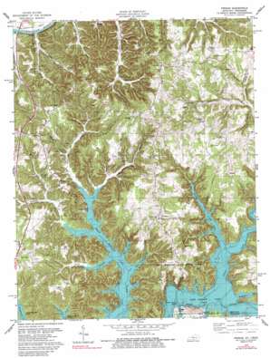
Frogue Topo Map Kentucky
To zoom in, hover over the map of Frogue
USGS Topo Quad 36085f3 - 1:24,000 scale
| Topo Map Name: | Frogue |
| USGS Topo Quad ID: | 36085f3 |
| Print Size: | ca. 21 1/4" wide x 27" high |
| Southeast Coordinates: | 36.625° N latitude / 85.25° W longitude |
| Map Center Coordinates: | 36.6875° N latitude / 85.3125° W longitude |
| U.S. States: | KY, TN |
| Filename: | o36085f3.jpg |
| Download Map JPG Image: | Frogue topo map 1:24,000 scale |
| Map Type: | Topographic |
| Topo Series: | 7.5´ |
| Map Scale: | 1:24,000 |
| Source of Map Images: | United States Geological Survey (USGS) |
| Alternate Map Versions: |
Frogue KY 1954, updated 1955 Download PDF Buy paper map Frogue KY 1954, updated 1967 Download PDF Buy paper map Frogue KY 1978, updated 1979 Download PDF Buy paper map Frogue KY 1978, updated 1988 Download PDF Buy paper map Frogue KY 2011 Download PDF Buy paper map Frogue KY 2013 Download PDF Buy paper map Frogue KY 2016 Download PDF Buy paper map |
1:24,000 Topo Quads surrounding Frogue
> Back to 36085e1 at 1:100,000 scale
> Back to 36084a1 at 1:250,000 scale
> Back to U.S. Topo Maps home
Frogue topo map: Gazetteer
Frogue: Bends
Herefords Bend elevation 171m 561′Frogue: Cliffs
Guthrie Bluff elevation 246m 807′Frogue: Crossings
Bryson Ford (historical) elevation 196m 643′Frogue: Islands
Boys Island elevation 222m 728′Little Cactus Island elevation 202m 662′
Trooper Island elevation 213m 698′
Frogue: Parks
Dale Hollow Lake State Park elevation 317m 1040′Frogue: Populated Places
Frogue elevation 295m 967′Green Grove elevation 300m 984′
Hegira elevation 323m 1059′
Hobart elevation 305m 1000′
Kettle elevation 300m 984′
Long Ridge elevation 230m 754′
Modoc elevation 317m 1040′
Frogue: Post Offices
Hobart Post Office (historical) elevation 312m 1023′Illwill Post Office (historical) elevation 196m 643′
Frogue: Reservoirs
Dale Hollow Lake elevation 196m 643′Frogue: Ridges
Boom Ridge elevation 281m 921′Chestnut Grove Ridge elevation 302m 990′
Scott Ridge elevation 206m 675′
Frogue: Streams
Casey Branch elevation 196m 643′Clover Creek elevation 165m 541′
East Fork Raft Creek elevation 187m 613′
Fannys Creek elevation 196m 643′
Gamblin Branch elevation 211m 692′
Hoot Branch elevation 196m 643′
Huffakre Fork elevation 214m 702′
Illwill Creek elevation 196m 643′
Jones Branch elevation 196m 643′
Mill Creek elevation 197m 646′
Nunn Branch elevation 240m 787′
Raft Creek elevation 200m 656′
Riddle Prong elevation 216m 708′
Spring Branch elevation 238m 780′
Williams Creek elevation 196m 643′
Willis Branch elevation 204m 669′
Frogue: Valleys
Bend Hollow elevation 203m 666′Bybee Hollow elevation 201m 659′
Dickens Hollow elevation 198m 649′
Hay Hollow elevation 199m 652′
Jackson Hollow elevation 238m 780′
Lawson Hollow elevation 243m 797′
Lucky Hollow elevation 245m 803′
Pierce Hollow (historical) elevation 196m 643′
Prichard Hollow elevation 258m 846′
Spurlins Hollow elevation 225m 738′
Store Hollow elevation 211m 692′
Storehouse Hollow elevation 253m 830′
Frogue digital topo map on disk
Buy this Frogue topo map showing relief, roads, GPS coordinates and other geographical features, as a high-resolution digital map file on DVD:


