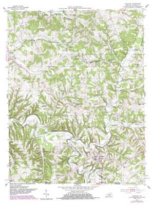
Gamaliel Topo Map Kentucky
To zoom in, hover over the map of Gamaliel
USGS Topo Quad 36085f7 - 1:24,000 scale
| Topo Map Name: | Gamaliel |
| USGS Topo Quad ID: | 36085f7 |
| Print Size: | ca. 21 1/4" wide x 27" high |
| Southeast Coordinates: | 36.625° N latitude / 85.75° W longitude |
| Map Center Coordinates: | 36.6875° N latitude / 85.8125° W longitude |
| U.S. State: | KY |
| Filename: | o36085f7.jpg |
| Download Map JPG Image: | Gamaliel topo map 1:24,000 scale |
| Map Type: | Topographic |
| Topo Series: | 7.5´ |
| Map Scale: | 1:24,000 |
| Source of Map Images: | United States Geological Survey (USGS) |
| Alternate Map Versions: |
Gamaliel KY 1954, updated 1955 Download PDF Buy paper map Gamaliel KY 1954, updated 1983 Download PDF Buy paper map Gamaliel KY 2010 Download PDF Buy paper map Gamaliel KY 2013 Download PDF Buy paper map Gamaliel KY 2016 Download PDF Buy paper map |
1:24,000 Topo Quads surrounding Gamaliel
> Back to 36085e1 at 1:100,000 scale
> Back to 36084a1 at 1:250,000 scale
> Back to U.S. Topo Maps home
Gamaliel topo map: Gazetteer
Gamaliel: Populated Places
Emberton elevation 261m 856′Flippin elevation 224m 734′
Freetown elevation 264m 866′
Gamaliel elevation 257m 843′
Gum Tree elevation 286m 938′
Gamaliel: Streams
Adams Branch elevation 218m 715′Cable Branch elevation 232m 761′
Cane Creek elevation 197m 646′
East Fork Barren River elevation 199m 652′
Isenburg Branch elevation 223m 731′
Line Creek elevation 207m 679′
Line Creek elevation 201m 659′
Long Branch elevation 213m 698′
Mill Creek elevation 208m 682′
Miller Branch elevation 232m 761′
Rocky Branch elevation 213m 698′
South Fork Indian Creek elevation 218m 715′
Sugar Creek elevation 197m 646′
White Oak Branch elevation 224m 734′
Gamaliel digital topo map on disk
Buy this Gamaliel topo map showing relief, roads, GPS coordinates and other geographical features, as a high-resolution digital map file on DVD:


