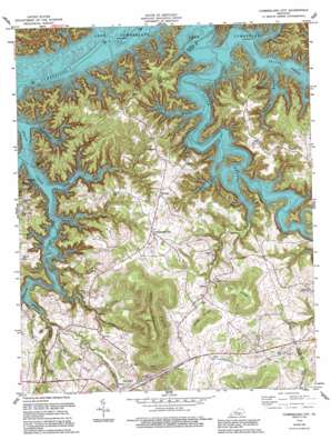
Cumberland City Topo Map Kentucky
To zoom in, hover over the map of Cumberland City
USGS Topo Quad 36085g1 - 1:24,000 scale
| Topo Map Name: | Cumberland City |
| USGS Topo Quad ID: | 36085g1 |
| Print Size: | ca. 21 1/4" wide x 27" high |
| Southeast Coordinates: | 36.75° N latitude / 85° W longitude |
| Map Center Coordinates: | 36.8125° N latitude / 85.0625° W longitude |
| U.S. State: | KY |
| Filename: | o36085g1.jpg |
| Download Map JPG Image: | Cumberland City topo map 1:24,000 scale |
| Map Type: | Topographic |
| Topo Series: | 7.5´ |
| Map Scale: | 1:24,000 |
| Source of Map Images: | United States Geological Survey (USGS) |
| Alternate Map Versions: |
Cumberland City KY 1954, updated 1955 Download PDF Buy paper map Cumberland City KY 1954, updated 1965 Download PDF Buy paper map Cumberland City KY 1978, updated 1978 Download PDF Buy paper map Cumberland City KY 1978, updated 1995 Download PDF Buy paper map Cumberland City KY 2010 Download PDF Buy paper map Cumberland City KY 2013 Download PDF Buy paper map Cumberland City KY 2016 Download PDF Buy paper map |
1:24,000 Topo Quads surrounding Cumberland City
> Back to 36085e1 at 1:100,000 scale
> Back to 36084a1 at 1:250,000 scale
> Back to U.S. Topo Maps home
Cumberland City topo map: Gazetteer
Cumberland City: Gaps
Road Gap elevation 327m 1072′Cumberland City: Oilfields
Clarks Oilwell (historical) elevation 220m 721′Cumberland City: Populated Places
Alpha elevation 309m 1013′Cabell elevation 319m 1046′
Cartwright elevation 290m 951′
Cumberland City elevation 319m 1046′
Gar (historical) elevation 220m 721′
Marlow elevation 251m 823′
Narvel elevation 278m 912′
Nora elevation 322m 1056′
Watauga elevation 320m 1049′
Cumberland City: Post Offices
Alpha Post Office (historical) elevation 298m 977′Cabell Grove Post Office (historical) elevation 308m 1010′
Camden Post Office (historical) elevation 318m 1043′
Cartwright Post Office (historical) elevation 282m 925′
Coffey Springs Post Office (historical) elevation 312m 1023′
Cumberland City Post Office (historical) elevation 319m 1046′
Dryden Post Office (historical) elevation 220m 721′
Fairland Post Office (historical) elevation 281m 921′
Gar Post Office (historical) elevation 220m 721′
Marlow Post Office (historical) elevation 245m 803′
Narvel Post Office (historical) elevation 284m 931′
Nora Post Office (historical) elevation 322m 1056′
Osco Post Office (historical) elevation 220m 721′
Watauga Post Office (historical) elevation 330m 1082′
Zenobia Post Office (historical) elevation 245m 803′
Cumberland City: Ridges
Beck Ridge elevation 281m 921′Cabell Ridge elevation 307m 1007′
Sulpher Spring Ridge elevation 277m 908′
Cumberland City: Springs
Spout Springs elevation 310m 1017′Cumberland City: Streams
Beaver Creek elevation 220m 721′Belt Branch elevation 220m 721′
Brown Creek elevation 220m 721′
Gross Creek elevation 222m 728′
Handcock Creek elevation 220m 721′
Hayes Creek elevation 223m 731′
Indian Creek elevation 220m 721′
Laurel Creek elevation 220m 721′
Marlow Creek elevation 251m 823′
Middle Fork Indian Creek elevation 220m 721′
Owens Branch elevation 225m 738′
Shelton Branch elevation 220m 721′
Simpsons Branch elevation 220m 721′
Slate Branch elevation 220m 721′
Stillhouse Branch elevation 242m 793′
West Fork Indian Creek elevation 220m 721′
Whippoorwill Creek elevation 220m 721′
Williams Creek elevation 220m 721′
Cumberland City: Summits
Cedar Knob elevation 362m 1187′Haw Knob elevation 414m 1358′
Short Mountain elevation 497m 1630′
Thurston Knob elevation 244m 800′
Cumberland City: Valleys
Bill Long Hollow elevation 220m 721′Happy Hollow (historical) elevation 220m 721′
Jim City Hollow elevation 222m 728′
The Lonnie Hollow (historical) elevation 220m 721′
Cumberland City: Wells
Davis Gas Well (historical) elevation 220m 721′Cumberland City digital topo map on disk
Buy this Cumberland City topo map showing relief, roads, GPS coordinates and other geographical features, as a high-resolution digital map file on DVD:


