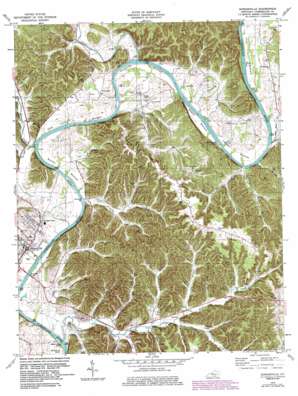
Burkesville Topo Map Kentucky
To zoom in, hover over the map of Burkesville
USGS Topo Quad 36085g3 - 1:24,000 scale
| Topo Map Name: | Burkesville |
| USGS Topo Quad ID: | 36085g3 |
| Print Size: | ca. 21 1/4" wide x 27" high |
| Southeast Coordinates: | 36.75° N latitude / 85.25° W longitude |
| Map Center Coordinates: | 36.8125° N latitude / 85.3125° W longitude |
| U.S. State: | KY |
| Filename: | o36085g3.jpg |
| Download Map JPG Image: | Burkesville topo map 1:24,000 scale |
| Map Type: | Topographic |
| Topo Series: | 7.5´ |
| Map Scale: | 1:24,000 |
| Source of Map Images: | United States Geological Survey (USGS) |
| Alternate Map Versions: |
Burkesville KY 1953, updated 1955 Download PDF Buy paper map Burkesville KY 1953, updated 1971 Download PDF Buy paper map Burkesville KY 1978, updated 1979 Download PDF Buy paper map Burkesville KY 1978, updated 1983 Download PDF Buy paper map Burkesville KY 2010 Download PDF Buy paper map Burkesville KY 2013 Download PDF Buy paper map Burkesville KY 2016 Download PDF Buy paper map |
1:24,000 Topo Quads surrounding Burkesville
> Back to 36085e1 at 1:100,000 scale
> Back to 36084a1 at 1:250,000 scale
> Back to U.S. Topo Maps home
Burkesville topo map: Gazetteer
Burkesville: Bars
Alexander Bar elevation 164m 538′Burkesville: Bends
Clay Lick Bottom elevation 176m 577′Howards Bottom elevation 172m 564′
Irish Bottom elevation 175m 574′
Lawson Bottom elevation 176m 577′
Scotts Bottom elevation 173m 567′
Steele Bottom elevation 172m 564′
Burkesville: Bridges
Burkesville Bridge elevation 160m 524′Burkesville: Crossings
Garman Ferry elevation 160m 524′Burkesville: Islands
Bear Creek Island elevation 165m 541′Spearman Island elevation 160m 524′
Thomas Island elevation 162m 531′
Burkesville: Populated Places
Bakerton elevation 183m 600′Bow elevation 185m 606′
Burkesville elevation 177m 580′
Claywell elevation 268m 879′
Dougan Town elevation 179m 587′
Burkesville: Ridges
Smith Grove Ridge elevation 303m 994′String Ridge elevation 280m 918′
Burkesville: Streams
Bear Creek elevation 198m 649′Beech Branch elevation 168m 551′
Big Renox Creek elevation 162m 531′
Big Whetstone Creek elevation 171m 561′
Big Willis Creek elevation 168m 551′
Brush Creek elevation 165m 541′
Carter Branch elevation 182m 597′
Cedar Creek elevation 164m 538′
Crocus Creek elevation 269m 882′
Dry Fork elevation 166m 544′
Goose Creek elevation 164m 538′
Lewis Creek elevation 163m 534′
Lick Branch elevation 173m 567′
Little Renox Creek elevation 168m 551′
Little Whetstone Creek elevation 164m 538′
Little Willis Creek elevation 164m 538′
Oil Fork elevation 170m 557′
Otter Creek elevation 165m 541′
Slate Fork elevation 176m 577′
Vaughn Creek elevation 176m 577′
Wade Branch elevation 168m 551′
Burkesville: Valleys
Black Hollow elevation 172m 564′Bruton Hollow elevation 171m 561′
First Night Hollow elevation 183m 600′
Gap Hollow elevation 176m 577′
John Bow Hollow elevation 179m 587′
Julia Bow Hollow elevation 182m 597′
Wolfpen Hollow elevation 181m 593′
Burkesville digital topo map on disk
Buy this Burkesville topo map showing relief, roads, GPS coordinates and other geographical features, as a high-resolution digital map file on DVD:


