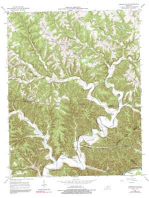
Amandaville Topo Map Kentucky
To zoom in, hover over the map of Amandaville
USGS Topo Quad 36085h3 - 1:24,000 scale
| Topo Map Name: | Amandaville |
| USGS Topo Quad ID: | 36085h3 |
| Print Size: | ca. 21 1/4" wide x 27" high |
| Southeast Coordinates: | 36.875° N latitude / 85.25° W longitude |
| Map Center Coordinates: | 36.9375° N latitude / 85.3125° W longitude |
| U.S. State: | KY |
| Filename: | o36085h3.jpg |
| Download Map JPG Image: | Amandaville topo map 1:24,000 scale |
| Map Type: | Topographic |
| Topo Series: | 7.5´ |
| Map Scale: | 1:24,000 |
| Source of Map Images: | United States Geological Survey (USGS) |
| Alternate Map Versions: |
Amandaville KY 1953, updated 1954 Download PDF Buy paper map Amandaville KY 1953, updated 1970 Download PDF Buy paper map Amandaville KY 1953, updated 1990 Download PDF Buy paper map Amandaville KY 1953, updated 1991 Download PDF Buy paper map Amandaville KY 2010 Download PDF Buy paper map Amandaville KY 2013 Download PDF Buy paper map Amandaville KY 2016 Download PDF Buy paper map |
1:24,000 Topo Quads surrounding Amandaville
> Back to 36085e1 at 1:100,000 scale
> Back to 36084a1 at 1:250,000 scale
> Back to U.S. Topo Maps home
Amandaville topo map: Gazetteer
Amandaville: Populated Places
Amandaville elevation 183m 600′Chance elevation 310m 1017′
Cundiff elevation 295m 967′
Inroad elevation 192m 629′
Amandaville: Ridges
Big Pond Ridge elevation 285m 935′Bird Ridge elevation 303m 994′
Chestnut Flat Ridge elevation 272m 892′
Harvey Ridge elevation 293m 961′
Independence Ridge elevation 283m 928′
Jones Ridge elevation 297m 974′
Amandaville: Streams
Burns Creek elevation 193m 633′Casey Fork elevation 213m 698′
Cedar Creek elevation 176m 577′
Collins Branch elevation 174m 570′
Harrods Fork elevation 186m 610′
Pine Branch elevation 171m 561′
Powells Creek elevation 194m 636′
Puncheon Camp Creek elevation 175m 574′
Rock Lick Creek elevation 207m 679′
Sand Lick Creek elevation 188m 616′
West Fork Crocus Creek elevation 170m 557′
Amandaville digital topo map on disk
Buy this Amandaville topo map showing relief, roads, GPS coordinates and other geographical features, as a high-resolution digital map file on DVD:


