Watertown Topo Map Tennessee
To zoom in, hover over the map of Watertown
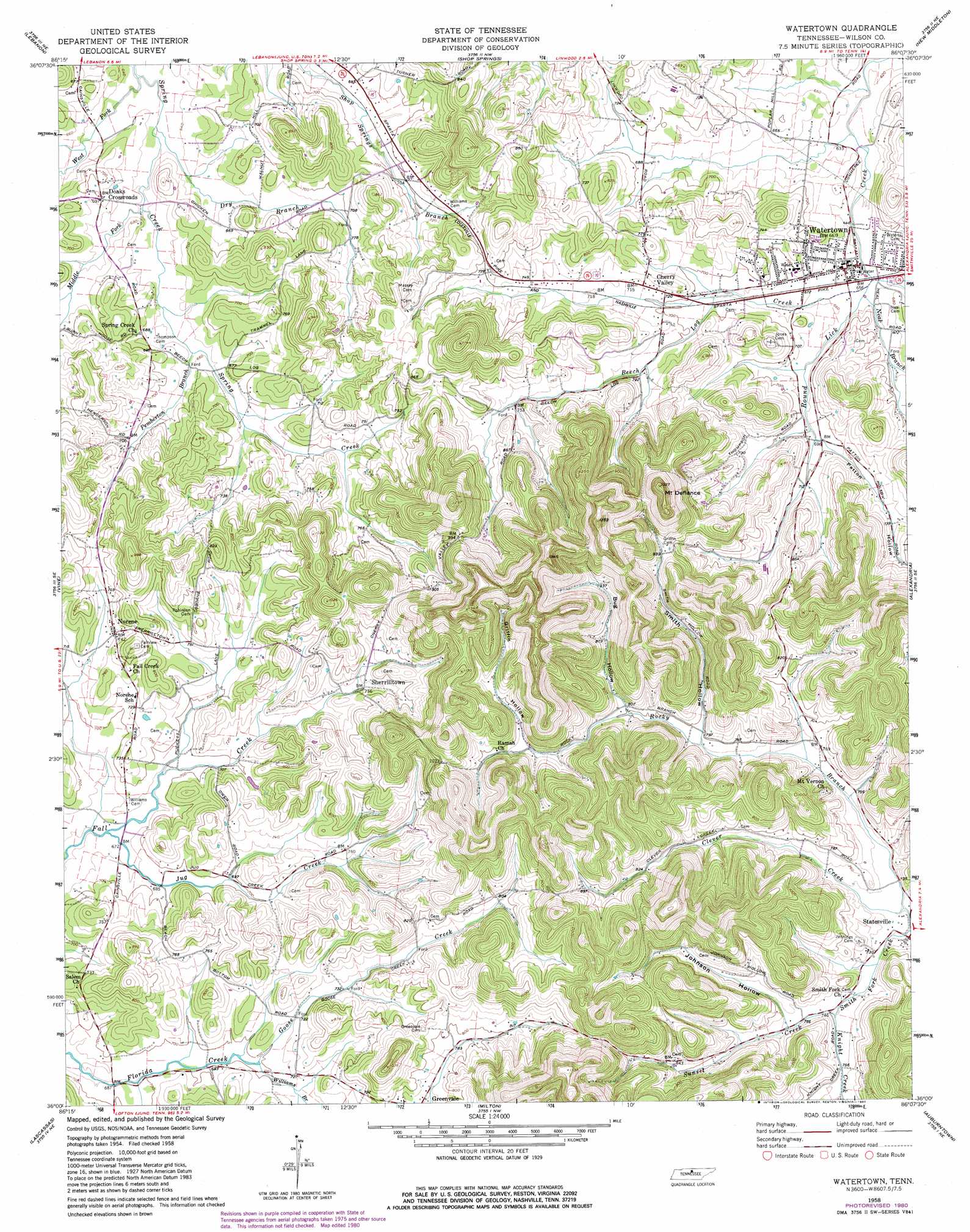
USGS Topo Quad 36086a2 - 1:24,000 scale
| Topo Map Name: | Watertown |
| USGS Topo Quad ID: | 36086a2 |
| Print Size: | ca. 21 1/4" wide x 27" high |
| Southeast Coordinates: | 36° N latitude / 86.125° W longitude |
| Map Center Coordinates: | 36.0625° N latitude / 86.1875° W longitude |
| U.S. State: | TN |
| Filename: | o36086a2.jpg |
| Download Map JPG Image: | Watertown topo map 1:24,000 scale |
| Map Type: | Topographic |
| Topo Series: | 7.5´ |
| Map Scale: | 1:24,000 |
| Source of Map Images: | United States Geological Survey (USGS) |
| Alternate Map Versions: |
Watertown TN 1958, updated 1959 Download PDF Buy paper map Watertown TN 1958, updated 1980 Download PDF Buy paper map Watertown TN 1994, updated 1997 Download PDF Buy paper map Watertown TN 2010 Download PDF Buy paper map Watertown TN 2013 Download PDF Buy paper map Watertown TN 2016 Download PDF Buy paper map |
1:24,000 Topo Quads surrounding Watertown
Laguardo |
Hunters Point |
Bellwood |
Dixon Springs |
Carthage |
Martha |
Lebanon |
Shop Springs |
New Middleton |
Gordonsville |
Gladeville |
Vine |
Watertown |
Alexandria |
Liberty |
Walterhill |
Lascassas |
Milton |
Auburntown |
Gassaway |
Murfreesboro |
Dillton |
Readyville |
Woodbury |
Short Mountain |
> Back to 36086a1 at 1:100,000 scale
> Back to 36086a1 at 1:250,000 scale
> Back to U.S. Topo Maps home
Watertown topo map: Gazetteer
Watertown: Populated Places
Center Hill (historical) elevation 212m 695′Cherry Valley elevation 219m 718′
Doaks Crossroads elevation 210m 688′
Mount Vernon elevation 231m 757′
Norene elevation 226m 741′
Sherrilltown elevation 245m 803′
Watertown elevation 199m 652′
Watertown: Streams
Beech Log Creek elevation 198m 649′Dry Branch elevation 194m 636′
Goose Creek elevation 212m 695′
Jug Creek elevation 202m 662′
Knight Creek elevation 226m 741′
Middle Fork Spring Creek elevation 195m 639′
Neal Branch elevation 198m 649′
Pemberton Branch elevation 201m 659′
Rocky Branch elevation 220m 721′
Sunset Creek elevation 225m 738′
West Fork Spring Creek elevation 189m 620′
Williams Branch elevation 213m 698′
Watertown: Summits
Mount Defiance elevation 398m 1305′Watertown: Valleys
Bug Hollow elevation 245m 803′Griffin Hollow elevation 263m 862′
Johnson Hollow elevation 231m 757′
Patton Hollow elevation 212m 695′
Smith Hollow elevation 242m 793′
Watertown digital topo map on disk
Buy this Watertown topo map showing relief, roads, GPS coordinates and other geographical features, as a high-resolution digital map file on DVD: