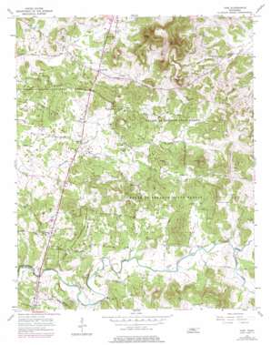
Vine Topo Map Tennessee
To zoom in, hover over the map of Vine
USGS Topo Quad 36086a3 - 1:24,000 scale
| Topo Map Name: | Vine |
| USGS Topo Quad ID: | 36086a3 |
| Print Size: | ca. 21 1/4" wide x 27" high |
| Southeast Coordinates: | 36° N latitude / 86.25° W longitude |
| Map Center Coordinates: | 36.0625° N latitude / 86.3125° W longitude |
| U.S. State: | TN |
| Filename: | o36086a3.jpg |
| Download Map JPG Image: | Vine topo map 1:24,000 scale |
| Map Type: | Topographic |
| Topo Series: | 7.5´ |
| Map Scale: | 1:24,000 |
| Source of Map Images: | United States Geological Survey (USGS) |
| Alternate Map Versions: |
Vine TN 1956, updated 1957 Download PDF Buy paper map Vine TN 1956, updated 1977 Download PDF Buy paper map Vine TN 1994, updated 1997 Download PDF Buy paper map Vine TN 2010 Download PDF Buy paper map Vine TN 2013 Download PDF Buy paper map Vine TN 2016 Download PDF Buy paper map |
1:24,000 Topo Quads surrounding Vine
> Back to 36086a1 at 1:100,000 scale
> Back to 36086a1 at 1:250,000 scale
> Back to U.S. Topo Maps home
Vine topo map: Gazetteer
Vine: Forests
Cedars of Lebanon State Forest elevation 219m 718′Vine: Populated Places
Adams Grove elevation 213m 698′Bairds Mill elevation 207m 679′
Hurricane elevation 211m 692′
Josephine (historical) elevation 236m 774′
Major elevation 191m 626′
Mount Carmel (historical) elevation 181m 593′
Oak Point (historical) elevation 217m 711′
Silver Hill elevation 190m 623′
Tater Peeler (historical) elevation 224m 734′
Vine elevation 186m 610′
Vine: Springs
Jacksons Cave Spring elevation 190m 623′Vine: Streams
Cave Creek elevation 179m 587′Cedar Branch elevation 197m 646′
Dry Fork elevation 182m 597′
East Fork Hurricane Creek elevation 189m 620′
Florida Creek elevation 198m 649′
Partlow Branch elevation 190m 623′
Vine: Summits
Edwards Hill elevation 281m 921′Egypt Hill elevation 350m 1148′
Pilot Knob elevation 357m 1171′
Pultight Hill elevation 299m 980′
Thompson Hills elevation 234m 767′
Vine digital topo map on disk
Buy this Vine topo map showing relief, roads, GPS coordinates and other geographical features, as a high-resolution digital map file on DVD:


