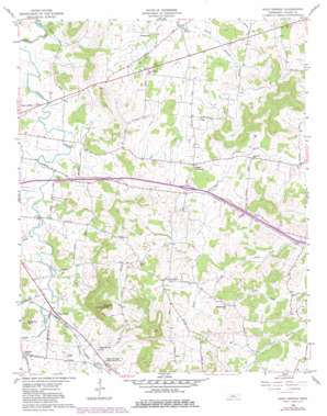
Shop Springs Topo Map Tennessee
To zoom in, hover over the map of Shop Springs
USGS Topo Quad 36086b2 - 1:24,000 scale
| Topo Map Name: | Shop Springs |
| USGS Topo Quad ID: | 36086b2 |
| Print Size: | ca. 21 1/4" wide x 27" high |
| Southeast Coordinates: | 36.125° N latitude / 86.125° W longitude |
| Map Center Coordinates: | 36.1875° N latitude / 86.1875° W longitude |
| U.S. State: | TN |
| Filename: | o36086b2.jpg |
| Download Map JPG Image: | Shop Springs topo map 1:24,000 scale |
| Map Type: | Topographic |
| Topo Series: | 7.5´ |
| Map Scale: | 1:24,000 |
| Source of Map Images: | United States Geological Survey (USGS) |
| Alternate Map Versions: |
Shop Springs TN 1958, updated 1959 Download PDF Buy paper map Shop Springs TN 1958, updated 1980 Download PDF Buy paper map Shop Springs TN 1994, updated 1997 Download PDF Buy paper map Shop Springs TN 2010 Download PDF Buy paper map Shop Springs TN 2013 Download PDF Buy paper map Shop Springs TN 2016 Download PDF Buy paper map |
1:24,000 Topo Quads surrounding Shop Springs
> Back to 36086a1 at 1:100,000 scale
> Back to 36086a1 at 1:250,000 scale
> Back to U.S. Topo Maps home
Shop Springs topo map: Gazetteer
Shop Springs: Crossings
Interchange 245 elevation 201m 659′Shop Springs: Populated Places
Big Spring (historical) elevation 164m 538′Greenwood elevation 183m 600′
Leemans Corner elevation 202m 662′
Linwood elevation 216m 708′
Shop Springs elevation 212m 695′
Spring Creek (historical) elevation 183m 600′
Tuckers Crossroads elevation 193m 633′
Shop Springs: Springs
Big Spring elevation 165m 541′Shop Springs: Streams
Black Branch elevation 171m 561′Dedman Branch elevation 186m 610′
East Prong Jennings Fork elevation 189m 620′
Grissim Branch elevation 159m 521′
Shop Springs Branch elevation 179m 587′
West Prong Jennings Fork elevation 189m 620′
Shop Springs: Summits
Jennings Knob elevation 353m 1158′Shop Springs digital topo map on disk
Buy this Shop Springs topo map showing relief, roads, GPS coordinates and other geographical features, as a high-resolution digital map file on DVD:


