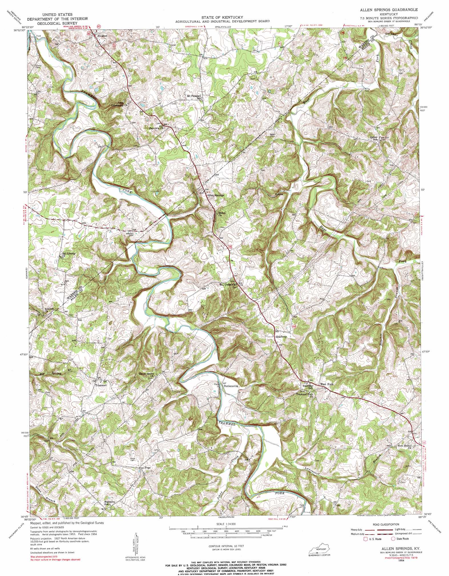
Allen Springs Topo Map Kentucky
To zoom in, hover over the map of Allen Springs
USGS Topo Quad 36086g3 - 1:24,000 scale
| Topo Map Name: | Allen Springs |
| USGS Topo Quad ID: | 36086g3 |
| Print Size: | ca. 21 1/4" wide x 27" high |
| Southeast Coordinates: | 36.75° N latitude / 86.25° W longitude |
| Map Center Coordinates: | 36.8125° N latitude / 86.3125° W longitude |
| U.S. State: | KY |
| Filename: | o36086g3.jpg |
| Download Map JPG Image: | Allen Springs topo map 1:24,000 scale |
| Map Type: | Topographic |
| Topo Series: | 7.5´ |
| Map Scale: | 1:24,000 |
| Source of Map Images: | United States Geological Survey (USGS) |
| Alternate Map Versions: |
Allen Springs KY 1954, updated 1956 Download PDF Buy paper map Allen Springs KY 1954, updated 1983 Download PDF Buy paper map Allen Springs KY 2010 Download PDF Buy paper map Allen Springs KY 2013 Download PDF Buy paper map Allen Springs KY 2016 Download PDF Buy paper map |
1:24,000 Topo Quads surrounding Allen Springs
Hadley |
Bowling Green North |
Bristow |
Smiths Grove |
Park City |
Rockfield |
Bowling Green South |
Polkville |
Meador |
Lucas |
Woodburn |
Drake |
Allen Springs |
Scottsville |
Austin |
Franklin |
Hickory Flat |
Adolphus |
Petroleum |
Holland |
Portland |
Fountain Head |
Turners Station |
Westmoreland |
Lafayette |
> Back to 36086e1 at 1:100,000 scale
> Back to 36086a1 at 1:250,000 scale
> Back to U.S. Topo Maps home
Allen Springs topo map: Gazetteer
Allen Springs: Airports
Falin Landing Strip elevation 187m 613′Allen Springs: Populated Places
Allen Springs elevation 205m 672′Alvaton elevation 202m 662′
Butlersville elevation 162m 531′
Halfway elevation 235m 770′
Pope elevation 223m 731′
Raley Ford elevation 147m 482′
Trammel elevation 225m 738′
West Fork elevation 231m 757′
Allen Springs: Streams
Boucher Branch elevation 159m 521′Johns Creek elevation 163m 534′
Lancaster Branch elevation 165m 541′
Sulphur Creek elevation 145m 475′
Allen Springs digital topo map on disk
Buy this Allen Springs topo map showing relief, roads, GPS coordinates and other geographical features, as a high-resolution digital map file on DVD: