Lucas Topo Map Kentucky
To zoom in, hover over the map of Lucas
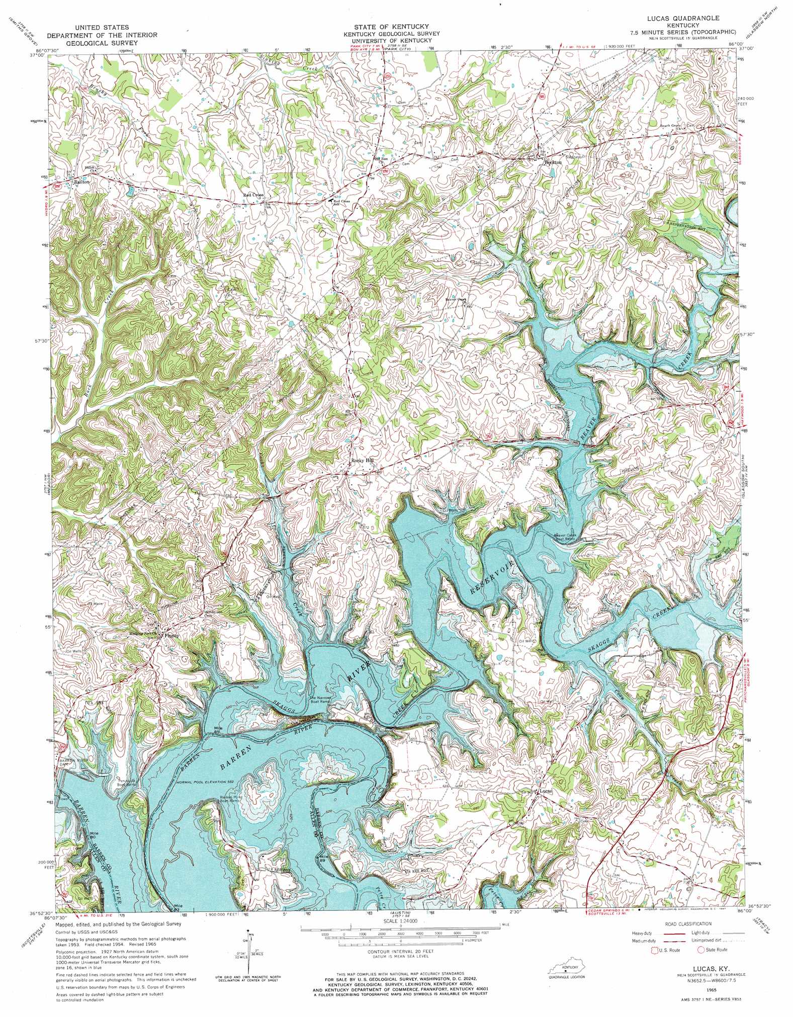
USGS Topo Quad 36086h1 - 1:24,000 scale
| Topo Map Name: | Lucas |
| USGS Topo Quad ID: | 36086h1 |
| Print Size: | ca. 21 1/4" wide x 27" high |
| Southeast Coordinates: | 36.875° N latitude / 86° W longitude |
| Map Center Coordinates: | 36.9375° N latitude / 86.0625° W longitude |
| U.S. State: | KY |
| Filename: | o36086h1.jpg |
| Download Map JPG Image: | Lucas topo map 1:24,000 scale |
| Map Type: | Topographic |
| Topo Series: | 7.5´ |
| Map Scale: | 1:24,000 |
| Source of Map Images: | United States Geological Survey (USGS) |
| Alternate Map Versions: |
Lucas KY 1954, updated 1964 Download PDF Buy paper map Lucas KY 2010 Download PDF Buy paper map Lucas KY 2013 Download PDF Buy paper map Lucas KY 2016 Download PDF Buy paper map |
1:24,000 Topo Quads surrounding Lucas
Brownsville |
Rhoda |
Mammoth Cave |
Horse Cave |
Park |
Bristow |
Smiths Grove |
Park City |
Glasgow North |
Hiseville |
Polkville |
Meador |
Lucas |
Glasgow South |
Temple Hill |
Allen Springs |
Scottsville |
Austin |
Tracy |
Freedom |
Adolphus |
Petroleum |
Holland |
Fountain Run |
Gamaliel |
> Back to 36086e1 at 1:100,000 scale
> Back to 36086a1 at 1:250,000 scale
> Back to U.S. Topo Maps home
Lucas topo map: Gazetteer
Lucas: Gaps
The Narrows elevation 178m 583′Lucas: Populated Places
Beckton elevation 228m 748′Finney elevation 222m 728′
Lucas elevation 229m 751′
Railton elevation 231m 757′
Red Cross elevation 238m 780′
Rocky Hill elevation 227m 744′
Lucas: Reservoirs
Barren River Lake elevation 176m 577′Lucas: Streams
Beaver Creek elevation 168m 551′Cooks Creek elevation 168m 551′
Coon Creek elevation 168m 551′
Peter Creek elevation 168m 551′
Skaggs Creek elevation 168m 551′
Lucas digital topo map on disk
Buy this Lucas topo map showing relief, roads, GPS coordinates and other geographical features, as a high-resolution digital map file on DVD: