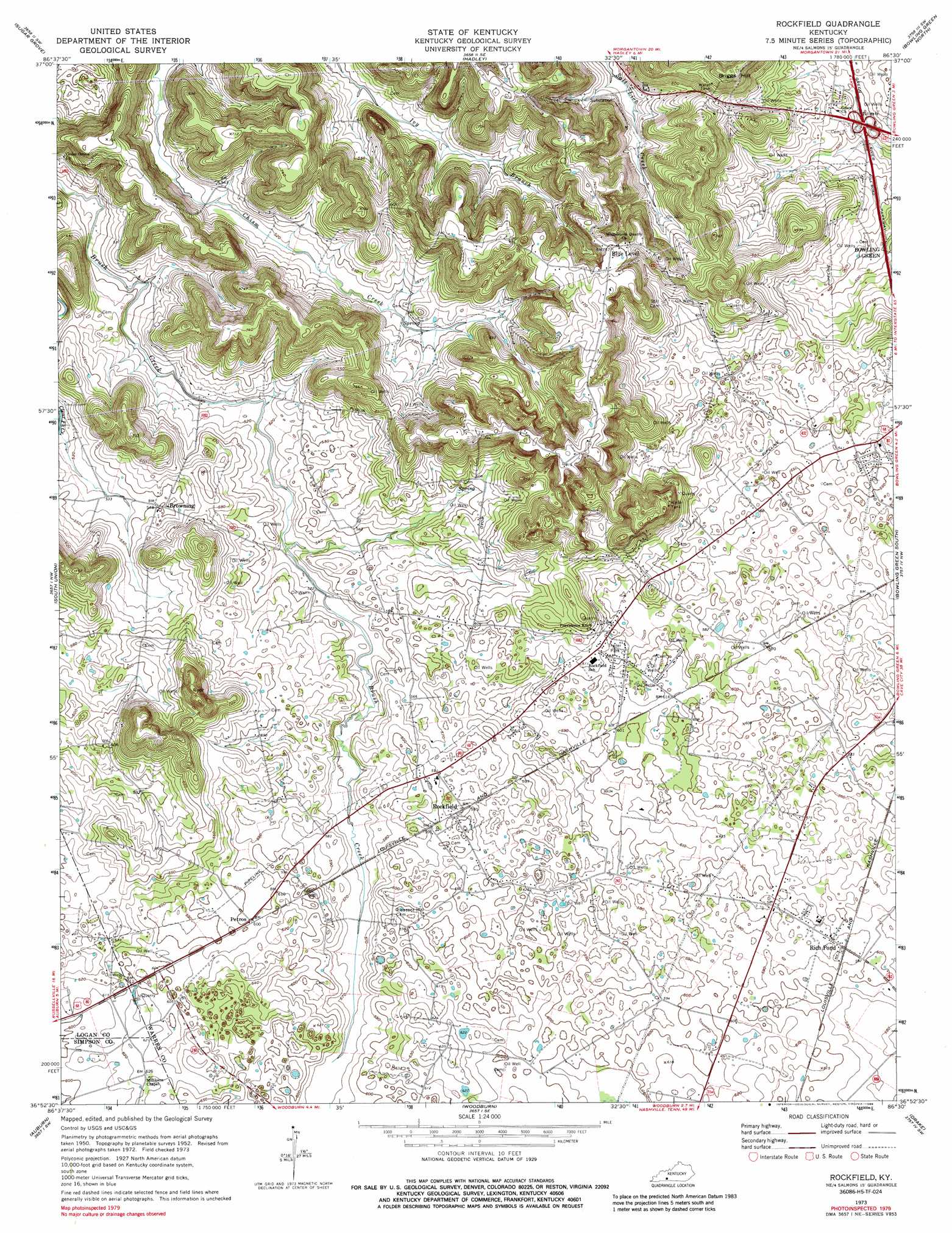
Rockfield Topo Map Kentucky
To zoom in, hover over the map of Rockfield
USGS Topo Quad 36086h5 - 1:24,000 scale
| Topo Map Name: | Rockfield |
| USGS Topo Quad ID: | 36086h5 |
| Print Size: | ca. 21 1/4" wide x 27" high |
| Southeast Coordinates: | 36.875° N latitude / 86.5° W longitude |
| Map Center Coordinates: | 36.9375° N latitude / 86.5625° W longitude |
| U.S. State: | KY |
| Filename: | o36086h5.jpg |
| Download Map JPG Image: | Rockfield topo map 1:24,000 scale |
| Map Type: | Topographic |
| Topo Series: | 7.5´ |
| Map Scale: | 1:24,000 |
| Source of Map Images: | United States Geological Survey (USGS) |
| Alternate Map Versions: |
Rockfield KY 1952, updated 1953 Download PDF Buy paper map Rockfield KY 1952, updated 1966 Download PDF Buy paper map Rockfield KY 1973, updated 1974 Download PDF Buy paper map Rockfield KY 1979, updated 1988 Download PDF Buy paper map Rockfield KY 2010 Download PDF Buy paper map Rockfield KY 2013 Download PDF Buy paper map Rockfield KY 2016 Download PDF Buy paper map |
1:24,000 Topo Quads surrounding Rockfield
South Hill |
Morgantown |
Riverside |
Reedyville |
Brownsville |
Quality |
Sugar Grove |
Hadley |
Bowling Green North |
Bristow |
Homer |
South Union |
Rockfield |
Bowling Green South |
Polkville |
Dennis |
Auburn |
Woodburn |
Drake |
Allen Springs |
Adairville |
Prices Mill |
Franklin |
Hickory Flat |
Adolphus |
> Back to 36086e1 at 1:100,000 scale
> Back to 36086a1 at 1:250,000 scale
> Back to U.S. Topo Maps home
Rockfield topo map: Gazetteer
Rockfield: Populated Places
Blue Level elevation 230m 754′Browning elevation 168m 551′
Petros elevation 183m 600′
Rich Pond elevation 179m 587′
Rockfield elevation 180m 590′
Rockfield: Summits
Briggs Hill elevation 238m 780′Rockfield digital topo map on disk
Buy this Rockfield topo map showing relief, roads, GPS coordinates and other geographical features, as a high-resolution digital map file on DVD: