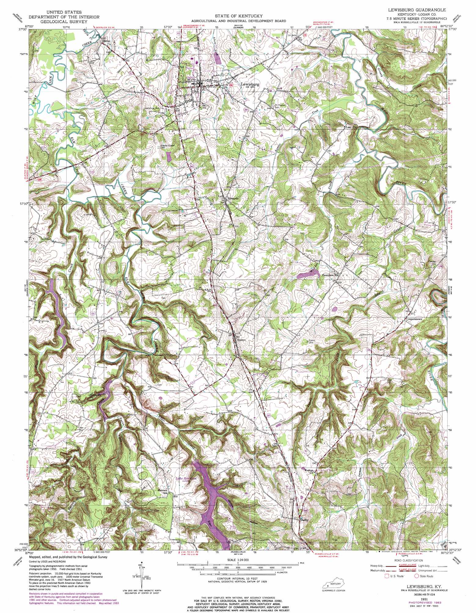
Lewisburg Topo Map Kentucky
To zoom in, hover over the map of Lewisburg
USGS Topo Quad 36086h8 - 1:24,000 scale
| Topo Map Name: | Lewisburg |
| USGS Topo Quad ID: | 36086h8 |
| Print Size: | ca. 21 1/4" wide x 27" high |
| Southeast Coordinates: | 36.875° N latitude / 86.875° W longitude |
| Map Center Coordinates: | 36.9375° N latitude / 86.9375° W longitude |
| U.S. State: | KY |
| Filename: | o36086h8.jpg |
| Download Map JPG Image: | Lewisburg topo map 1:24,000 scale |
| Map Type: | Topographic |
| Topo Series: | 7.5´ |
| Map Scale: | 1:24,000 |
| Source of Map Images: | United States Geological Survey (USGS) |
| Alternate Map Versions: |
Lewisburg KY 1951, updated 1953 Download PDF Buy paper map Lewisburg KY 1951, updated 1983 Download PDF Buy paper map Lewisburg KY 2010 Download PDF Buy paper map Lewisburg KY 2013 Download PDF Buy paper map Lewisburg KY 2016 Download PDF Buy paper map |
1:24,000 Topo Quads surrounding Lewisburg
Greenville |
Drakesboro |
Rochester |
South Hill |
Morgantown |
Kirkmansville |
Rosewood |
Dunmor |
Quality |
Sugar Grove |
Allegre |
Sharon Grove |
Lewisburg |
Homer |
South Union |
Elkton |
Olmstead |
Russellville |
Dennis |
Auburn |
Guthrie |
Allensville |
Dot |
Adairville |
Prices Mill |
> Back to 36086e1 at 1:100,000 scale
> Back to 36086a1 at 1:250,000 scale
> Back to U.S. Topo Maps home
Lewisburg topo map: Gazetteer
Lewisburg: Populated Places
Cooperstown elevation 173m 567′Danby elevation 229m 751′
Edwards elevation 171m 561′
Epleys elevation 206m 675′
Henrysville (historical) elevation 165m 541′
Jerico elevation 141m 462′
Lewisburg elevation 146m 479′
Lost City elevation 174m 570′
Lewisburg: Streams
Austin Creek elevation 131m 429′Barren Fork elevation 141m 462′
Buena Vista Creek elevation 138m 452′
Clifty Creek elevation 128m 419′
Duck Lick Creek elevation 131m 429′
Edger Creek elevation 139m 456′
Elk Lick Creek elevation 126m 413′
Greasy Creek elevation 131m 429′
Larman Creek elevation 146m 479′
Laurel Creek elevation 130m 426′
McAdoo Creek elevation 132m 433′
Lewisburg: Valleys
Wildcat Hollow elevation 150m 492′Lewisburg digital topo map on disk
Buy this Lewisburg topo map showing relief, roads, GPS coordinates and other geographical features, as a high-resolution digital map file on DVD: