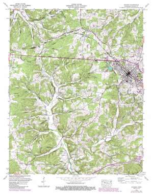
Dickson Topo Map Tennessee
To zoom in, hover over the map of Dickson
USGS Topo Quad 36087a4 - 1:24,000 scale
| Topo Map Name: | Dickson |
| USGS Topo Quad ID: | 36087a4 |
| Print Size: | ca. 21 1/4" wide x 27" high |
| Southeast Coordinates: | 36° N latitude / 87.375° W longitude |
| Map Center Coordinates: | 36.0625° N latitude / 87.4375° W longitude |
| U.S. State: | TN |
| Filename: | o36087a4.jpg |
| Download Map JPG Image: | Dickson topo map 1:24,000 scale |
| Map Type: | Topographic |
| Topo Series: | 7.5´ |
| Map Scale: | 1:24,000 |
| Source of Map Images: | United States Geological Survey (USGS) |
| Alternate Map Versions: |
Dickson TN 1936 Download PDF Buy paper map Dickson TN 1953, updated 1957 Download PDF Buy paper map Dickson TN 1953, updated 1970 Download PDF Buy paper map Dickson TN 1953, updated 1987 Download PDF Buy paper map Dickson TN 2010 Download PDF Buy paper map Dickson TN 2013 Download PDF Buy paper map Dickson TN 2016 Download PDF Buy paper map |
1:24,000 Topo Quads surrounding Dickson
> Back to 36087a1 at 1:100,000 scale
> Back to 36086a1 at 1:250,000 scale
> Back to U.S. Topo Maps home
Dickson topo map: Gazetteer
Dickson: Cliffs
England Bluff elevation 200m 656′Dickson: Dams
New City Lake Dam elevation 247m 810′Dickson: Lakes
Indian Pond elevation 260m 853′Dickson: Mines
Worley Furnace Mines elevation 239m 784′Dickson: Parks
J Dan Buckner Park elevation 254m 833′Dickson: Populated Places
Beech Grove (historical) elevation 232m 761′Dickson elevation 245m 803′
East Dickson elevation 252m 826′
Eno elevation 205m 672′
Forks of Piney (historical) elevation 178m 583′
Hillcrest elevation 213m 698′
Oak Grove elevation 235m 770′
Pond elevation 279m 915′
Robinsons Chapel elevation 231m 757′
Water Valley (historical) elevation 185m 606′
West Dickson elevation 252m 826′
Dickson: Post Offices
Dickson Post Office elevation 242m 793′Dickson: Reservoirs
Dickson Lake elevation 235m 770′New City Lake elevation 247m 810′
Dickson: Springs
Baker Spring elevation 228m 748′Bruce Spring elevation 208m 682′
Donegan Spring elevation 207m 679′
Fielder Spring elevation 187m 613′
Redden Spring elevation 193m 633′
Walnut Grove Spring elevation 205m 672′
Dickson: Streams
Baker Branch elevation 198m 649′Big Branch elevation 207m 679′
Coon Creek elevation 191m 626′
Dry Hollow Branch elevation 180m 590′
East Piney River elevation 174m 570′
Fannie Branch elevation 206m 675′
Fielder Branch elevation 189m 620′
Grab Creek elevation 194m 636′
Redden Branch elevation 192m 629′
Spring Branch elevation 191m 626′
West Piney River elevation 173m 567′
Wiley Branch elevation 183m 600′
Willow Branch elevation 207m 679′
Worley Furnace Branch elevation 202m 662′
Dickson: Summits
Center Avenue Hill elevation 245m 803′Dickson: Valleys
Bruce Hollow elevation 184m 603′Campbell Hollow elevation 200m 656′
Chester Hollow elevation 200m 656′
Fuqua Hollow elevation 197m 646′
Gilliam Hollow elevation 194m 636′
Gray Hollow elevation 178m 583′
Locke Hollow elevation 191m 626′
Moore Hollow elevation 194m 636′
Opossum Hollow elevation 176m 577′
Orebank Hollow elevation 235m 770′
Plum Orchard Hollow elevation 193m 633′
Springer Hollow elevation 237m 777′
Standing Rock Hollow elevation 217m 711′
Tab Hollow elevation 213m 698′
Trestle Hollow elevation 201m 659′
Wildcat Hollow elevation 222m 728′
Dickson digital topo map on disk
Buy this Dickson topo map showing relief, roads, GPS coordinates and other geographical features, as a high-resolution digital map file on DVD:


