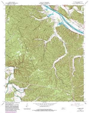
Lillamay Topo Map Tennessee
To zoom in, hover over the map of Lillamay
USGS Topo Quad 36087b1 - 1:24,000 scale
| Topo Map Name: | Lillamay |
| USGS Topo Quad ID: | 36087b1 |
| Print Size: | ca. 21 1/4" wide x 27" high |
| Southeast Coordinates: | 36.125° N latitude / 87° W longitude |
| Map Center Coordinates: | 36.1875° N latitude / 87.0625° W longitude |
| U.S. State: | TN |
| Filename: | o36087b1.jpg |
| Download Map JPG Image: | Lillamay topo map 1:24,000 scale |
| Map Type: | Topographic |
| Topo Series: | 7.5´ |
| Map Scale: | 1:24,000 |
| Source of Map Images: | United States Geological Survey (USGS) |
| Alternate Map Versions: |
Lillamay TN 1966, updated 1967 Download PDF Buy paper map Lillamay TN 1966, updated 1977 Download PDF Buy paper map Lillamay TN 1966, updated 1984 Download PDF Buy paper map Lillamay TN 2010 Download PDF Buy paper map Lillamay TN 2013 Download PDF Buy paper map Lillamay TN 2016 Download PDF Buy paper map |
1:24,000 Topo Quads surrounding Lillamay
> Back to 36087a1 at 1:100,000 scale
> Back to 36086a1 at 1:250,000 scale
> Back to U.S. Topo Maps home
Lillamay topo map: Gazetteer
Lillamay: Bends
Horseshoe Bend elevation 146m 479′Mound Bottom elevation 148m 485′
Lillamay: Crossings
Knights Ferry (historical) elevation 117m 383′Lillamay: Gaps
The Narrows elevation 144m 472′Lillamay: Parks
Brush Creek Access Area elevation 117m 383′Cheatham State Wildlife Management Area elevation 202m 662′
Lillamay: Populated Places
Gravelotte elevation 131m 429′Lillamay elevation 133m 436′
Marrowbone elevation 133m 436′
Mound Bottom (historical) elevation 152m 498′
Sulphur Springs elevation 136m 446′
Lillamay: Springs
Sulphur Spring elevation 142m 465′Lillamay: Streams
Blue Creek elevation 117m 383′Brush Creek elevation 117m 383′
Dry Creek elevation 121m 396′
Little Dry Creek elevation 130m 426′
Little Marrowbone Creek elevation 127m 416′
Marrowbone Creek elevation 119m 390′
Middle Fork Brush Creek elevation 124m 406′
Mound Creek elevation 141m 462′
Possumtrot Branch elevation 122m 400′
Sams Creek elevation 117m 383′
Sandy Run elevation 120m 393′
Stillhouse Branch elevation 121m 396′
Lillamay: Valleys
Gardling Hollow elevation 135m 442′Spring Hollow elevation 133m 436′
Lillamay digital topo map on disk
Buy this Lillamay topo map showing relief, roads, GPS coordinates and other geographical features, as a high-resolution digital map file on DVD:


