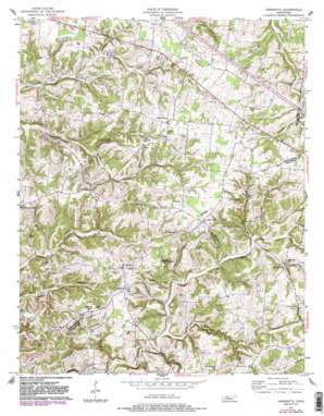
Henrietta Topo Map Tennessee
To zoom in, hover over the map of Henrietta
USGS Topo Quad 36087d2 - 1:24,000 scale
| Topo Map Name: | Henrietta |
| USGS Topo Quad ID: | 36087d2 |
| Print Size: | ca. 21 1/4" wide x 27" high |
| Southeast Coordinates: | 36.375° N latitude / 87.125° W longitude |
| Map Center Coordinates: | 36.4375° N latitude / 87.1875° W longitude |
| U.S. State: | TN |
| Filename: | o36087d2.jpg |
| Download Map JPG Image: | Henrietta topo map 1:24,000 scale |
| Map Type: | Topographic |
| Topo Series: | 7.5´ |
| Map Scale: | 1:24,000 |
| Source of Map Images: | United States Geological Survey (USGS) |
| Alternate Map Versions: |
Henrietta TN 1957, updated 1958 Download PDF Buy paper map Henrietta TN 1957, updated 1983 Download PDF Buy paper map Henrietta TN 1957, updated 1983 Download PDF Buy paper map Henrietta TN 2010 Download PDF Buy paper map Henrietta TN 2013 Download PDF Buy paper map Henrietta TN 2016 Download PDF Buy paper map |
1:24,000 Topo Quads surrounding Henrietta
> Back to 36087a1 at 1:100,000 scale
> Back to 36086a1 at 1:250,000 scale
> Back to U.S. Topo Maps home
Henrietta topo map: Gazetteer
Henrietta: Populated Places
Fredonia elevation 198m 649′Henrietta elevation 195m 639′
Hickory Point elevation 192m 629′
Oak Plains elevation 205m 672′
Shady Grove elevation 205m 672′
Thomasville elevation 173m 567′
Woodford (historical) elevation 192m 629′
Henrietta: Springs
Blue Spring elevation 148m 485′Henrietta: Streams
Buffalo Creek elevation 157m 515′Raccoon Creek elevation 130m 426′
Reynolds Branch elevation 143m 469′
Rush Branch elevation 149m 488′
Sorghum Branch elevation 155m 508′
Henrietta digital topo map on disk
Buy this Henrietta topo map showing relief, roads, GPS coordinates and other geographical features, as a high-resolution digital map file on DVD:


