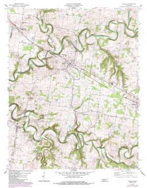
Adams Topo Map Tennessee
To zoom in, hover over the map of Adams
USGS Topo Quad 36087e1 - 1:24,000 scale
| Topo Map Name: | Adams |
| USGS Topo Quad ID: | 36087e1 |
| Print Size: | ca. 21 1/4" wide x 27" high |
| Southeast Coordinates: | 36.5° N latitude / 87° W longitude |
| Map Center Coordinates: | 36.5625° N latitude / 87.0625° W longitude |
| U.S. State: | TN |
| Filename: | o36087e1.jpg |
| Download Map JPG Image: | Adams topo map 1:24,000 scale |
| Map Type: | Topographic |
| Topo Series: | 7.5´ |
| Map Scale: | 1:24,000 |
| Source of Map Images: | United States Geological Survey (USGS) |
| Alternate Map Versions: |
Adams TN 1957, updated 1958 Download PDF Buy paper map Adams TN 1957, updated 1977 Download PDF Buy paper map Adams TN 1957, updated 1984 Download PDF Buy paper map Adams TN 2010 Download PDF Buy paper map Adams TN 2013 Download PDF Buy paper map Adams TN 2016 Download PDF Buy paper map |
1:24,000 Topo Quads surrounding Adams
> Back to 36087e1 at 1:100,000 scale
> Back to 36086a1 at 1:250,000 scale
> Back to U.S. Topo Maps home
Adams topo map: Gazetteer
Adams: Dams
Harper Lake Dam elevation 145m 475′Adams: Populated Places
Adams elevation 167m 547′Forest Mills (historical) elevation 136m 446′
Forts (historical) elevation 150m 492′
Glenraven (historical) elevation 170m 557′
Holmansville (historical) elevation 179m 587′
Sadlersville elevation 166m 544′
Walnut Grove elevation 150m 492′
Washington Hall (historical) elevation 188m 616′
Wessyngton (historical) elevation 187m 613′
Adams: Reservoirs
Harper Lake elevation 145m 475′Adams: Streams
Brush Creek elevation 128m 419′Buzzard Creek elevation 131m 429′
Calebs Creek elevation 137m 449′
Chambers Spring Branch elevation 131m 429′
Elk Fork elevation 123m 403′
Elk Fork elevation 125m 410′
Millers Creek elevation 137m 449′
Sturgeon Creek elevation 127m 416′
Adams digital topo map on disk
Buy this Adams topo map showing relief, roads, GPS coordinates and other geographical features, as a high-resolution digital map file on DVD:


