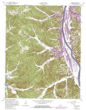
Tharpe Topo Map Tennessee
To zoom in, hover over the map of Tharpe
USGS Topo Quad 36087e8 - 1:24,000 scale
| Topo Map Name: | Tharpe |
| USGS Topo Quad ID: | 36087e8 |
| Print Size: | ca. 21 1/4" wide x 27" high |
| Southeast Coordinates: | 36.5° N latitude / 87.875° W longitude |
| Map Center Coordinates: | 36.5625° N latitude / 87.9375° W longitude |
| U.S. State: | TN |
| Filename: | o36087e8.jpg |
| Download Map JPG Image: | Tharpe topo map 1:24,000 scale |
| Map Type: | Topographic |
| Topo Series: | 7.5´ |
| Map Scale: | 1:24,000 |
| Source of Map Images: | United States Geological Survey (USGS) |
| Alternate Map Versions: |
Tharpe TN 1936 Download PDF Buy paper map Tharpe TN 1951, updated 1953 Download PDF Buy paper map Tharpe TN 1957, updated 1960 Download PDF Buy paper map Tharpe TN 1957, updated 1980 Download PDF Buy paper map Tharpe TN 1999, updated 2001 Download PDF Buy paper map Tharpe TN 2011 Download PDF Buy paper map Tharpe TN 2013 Download PDF Buy paper map Tharpe TN 2016 Download PDF Buy paper map |
| FStopo: | US Forest Service topo Tharpe is available: Download FStopo PDF Download FStopo TIF |
1:24,000 Topo Quads surrounding Tharpe
> Back to 36087e1 at 1:100,000 scale
> Back to 36086a1 at 1:250,000 scale
> Back to U.S. Topo Maps home
Tharpe topo map: Gazetteer
Tharpe: Bays
Neville Bay elevation 107m 351′Tharpe: Dams
Bards Dam elevation 107m 351′Tharpe: Lakes
Rawls Pond elevation 107m 351′Tharpe: Parks
Bear Creek Waterfowl Management Unit elevation 107m 351′Bumpus Mills Recreation Area elevation 118m 387′
Gatlin Point Lake Access elevation 107m 351′
Neville Bay Lake Access elevation 109m 357′
Saline Creek Access Point elevation 107m 351′
Saline Creek Public Use Area elevation 107m 351′
Tharpe: Populated Places
Snider elevation 158m 518′Tharpe elevation 117m 383′
Tip Top elevation 143m 469′
Tharpe: Reservoirs
Bards Lake elevation 107m 351′Tharpe: Ridges
Nolin Ridge elevation 160m 524′Tharpe: Springs
Brandon Spring elevation 109m 357′Tharpe: Streams
Bards Creek elevation 107m 351′Barrett Creek elevation 107m 351′
Bear Creek elevation 107m 351′
Bee Branch elevation 113m 370′
Beech Fork Creek elevation 107m 351′
Beech Fork Creek elevation 107m 351′
Blue Creek elevation 107m 351′
Brandon Spring Branch elevation 107m 351′
Bruton Spring Branch elevation 107m 351′
Cow Creek elevation 109m 357′
Dry Branch elevation 126m 413′
Happy Hollow Branch elevation 110m 360′
Harris Branch elevation 107m 351′
Neville Creek elevation 110m 360′
Rayburn Creek elevation 121m 396′
South Fork Panther Creek elevation 122m 400′
Walker Branch elevation 107m 351′
Tharpe: Summits
Round Top elevation 188m 616′Tharpe: Swamps
Neville Bay elevation 107m 351′Tharpe: Valleys
Buckingham Hollow elevation 131m 429′Burgess Hollow elevation 127m 416′
Crutcher Hollow elevation 110m 360′
Fox Hollow elevation 107m 351′
Happy Hollow elevation 111m 364′
Hickory Hollow elevation 116m 380′
Jackson Hollow elevation 125m 410′
New Ground Hollow elevation 126m 413′
Stilly Hollow elevation 116m 380′
Wildcat Hollow elevation 115m 377′
Tharpe digital topo map on disk
Buy this Tharpe topo map showing relief, roads, GPS coordinates and other geographical features, as a high-resolution digital map file on DVD:


