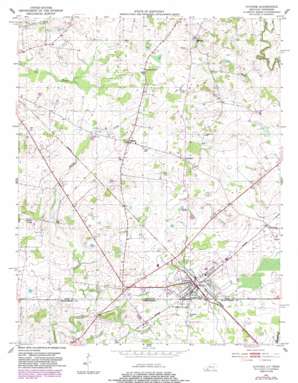
Guthrie Topo Map Kentucky
To zoom in, hover over the map of Guthrie
USGS Topo Quad 36087f2 - 1:24,000 scale
| Topo Map Name: | Guthrie |
| USGS Topo Quad ID: | 36087f2 |
| Print Size: | ca. 21 1/4" wide x 27" high |
| Southeast Coordinates: | 36.625° N latitude / 87.125° W longitude |
| Map Center Coordinates: | 36.6875° N latitude / 87.1875° W longitude |
| U.S. States: | KY, TN |
| Filename: | o36087f2.jpg |
| Download Map JPG Image: | Guthrie topo map 1:24,000 scale |
| Map Type: | Topographic |
| Topo Series: | 7.5´ |
| Map Scale: | 1:24,000 |
| Source of Map Images: | United States Geological Survey (USGS) |
| Alternate Map Versions: |
Guthrie KY 1950, updated 1952 Download PDF Buy paper map Guthrie KY 1950, updated 1964 Download PDF Buy paper map Guthrie KY 1950, updated 1983 Download PDF Buy paper map Guthrie KY 2010 Download PDF Buy paper map Guthrie KY 2013 Download PDF Buy paper map Guthrie KY 2016 Download PDF Buy paper map |
1:24,000 Topo Quads surrounding Guthrie
> Back to 36087e1 at 1:100,000 scale
> Back to 36086a1 at 1:250,000 scale
> Back to U.S. Topo Maps home
Guthrie topo map: Gazetteer
Guthrie: Populated Places
Anderson elevation 193m 633′Guthrie elevation 167m 547′
Hadensville elevation 170m 557′
Hermon elevation 186m 610′
Pinchem elevation 185m 606′
Guthrie: Streams
Browns Branch elevation 154m 505′Dry Branch elevation 167m 547′
Guthrie digital topo map on disk
Buy this Guthrie topo map showing relief, roads, GPS coordinates and other geographical features, as a high-resolution digital map file on DVD:


