Trenton Topo Map Kentucky
To zoom in, hover over the map of Trenton
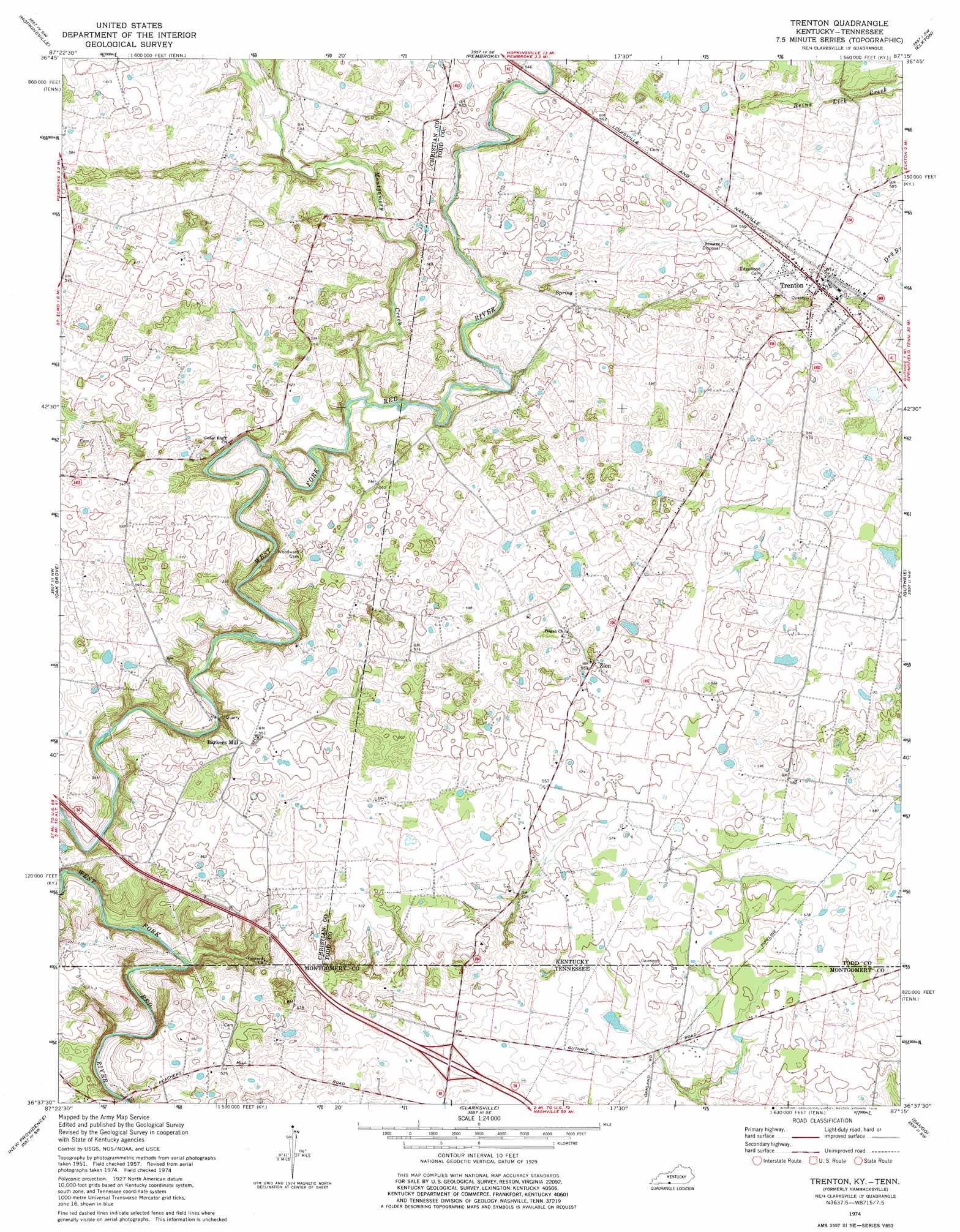
USGS Topo Quad 36087f3 - 1:24,000 scale
| Topo Map Name: | Trenton |
| USGS Topo Quad ID: | 36087f3 |
| Print Size: | ca. 21 1/4" wide x 27" high |
| Southeast Coordinates: | 36.625° N latitude / 87.25° W longitude |
| Map Center Coordinates: | 36.6875° N latitude / 87.3125° W longitude |
| U.S. States: | KY, TN |
| Filename: | o36087f3.jpg |
| Download Map JPG Image: | Trenton topo map 1:24,000 scale |
| Map Type: | Topographic |
| Topo Series: | 7.5´ |
| Map Scale: | 1:24,000 |
| Source of Map Images: | United States Geological Survey (USGS) |
| Alternate Map Versions: |
Hammacksville KY 1951, updated 1953 Download PDF Buy paper map Hammacksville KY 1957, updated 1960 Download PDF Buy paper map Trenton KY 1974, updated 1976 Download PDF Buy paper map Trenton KY 2010 Download PDF Buy paper map Trenton KY 2013 Download PDF Buy paper map Trenton KY 2016 Download PDF Buy paper map |
1:24,000 Topo Quads surrounding Trenton
Pleasant Green Hill |
Kelly |
Honey Grove |
Allegre |
Sharon Grove |
Church Hill |
Hopkinsville |
Pembroke |
Elkton |
Olmstead |
Herndon |
Oak Grove |
Trenton |
Guthrie |
Allensville |
Woodlawn |
New Providence |
Clarksville |
Sango |
Adams |
Needmore |
Palmyra |
Excell |
Henrietta |
Pleasant View |
> Back to 36087e1 at 1:100,000 scale
> Back to 36086a1 at 1:250,000 scale
> Back to U.S. Topo Maps home
Trenton topo map: Gazetteer
Trenton: Crossings
Interchange 1 elevation 158m 518′Trenton: Populated Places
Barkers Mill elevation 167m 547′Trenton elevation 179m 587′
Zion elevation 168m 551′
Trenton: Streams
Dry Branch elevation 170m 557′Montgomery Creek elevation 143m 469′
Reins Lick Creek elevation 160m 524′
Trenton digital topo map on disk
Buy this Trenton topo map showing relief, roads, GPS coordinates and other geographical features, as a high-resolution digital map file on DVD: