Herndon Topo Map Kentucky
To zoom in, hover over the map of Herndon
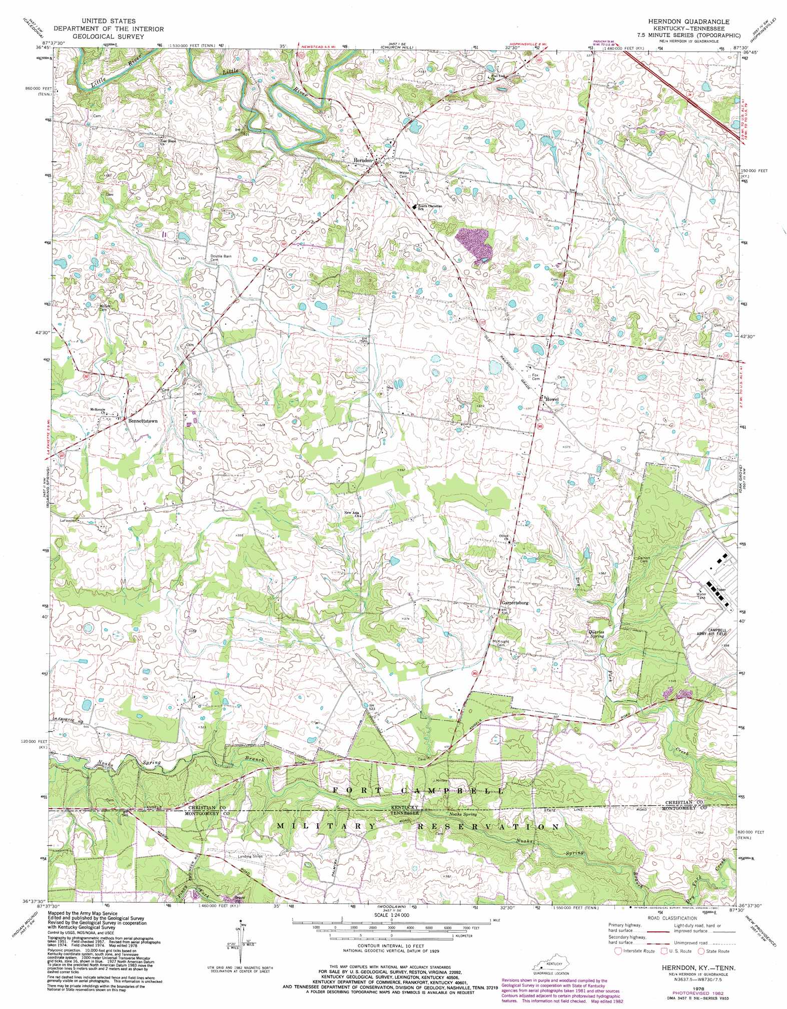
USGS Topo Quad 36087f5 - 1:24,000 scale
| Topo Map Name: | Herndon |
| USGS Topo Quad ID: | 36087f5 |
| Print Size: | ca. 21 1/4" wide x 27" high |
| Southeast Coordinates: | 36.625° N latitude / 87.5° W longitude |
| Map Center Coordinates: | 36.6875° N latitude / 87.5625° W longitude |
| U.S. States: | KY, TN |
| Filename: | o36087f5.jpg |
| Download Map JPG Image: | Herndon topo map 1:24,000 scale |
| Map Type: | Topographic |
| Topo Series: | 7.5´ |
| Map Scale: | 1:24,000 |
| Source of Map Images: | United States Geological Survey (USGS) |
| Alternate Map Versions: |
Herndon KY 1951, updated 1953 Download PDF Buy paper map Herndon KY 1957, updated 1960 Download PDF Buy paper map Herndon KY 1978, updated 1978 Download PDF Buy paper map Herndon KY 1978, updated 1983 Download PDF Buy paper map Herndon KY 2010 Download PDF Buy paper map Herndon KY 2013 Download PDF Buy paper map Herndon KY 2016 Download PDF Buy paper map |
1:24,000 Topo Quads surrounding Herndon
Cobb |
Gracey |
Pleasant Green Hill |
Kelly |
Honey Grove |
Cadiz |
Caledonia |
Church Hill |
Hopkinsville |
Pembroke |
Johnson Hollow |
Roaring Spring |
Herndon |
Oak Grove |
Trenton |
Bumpus Mills |
Indian Mound |
Woodlawn |
New Providence |
Clarksville |
Dover |
Cumberland City |
Needmore |
Palmyra |
Excell |
> Back to 36087e1 at 1:100,000 scale
> Back to 36086a1 at 1:250,000 scale
> Back to U.S. Topo Maps home
Herndon topo map: Gazetteer
Herndon: Populated Places
Bennettstown elevation 174m 570′Garrettsburg elevation 163m 534′
Herndon elevation 160m 524′
Howel elevation 180m 590′
LaFayette elevation 182m 597′
Herndon: Springs
Noahs Spring elevation 143m 469′Herndon digital topo map on disk
Buy this Herndon topo map showing relief, roads, GPS coordinates and other geographical features, as a high-resolution digital map file on DVD: