Roaring Spring Topo Map Kentucky
To zoom in, hover over the map of Roaring Spring
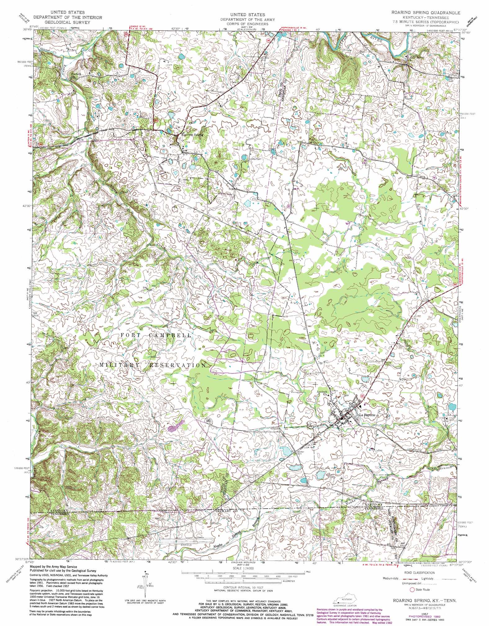
USGS Topo Quad 36087f6 - 1:24,000 scale
| Topo Map Name: | Roaring Spring |
| USGS Topo Quad ID: | 36087f6 |
| Print Size: | ca. 21 1/4" wide x 27" high |
| Southeast Coordinates: | 36.625° N latitude / 87.625° W longitude |
| Map Center Coordinates: | 36.6875° N latitude / 87.6875° W longitude |
| U.S. States: | KY, TN |
| Filename: | o36087f6.jpg |
| Download Map JPG Image: | Roaring Spring topo map 1:24,000 scale |
| Map Type: | Topographic |
| Topo Series: | 7.5´ |
| Map Scale: | 1:24,000 |
| Source of Map Images: | United States Geological Survey (USGS) |
| Alternate Map Versions: |
Roaring Spring KY 1951, updated 1953 Download PDF Buy paper map Roaring Spring KY 1957, updated 1960 Download PDF Buy paper map Roaring Spring KY 1957, updated 1976 Download PDF Buy paper map Roaring Spring KY 1957, updated 1983 Download PDF Buy paper map Roaring Spring KY 2010 Download PDF Buy paper map Roaring Spring KY 2013 Download PDF Buy paper map Roaring Spring KY 2016 Download PDF Buy paper map |
1:24,000 Topo Quads surrounding Roaring Spring
Lamasco |
Cobb |
Gracey |
Pleasant Green Hill |
Kelly |
Canton |
Cadiz |
Caledonia |
Church Hill |
Hopkinsville |
Linton |
Johnson Hollow |
Roaring Spring |
Herndon |
Oak Grove |
Tharpe |
Bumpus Mills |
Indian Mound |
Woodlawn |
New Providence |
Standing Rock |
Dover |
Cumberland City |
Needmore |
Palmyra |
> Back to 36087e1 at 1:100,000 scale
> Back to 36086a1 at 1:250,000 scale
> Back to U.S. Topo Maps home
Roaring Spring topo map: Gazetteer
Roaring Spring: Populated Places
La Fayette elevation 167m 547′Roaring Spring elevation 170m 557′
Roaring Spring: Streams
Casey Creek elevation 130m 426′Skinner Creek elevation 176m 577′
Weavers Branch elevation 166m 544′
Weavers Creek elevation 158m 518′
Weavers Creek elevation 157m 515′
Roaring Spring digital topo map on disk
Buy this Roaring Spring topo map showing relief, roads, GPS coordinates and other geographical features, as a high-resolution digital map file on DVD: