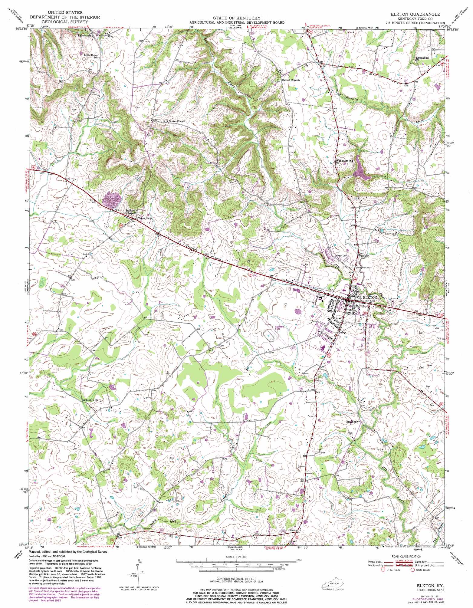
Elkton Topo Map Kentucky
To zoom in, hover over the map of Elkton
USGS Topo Quad 36087g2 - 1:24,000 scale
| Topo Map Name: | Elkton |
| USGS Topo Quad ID: | 36087g2 |
| Print Size: | ca. 21 1/4" wide x 27" high |
| Southeast Coordinates: | 36.75° N latitude / 87.125° W longitude |
| Map Center Coordinates: | 36.8125° N latitude / 87.1875° W longitude |
| U.S. State: | KY |
| Filename: | o36087g2.jpg |
| Download Map JPG Image: | Elkton topo map 1:24,000 scale |
| Map Type: | Topographic |
| Topo Series: | 7.5´ |
| Map Scale: | 1:24,000 |
| Source of Map Images: | United States Geological Survey (USGS) |
| Alternate Map Versions: |
Elkton KY 1951 Download PDF Buy paper map Elkton KY 1951, updated 1965 Download PDF Buy paper map Elkton KY 1951, updated 1983 Download PDF Buy paper map Elkton KY 2010 Download PDF Buy paper map Elkton KY 2013 Download PDF Buy paper map Elkton KY 2016 Download PDF Buy paper map |
1:24,000 Topo Quads surrounding Elkton
Crofton |
Haleys Mill |
Kirkmansville |
Rosewood |
Dunmor |
Kelly |
Honey Grove |
Allegre |
Sharon Grove |
Lewisburg |
Hopkinsville |
Pembroke |
Elkton |
Olmstead |
Russellville |
Oak Grove |
Trenton |
Guthrie |
Allensville |
Dot |
New Providence |
Clarksville |
Sango |
Adams |
Springfield North |
> Back to 36087e1 at 1:100,000 scale
> Back to 36086a1 at 1:250,000 scale
> Back to U.S. Topo Maps home
Elkton topo map: Gazetteer
Elkton: Airports
Standard Field elevation 198m 649′Elkton: Populated Places
Bradshaw elevation 179m 587′Elkton elevation 190m 623′
Tabernacle elevation 236m 774′
Tress Shop elevation 207m 679′
Wilhelmina elevation 232m 761′
Zion elevation 194m 636′
Elkton digital topo map on disk
Buy this Elkton topo map showing relief, roads, GPS coordinates and other geographical features, as a high-resolution digital map file on DVD: