Cadiz Topo Map Kentucky
To zoom in, hover over the map of Cadiz
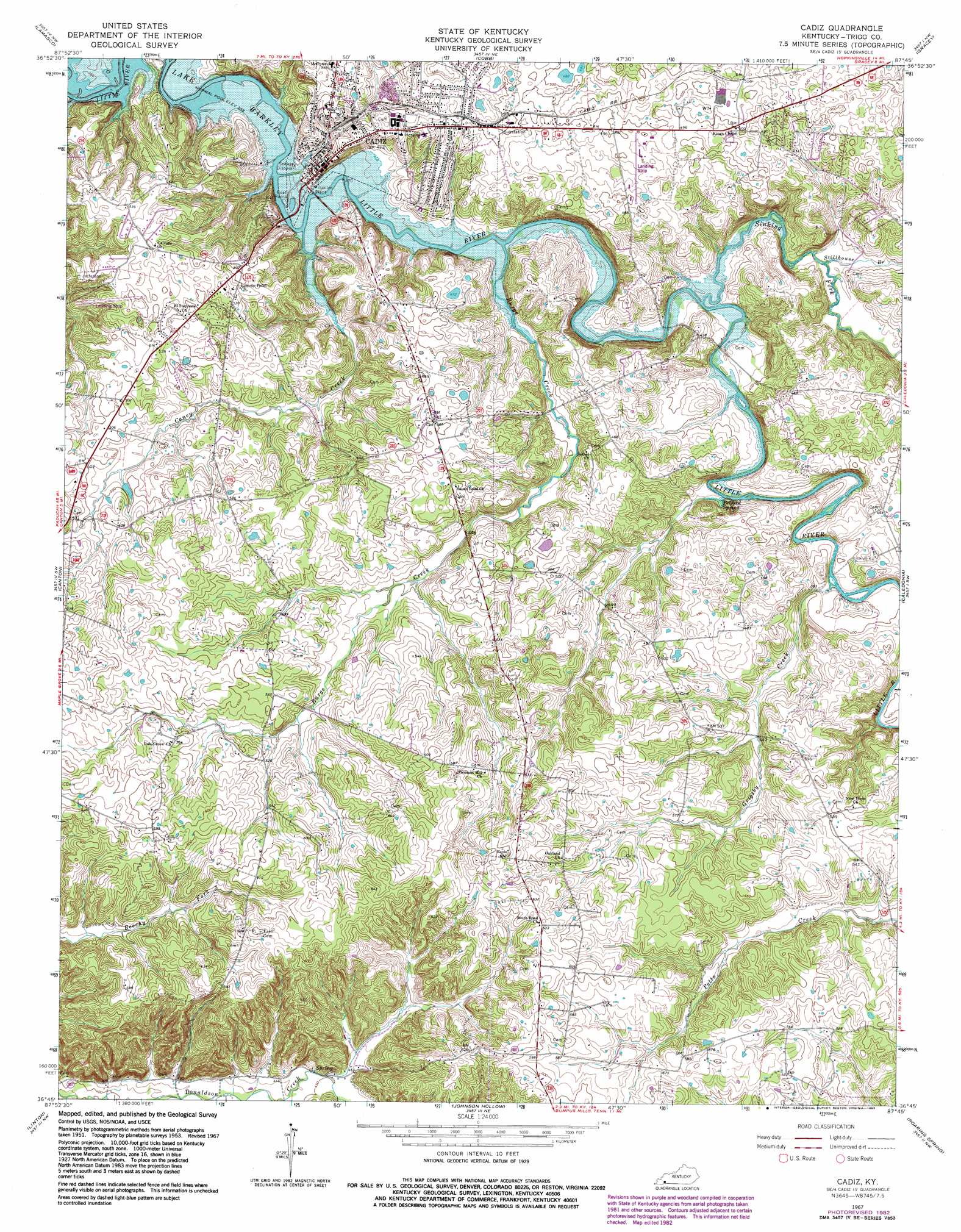
USGS Topo Quad 36087g7 - 1:24,000 scale
| Topo Map Name: | Cadiz |
| USGS Topo Quad ID: | 36087g7 |
| Print Size: | ca. 21 1/4" wide x 27" high |
| Southeast Coordinates: | 36.75° N latitude / 87.75° W longitude |
| Map Center Coordinates: | 36.8125° N latitude / 87.8125° W longitude |
| U.S. State: | KY |
| Filename: | o36087g7.jpg |
| Download Map JPG Image: | Cadiz topo map 1:24,000 scale |
| Map Type: | Topographic |
| Topo Series: | 7.5´ |
| Map Scale: | 1:24,000 |
| Source of Map Images: | United States Geological Survey (USGS) |
| Alternate Map Versions: |
Cadiz KY 1953, updated 1955 Download PDF Buy paper map Cadiz KY 1967, updated 1968 Download PDF Buy paper map Cadiz KY 1967, updated 1983 Download PDF Buy paper map Cadiz KY 2010 Download PDF Buy paper map Cadiz KY 2013 Download PDF Buy paper map Cadiz KY 2016 Download PDF Buy paper map |
1:24,000 Topo Quads surrounding Cadiz
Eddyville |
Princeton West |
Princeton East |
Dawson Springs Sw |
Dawson Springs Se |
Mont |
Lamasco |
Cobb |
Gracey |
Pleasant Green Hill |
Fenton |
Canton |
Cadiz |
Caledonia |
Church Hill |
Rushing Creek |
Linton |
Johnson Hollow |
Roaring Spring |
Herndon |
Hamlin |
Tharpe |
Bumpus Mills |
Indian Mound |
Woodlawn |
> Back to 36087e1 at 1:100,000 scale
> Back to 36086a1 at 1:250,000 scale
> Back to U.S. Topo Maps home
Cadiz topo map: Gazetteer
Cadiz: Airports
Lowe Airport elevation 149m 488′Cadiz: Populated Places
Cadiz elevation 129m 423′Cadiz: Springs
Belford Spring elevation 118m 387′Cadiz: Streams
Burge Creek elevation 113m 370′Caney Creek elevation 109m 357′
Grigsby Creek elevation 114m 374′
Sinking Fork elevation 112m 367′
Stillhouse Branch elevation 116m 380′
Cadiz digital topo map on disk
Buy this Cadiz topo map showing relief, roads, GPS coordinates and other geographical features, as a high-resolution digital map file on DVD: