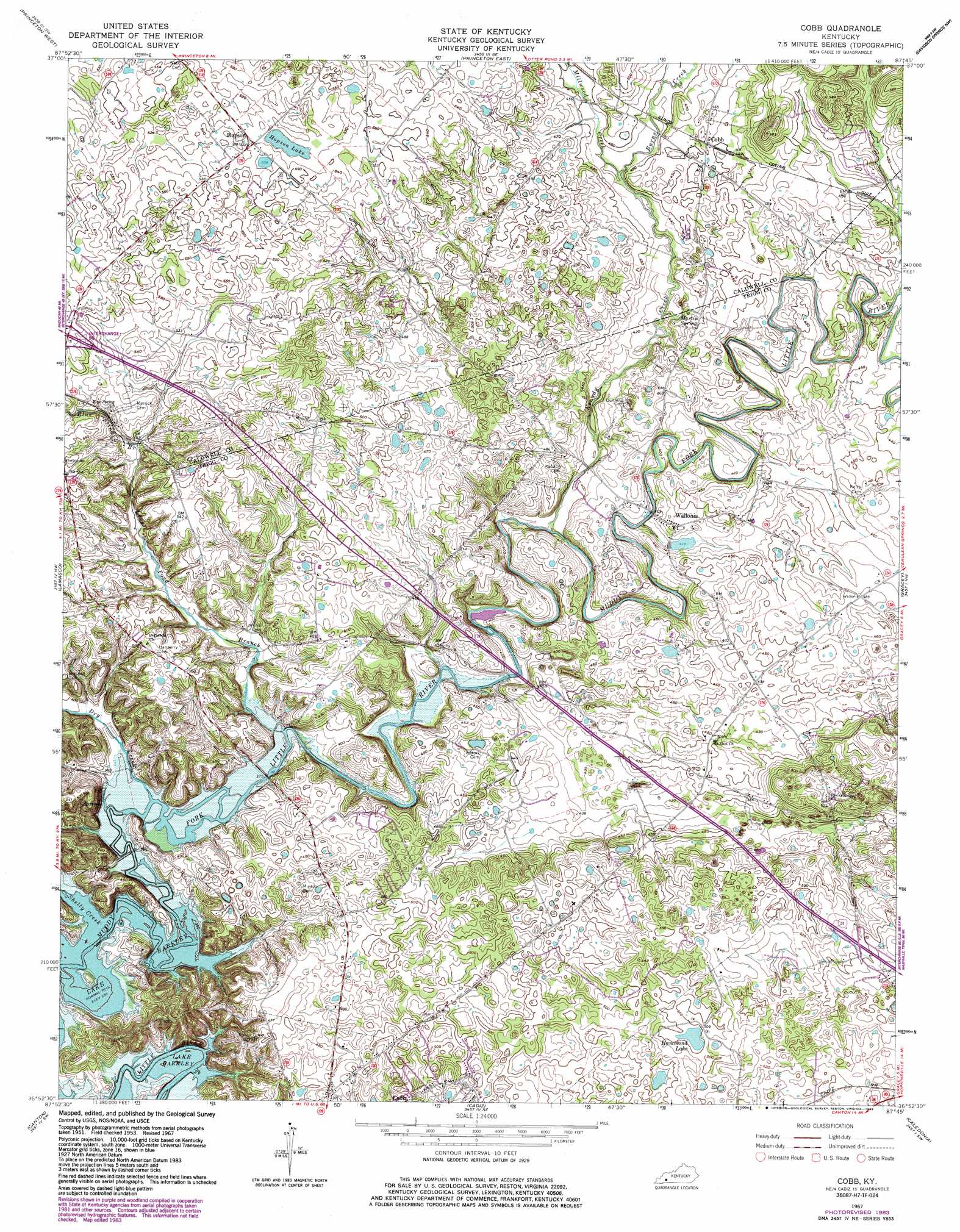
Cobb Topo Map Kentucky
To zoom in, hover over the map of Cobb
USGS Topo Quad 36087h7 - 1:24,000 scale
| Topo Map Name: | Cobb |
| USGS Topo Quad ID: | 36087h7 |
| Print Size: | ca. 21 1/4" wide x 27" high |
| Southeast Coordinates: | 36.875° N latitude / 87.75° W longitude |
| Map Center Coordinates: | 36.9375° N latitude / 87.8125° W longitude |
| U.S. State: | KY |
| Filename: | o36087h7.jpg |
| Download Map JPG Image: | Cobb topo map 1:24,000 scale |
| Map Type: | Topographic |
| Topo Series: | 7.5´ |
| Map Scale: | 1:24,000 |
| Source of Map Images: | United States Geological Survey (USGS) |
| Alternate Map Versions: |
Cobb KY 1953, updated 1954 Download PDF Buy paper map Cobb KY 1967, updated 1968 Download PDF Buy paper map Cobb KY 1967, updated 1983 Download PDF Buy paper map Cobb KY 2010 Download PDF Buy paper map Cobb KY 2013 Download PDF Buy paper map Cobb KY 2016 Download PDF Buy paper map |
1:24,000 Topo Quads surrounding Cobb
Fredonia |
Crider |
Olney |
Dawson Springs |
Saint Charles |
Eddyville |
Princeton West |
Princeton East |
Dawson Springs Sw |
Dawson Springs Se |
Mont |
Lamasco |
Cobb |
Gracey |
Pleasant Green Hill |
Fenton |
Canton |
Cadiz |
Caledonia |
Church Hill |
Rushing Creek |
Linton |
Johnson Hollow |
Roaring Spring |
Herndon |
> Back to 36087e1 at 1:100,000 scale
> Back to 36086a1 at 1:250,000 scale
> Back to U.S. Topo Maps home
Cobb topo map: Gazetteer
Cobb: Lakes
Hammond Lake elevation 151m 495′Hopson Lake elevation 160m 524′
Cobb: Populated Places
Cobb elevation 140m 459′Hopson elevation 165m 541′
Wallonia elevation 134m 439′
Cobb: Springs
Martin Spring elevation 133m 436′Cobb: Streams
Blue Spring Branch elevation 143m 469′Brushy Grove Creek elevation 128m 419′
Burns Creek elevation 138m 452′
Dry Creek elevation 108m 354′
Kenady Creek elevation 119m 390′
Long Pond Branch elevation 108m 354′
Millwood Creek elevation 135m 442′
Shelly Creek elevation 107m 351′
Cobb digital topo map on disk
Buy this Cobb topo map showing relief, roads, GPS coordinates and other geographical features, as a high-resolution digital map file on DVD: