Vale Topo Map Tennessee
To zoom in, hover over the map of Vale
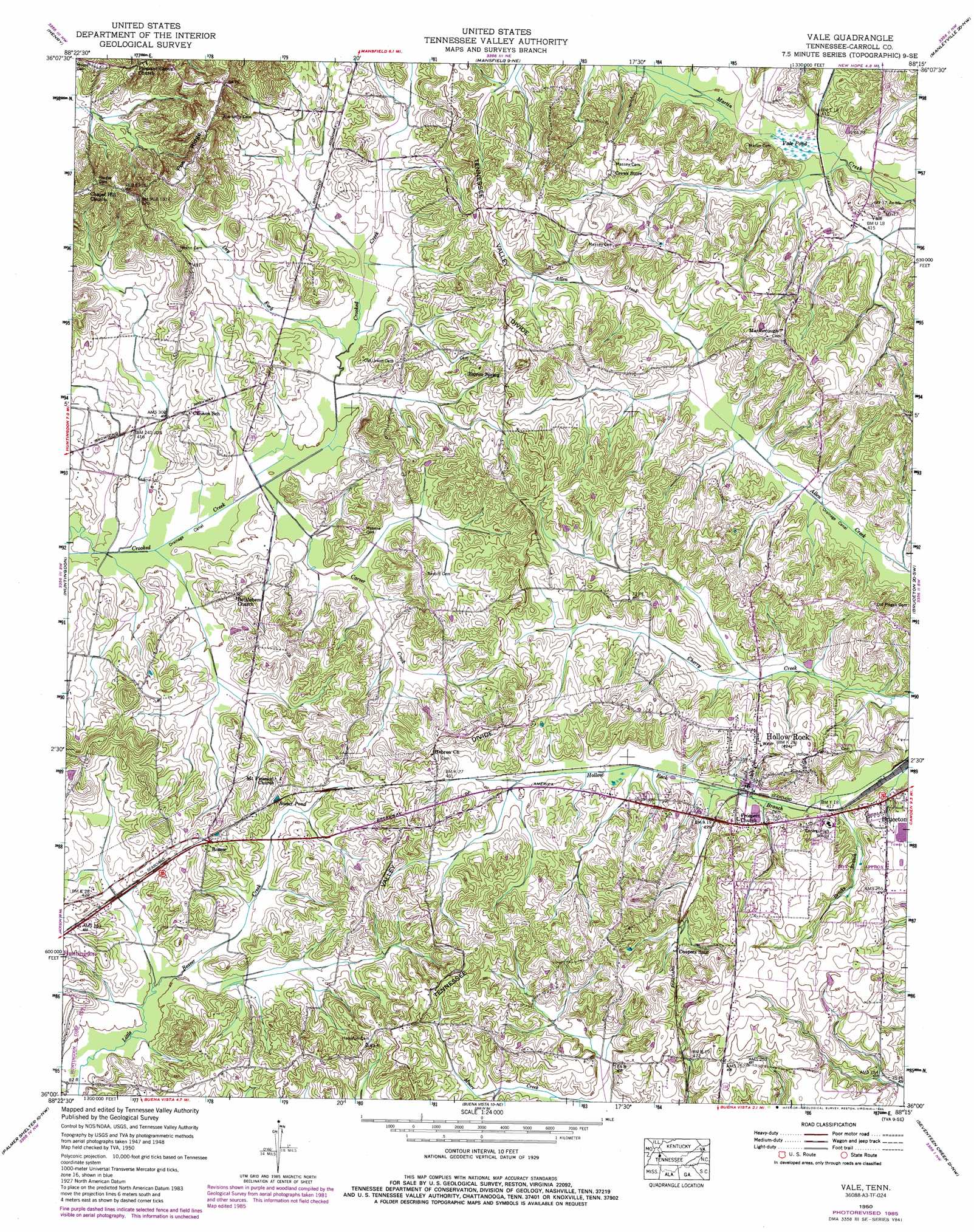
USGS Topo Quad 36088a3 - 1:24,000 scale
| Topo Map Name: | Vale |
| USGS Topo Quad ID: | 36088a3 |
| Print Size: | ca. 21 1/4" wide x 27" high |
| Southeast Coordinates: | 36° N latitude / 88.25° W longitude |
| Map Center Coordinates: | 36.0625° N latitude / 88.3125° W longitude |
| U.S. State: | TN |
| Filename: | o36088a3.jpg |
| Download Map JPG Image: | Vale topo map 1:24,000 scale |
| Map Type: | Topographic |
| Topo Series: | 7.5´ |
| Map Scale: | 1:24,000 |
| Source of Map Images: | United States Geological Survey (USGS) |
| Alternate Map Versions: |
Vale TN 1936 Download PDF Buy paper map Vale TN 1950, updated 1953 Download PDF Buy paper map Vale TN 1950, updated 1975 Download PDF Buy paper map Vale TN 1950, updated 1985 Download PDF Buy paper map Vale TN 2010 Download PDF Buy paper map Vale TN 2013 Download PDF Buy paper map Vale TN 2016 Download PDF Buy paper map |
1:24,000 Topo Quads surrounding Vale
Como |
Osage |
Paris |
West Sandy Dike |
Poplar Creek |
Mckenzie |
Henry |
Mansfield |
Manleyville |
Big Sandy |
Trezevant East |
Huntingdon |
Vale |
Bruceton |
Camden |
Mclemoresville |
Palmer Shelter |
Buena Vista |
Seventeen Creek |
Rockport |
Cedar Grove |
Clarksburg |
Yuma |
Holladay |
Sugar Tree |
> Back to 36088a1 at 1:100,000 scale
> Back to 36088a1 at 1:250,000 scale
> Back to U.S. Topo Maps home
Vale topo map: Gazetteer
Vale: Lakes
Rosser Pond elevation 138m 452′Vale: Populated Places
Carnsville (historical) elevation 136m 446′Hollow Rock elevation 128m 419′
Rosser elevation 149m 488′
Sandy Bridge (historical) elevation 137m 449′
Vale elevation 127m 416′
Vale: Ridges
Pea Ridge elevation 168m 551′Vale: Streams
Brooks Branch elevation 124m 406′Carver Creek elevation 118m 387′
Dry Fork elevation 122m 400′
Vale: Swamps
Vale Pond elevation 123m 403′Vale digital topo map on disk
Buy this Vale topo map showing relief, roads, GPS coordinates and other geographical features, as a high-resolution digital map file on DVD: